
Monsoon powering up over northern Australia

The monsoon trough is gathering strength over the northern Australian waters this weekend, and will start to drift over the continent over the coming week.
Over the past several days the monsoon trough has been strengthening, with increased cloud and moisture developing.
The monsoon trough can be thought of like a global seabreeze, as winds blow from the cooler part of the planet (the hemisphere in winter) towards the warmer half of Earth (the summer hemisphere) to cool it down. In this case, winds are coming from India, southeast Asia, and Indonesia and blowing towards Papua New Guinea, and northern Australia.
Once the monsoon trough develops, wind, rain, and thunderstorms will all increase over the Top End in the Northern Territory and over Far North Queensland throughout this week.
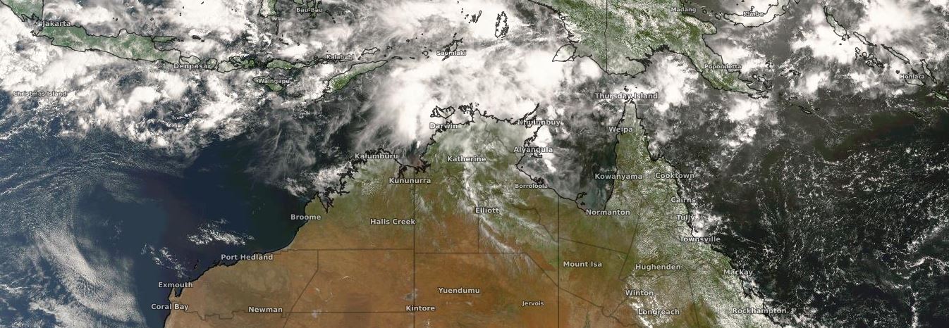
Image: Cloud can clearly be seen building north of Australia on Sunday
Widespread weekly rainfall totals of 100-200mm with isolated 300mm or more are expected over the tropical north. Damaging wind gusts exceeding 90km/h are also possible, most likely with squally showers and storms. Waves and tides will potentially rise, leading to an increased chance of coastal inundation and erosion.
The monsoon trough also greatly increases the chances of tropical cyclones developing in Australian waters. At this stage, models are signaling three major areas of increased chances: one to the the east of Christmas Island, another over the western Top End and Gulf of Carpentaria, and another off the Cooktown and Cairns coasts. All three of these tropical lows have the potential to develop into tropical cyclones over the coming week, though a Coral Sea tropical cyclone is looking like the most likely.
The next three tropical cyclones that develop in Australian Waters will be named Gretel, Harold, and Imogen.
The movement and intensity of these systems is still uncertain but it is important if you live in a cyclone prone area of Australia to have a plan in place if a system does develop nearby.