
Monsoon low taking flooding rain from the NT to Kimberley
A slow-moving low in an active monsoon trough has been flooding the Northern Territory's north with hundreds of millimetres of rain but is about to speed up, taking its big downpours to Western Australia's Kimberley.
Heavy rain began last weekend in the NT's Top End as the low formed and intensified. Rain then slowly spread to the Territory's interior with the movement of the low as it syphoned ample moisture from the Timor and Arafura seas.
Many centres have been drenched by heavy rain for several days running, adding up to 300-600mm, as much as two to three times the monthly average.
Some of the wettest places have been Wadeye with 661mm, Birrimba (435mm), Tipperary (429mm) and Victoria River Downs (405mm).
It has been the heaviest rain in -
50 years at Elliott (369mm in 7 days),
37 years at Monteinnie (359mm in 4 days),
33 years at Birrimba (435mm in 7 days,
31 years at Helen Springs (245mm in 4 days),
23 years at Cattle Creek (350mm in 7 days),
21 years at Tennant Creek (254mm in 3 days),
8 years at Old Delamere (247mm in 4 days),
6 years at Douglas River (399mm in 7 days),
3 years at Daly Waters (161mm in 4 days) and Bradshaw (319mm in 7 days), and
13 months at Elliott (118mm in 2 days)
The low is about to gain speed while travelling west from the NT's Barkly across Gregory then southern parts of WA's Kimberley, taking hundreds of millimetres of rain with it.
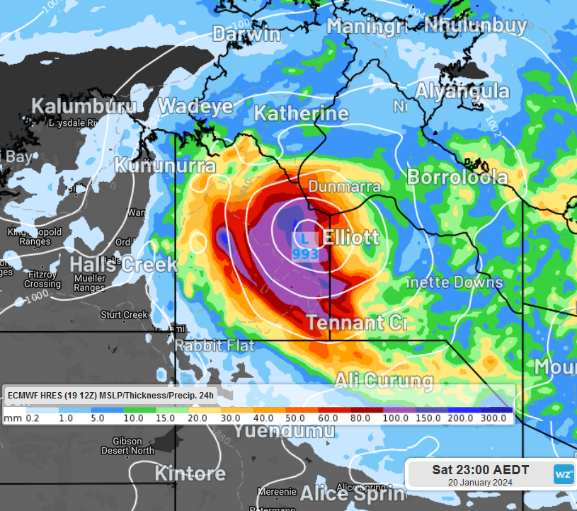
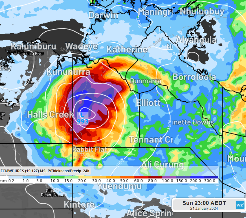
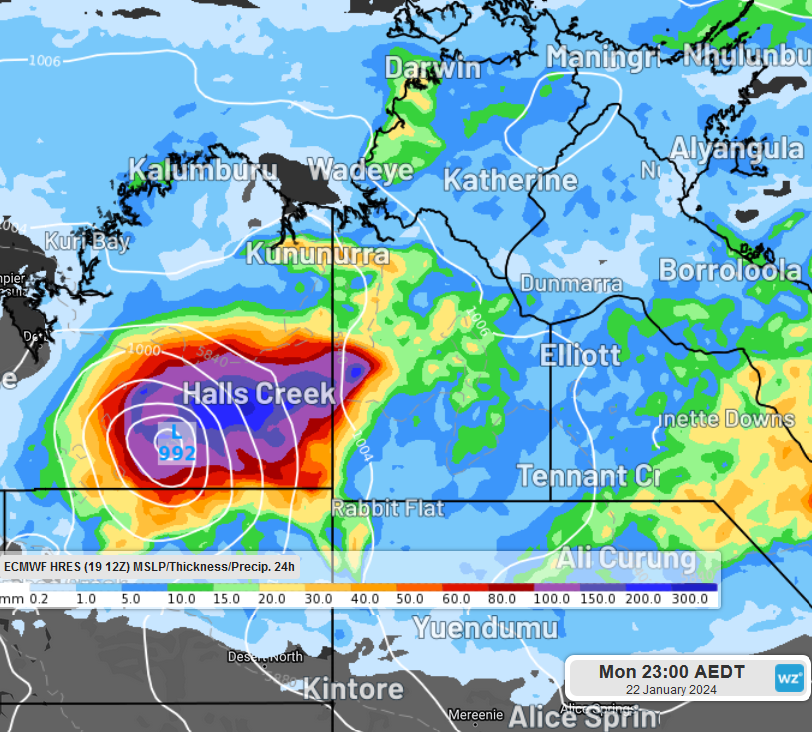
Images: ECMWF model prediction for low and associated rainfall between Saturday 20th January and Monday 22nd January.
Flood warnings had been issued for northwestern and central parts of the NT and a flood watch is out for the Kimberley.
The low is a chance to reach the Pilbara before moving off the coast or slowing over inland Pilbara before dissipating over the area.If you're in the area, keep an eye on the warnings.