
Monsoon fires up over northern Australia
This Australia Day will certainly be a wet one for a huge swathe of northern Australia as the monsoon trough deepens over the region.
For the last few days, the monsoon trough has extended across the north, from the Kimberley, through the Top End of the NT and into Far North Queensland. However, it has started to deepen further and also track south over the past 24 hours.
The Kimberley coast in WA and the North Tropical Coast in Queensland saw the biggest falls, as squally storms became slow-moving over these regions.
Areas around Townsville saw the most amount of rain, with Toomulla recording 220mm in the gauge in the 24 hours to 9am. Big falls of 210mm at Toolakea, 132mm at Picnic Bay and 94mm at Townsville Airport were also seen.
However, the heavy rain also stretched over the Great Divide with relative ease, bringing the monsoon to areas that don’t always see it each year. Hughenden was the pick of these towns, recording 107mm, its wettest January day in 38 years and its wettest day of any month for 13 years. Winton's 72mm is a 2-year high, Cloncurry's 35mm is an 11-month high and Richmond's 53mm is a 2-month high.
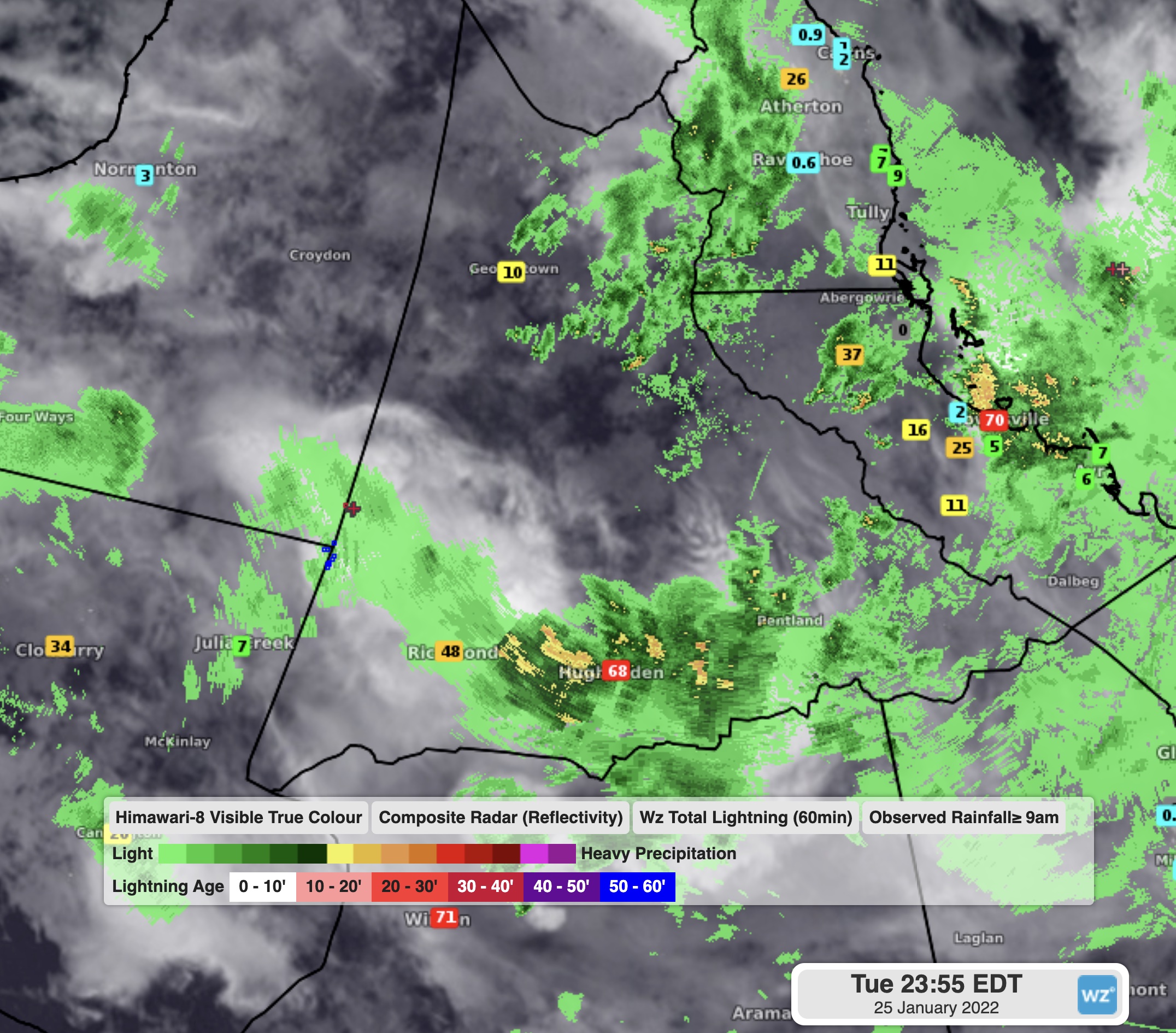
Image: Rain radar and totals since 9am Tuesday over northern QLD
Over in the west, a near stationary thunderstorm in the early hours of the morning brough a torrential 104mm of rain to Koolan Island in just 2 hours. Overall, Kalumburu collected 153mm, its wettest January day in 40 years and its wettest day of any month for 13 years, while Truscott’s 153mm was its wettest January day in 11 years.
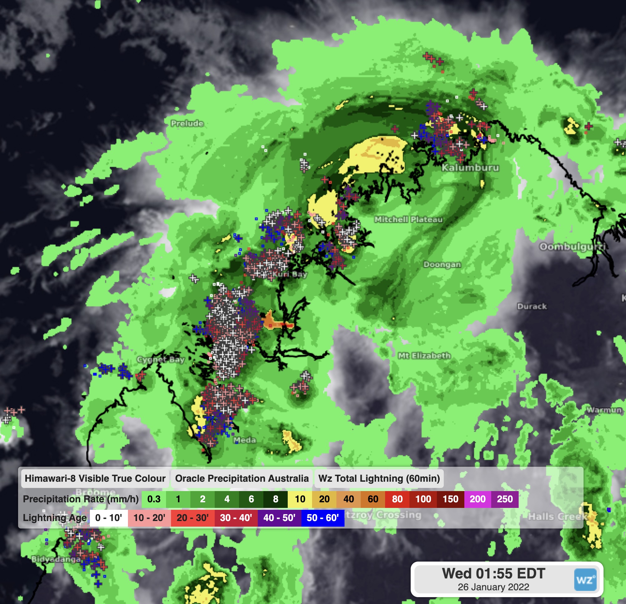
Image: WZ Oracle enhanced rain radar and lightning over the Kimberley
The monsoon trough is far from being done with Australia, with it expected to linger over the country for at least the next week, delivering more squally showers, rain and thunderstorms for many places in the north, including Broome, Darwin and Cairns. A low pressure centre also looks to form within it over the central NT, ensuring the territory, then northern WA gets a good drenching over the coming week.
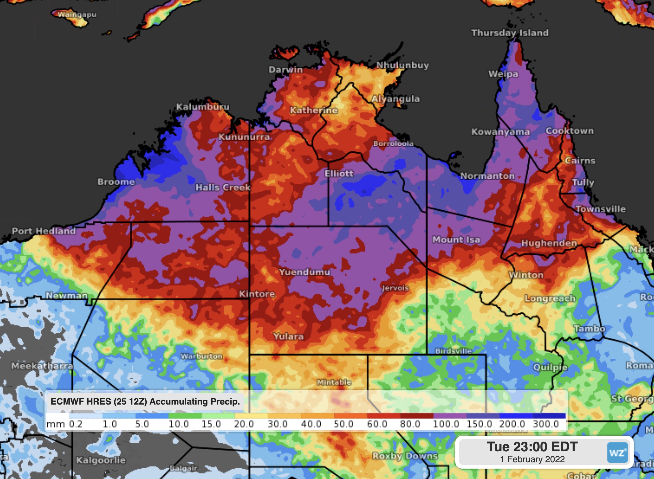
Image: Forecast accumulated rainfall over the next 7 days