
Massive temperature contrast between bitterly cold Melbourne and summery Sydney
It's an absolutely freezing September day across virtually all of Victoria and Tasmania, parts of South Australia, and southern parts of NSW today, as a strong spring cold front sweeps northwards.
This really is a cold system for this time of year, with snow in the forecast for areas well beyond the mountain districts where you'd expect to see snow falling in a typical southwesterly front.
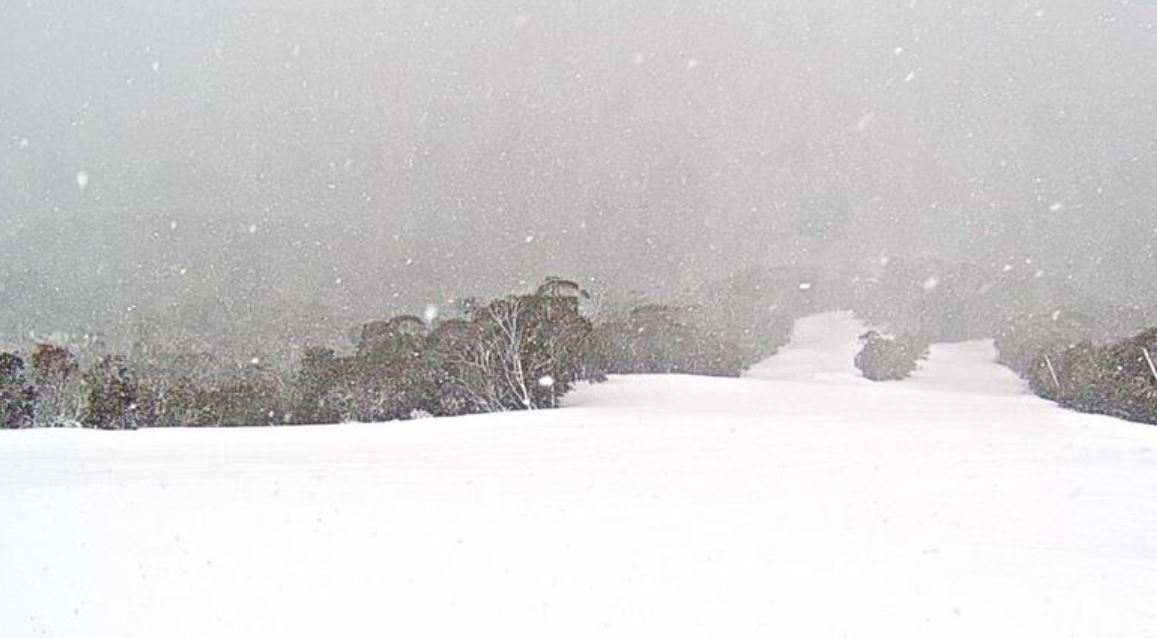
Image: Heavy snow falling on Monday morning at the top of Thredbo's High Noon run. Source: ski.com.au.
Snow should fall to elevations as low as 400 to 600 m a little later today in Victoria and Tasmania, which means snow could fall on places like the Grampians in western VIC, the Macedon Ranges in Central VIC and the Dandenong Ranges on Melbourne's eastern outskirts.
Even the city of Ballarat – which sits on about 430m, rising to over 600m on the hillier areas – could see snow.
Later today, snow above 900 metres is possible on the NSW Central Tablelands, while snow could fall at levels between 600m and 1000m in NSW tomorrow, which means the hills around Canberra and even the capital itself (city elevation 560m but many suburbs significantly higher) could cop a few flakes.
Meanwhile, the contrast in airmasses around midday on Monday can be illustrated in raw temperature terms by the fact that there was a 13-degree difference between Sydney and Melbourne temps as we were writing this story:
- At 11:50 am, it was 11.6°C in Melbourne.
- At 11:50 am, it was 24.6°C in Sydney.
Then a later on this afternoon, the gap widened from 13 degrees to almost 16:
- At 2 pm, it was in 10.1°C Melbourne.
- At 2 pm, it was in 25.9°C in Sydney.
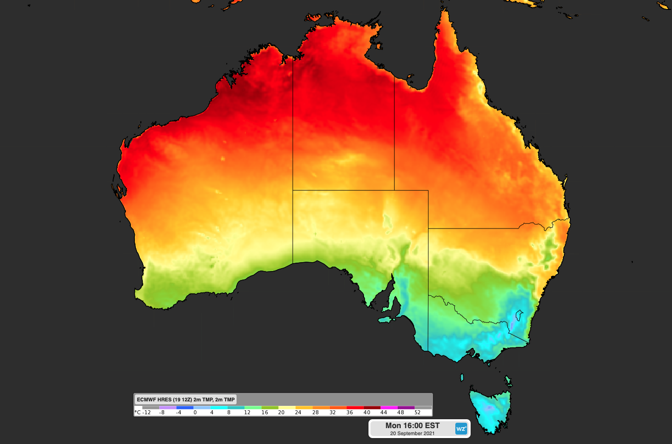
The contrast can also be illustrated graphically, as per the image below from Monday morning. Note the small "tongue" of warm orange-coloured temps extending down the east coast to about where Sydney is.
Sydney is expected to warm up to as high as 27°C on Monday afternoon before the cold air reaches the city later in the day.
Canberra hasn't yet felt the worst of this cold front, hovering at around 16°C at midday (which was the forecast max for today). But several degrees can be expected to be shaved off that, and pretty soon too.
2:50 pm STORY UPDATE: And right on cue, the cold air passed through Canberra early this afternoon.
At 14:30 AEST it's 8°C in Canberra and 26°C in Sydney. A strong cold front lies between. pic.twitter.com/AjPDeTPYZB
— Andrew Miskelly (@andrewmiskelly) September 20, 2021
Right on midday on Monday, you could "see" the cold air passing through the NSW Snowy Mountains by "observing" the data from Thredbo, where temps at the top station dropped from -2.2°C to -3.4°C in the space of 20 minutes.
When temps are already well into the negatives, and you're losing more than a degree at midday, you know it's a cold September day.
If you're a resident of NSW and are lucky enough to be anywhere noth of this frigid airmass, enjoy your Covid-permitted picnic before those winds turn cold and nasty either later today or early tomorrow, depending how close to the QLD border you live.