
Massive band of evening storms from Cape York to Vic
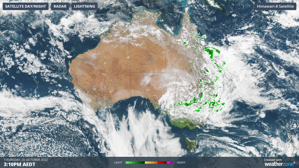
A huge, active band of showers and thunderstorms – some of them severe – is stretching from Cape York in far north Queensland, all the way down to northwest corner of Victoria.
Pretty much the whole eastern part of Australia is lit up like the proverbial Christmas tree with storm activity on the Weatherzone radar, as this three-hour radar loop up until 6:30 pm Thursday shows.
Weatherzone meteorologist Ben Domensino told you earlier today that heavy rain, large hail and damaging winds – the severe storm trifecta – were all likely to occur in parts of eastern Australia today, as severe thunderstorms erupt over Queensland and New South Wales.
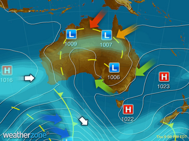
Those storms have now developed, as a low pressure trough (which you can see on the evening synoptic chart below) combines with ample moisture and an unstable atmosphere.
Meanwhile heavy rain has already been recorded in many areas this afternoon and early evening, including:
- Falls in the 40mm to 50 mm range have been recorded in parts of Queensland's Central Coast-Whitsundays forecast district, as well as the Herbert and Lower Burdekin.
- In New South Wales, the heaviest falls have been in the Hunter, Central Tablelands and Central Wests Slopes and Plains district, with 39.4 mm at Forbes, where the swollen Lachlan River is already experiencing moderate flooding according to the BoM's 12 pm warning.
The above are just a sample of the observations up to about 6:30 pm as we write this story, however further severe falls can be expected in many locations in the coming hours, with Sydney potentially in the firing line, although Brisbane looks like it might just miss the storms in southeast Queensland, most of which are west of the ranges.
We'll update you on the situation on Friday morning, ahead of what looks like another stormy, dangerous day across areas which are already saturated from recent heavy, persistent rains. As ever, please check our warnings page.