
Lots of blue sky to round out remarkably dry April
The final five days of April will be dry for much of Australia, a fitting end to one of the driest Aprils on record for some parts of the country.
While March was a notably wet month in Australia, there has been an abundance of blue skies and only pockets of substantial rain during April.
As of 9am on Monday, a broad area of the country had received less than 20 percent of the usual April rainfall.
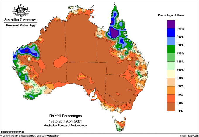
Image: Observed rainfall during April (to date) as a percentage of the long-term monthly average.
As you can see on the map above, this parched region stretched from the south coast of NSW all the way up to the Kimberley in WA, touching part of every state and territory. Many inland districts have stayed completely dry so far this month.
In NSW, Griffith Airport is likely to register no April rainfall for the first time in records dating back to 1959. This zero-rain zone encompasses a large chunk of central and northern Australia.
While Alice Springs is no stranger to 0mm during April, it's been an abrupt change from the wet scenes in March, when waterfalls were seen cascading down Uluru.
On the east coast, Sydney is currently having its 12th driest April in 163 years of records, with only 15.4mm in the city's gauge so far this month. This is well below the long-term average of 126.5mm.
Canberra's paltry 1.4mm should make this the capital city's third driest April on record and its driest since 1997.
But while most of Australia had an unusually dry April, parts of the country's west and northeast saw some decent rain.
The Cairns region in north tropical Queensland has been inundated with heavy rain over the last week or so.
One rain gauge at Mount Sophia registered 1104mm during the last eight days. This is nearly double Melbourne's average annual rainfall.
Preliminary figures show that Cairns has collected over 700mm so far this month, which would make this its wettest April since 1911.
In WA, a few places in the state's northwest managed to tripled their typical April rainfall thanks to Tropical Cyclone Seroja. And while Perth has only seen about half of its average April rain so far this month, there should be some more wet weather over the state's southwest on the final day of the month.
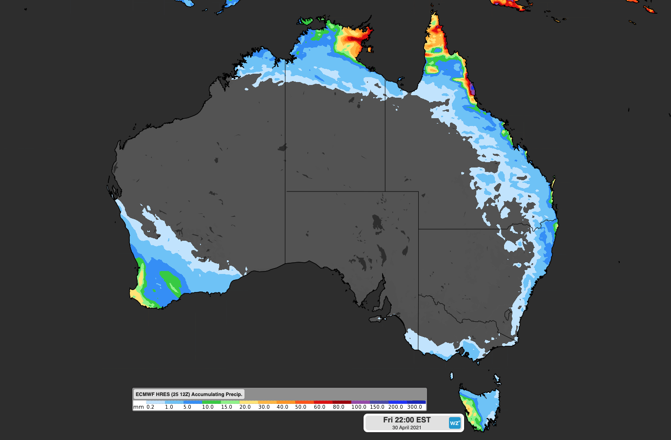
Image: Forecast accumulated rain between today (Monday) and Friday, according to the ECMWF-HRES model.
The map above shows where and how much rain is expected to fall in Australia during the final five days of April.