
Long dry spell continues for parts of UK and Europe
Much of the last few months have brought well-below normal rainfall to a large part of Europe, including the UK. This, in turn, has assisted an already-favourable large-scale pattern to deliver repeated heatwaves for many areas.
While the northern half of the UK has tended to avoid the hottest conditions, ongoing dry conditions have contributed to elevated fire risk. These conditions brought a large fire to parts of the Cairngorms in recent days. Further afield, large blazes continue in parts of south-west France and Iberia.
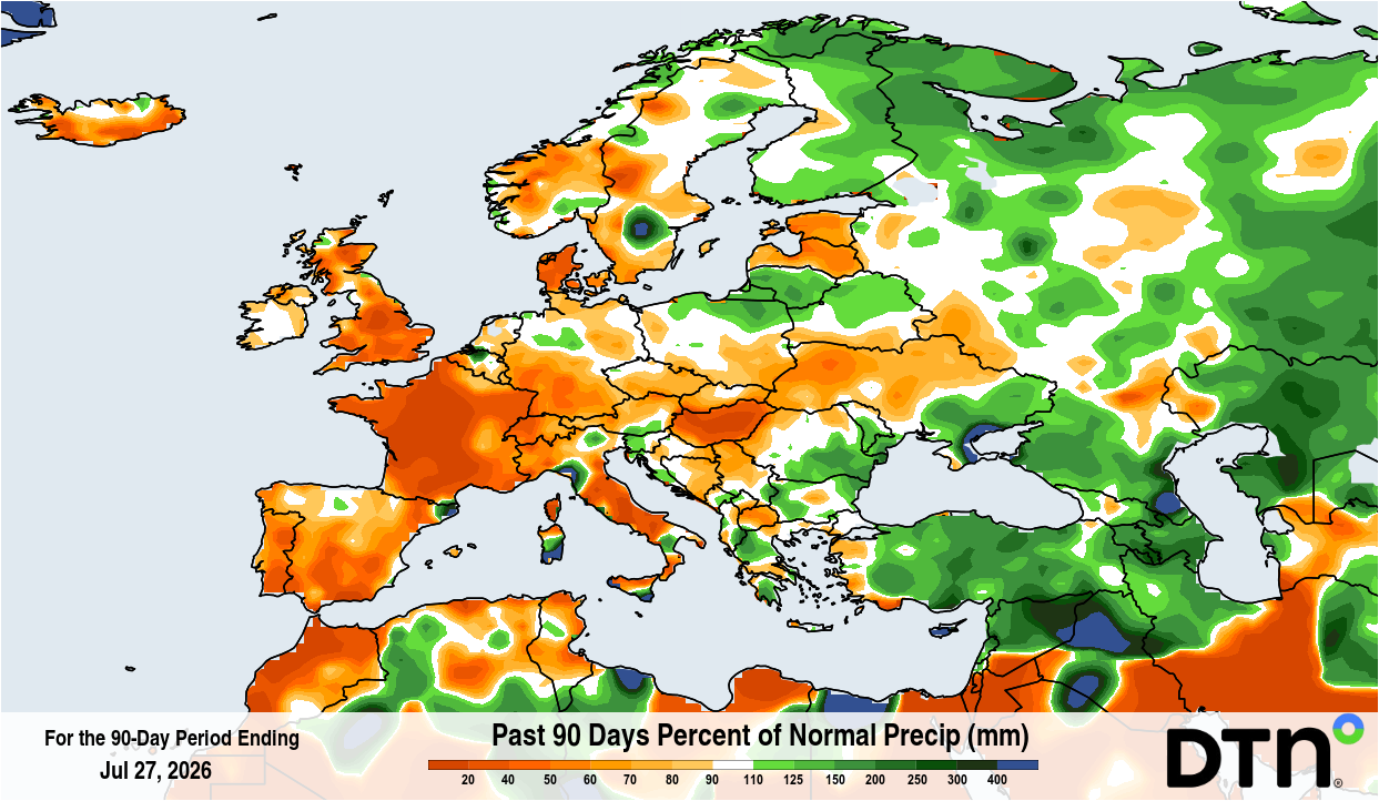
Image: Percent of normal precipitation received during the 90-day period ending on July 27, 2026. Source: DTN
The next few days
As a notably hot and dry July ends, another heatwave is gripping much of Europe and parts of the UK. However, the UK will see temperatures tending to ease back over the coming few days, as winds switch around into the west or north-west.
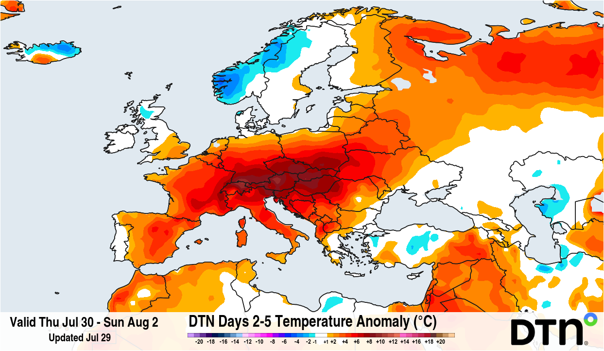
Image: Forecast temperature anomaly for the period from July 30 to August 2, 2026. Source: DTN.
Some much-needed rainfall will affect the northern-half of the UK, which should help with easing the fire risk for eastern Scotland. However, further south, apart from the chance of a shower or two, a large part of central and southern England will see little or no rainfall over the coming few days. Much of Europe will also remain dry and hot, and some of this hot air may spread back into southern Britain early next week.
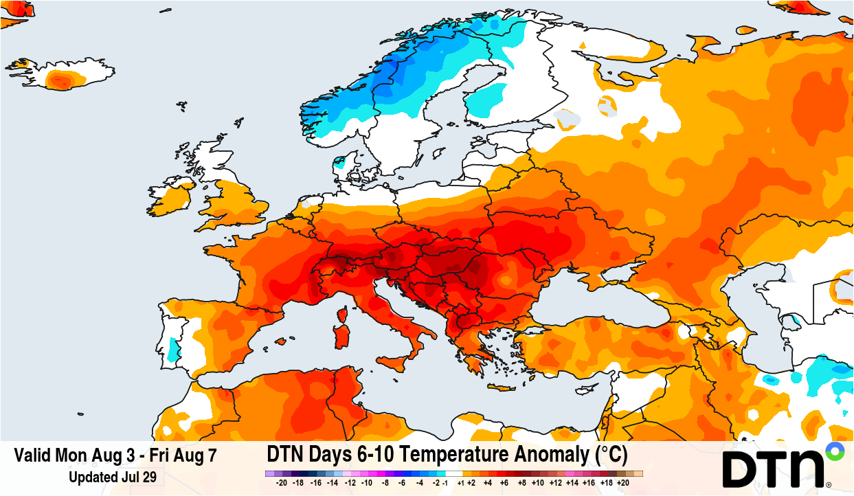
Image: Forecast temperature anomaly for the period from August 3 to 7, 2026. Source: DTN.
Into the middle of next week, there are a few hints that lower pressure may develop, for a time, across parts of northern Europe. This may promote scattered showers and thunderstorms, and a few of these may affect southern Britain. Whilst these will do little to alleviate the major shortfall in rainfall, locally they may ease the fire risk briefly.
Further ahead
August will likely continue the dry theme across much of Europe, including parts of the UK, especially the south. There will be further heatwave risks too, with much of continental Europe remaining hot. This hot air is likely to spread into the UK from time to time.
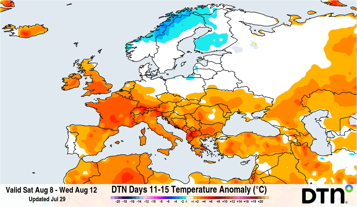
Image: Forecast temperature anomaly for the period from August 8 to 12, 2026. Source: DTN.
The northern half of the UK has a higher chance of rain in August, but with some longer dry spells possible too. There are some hints that parts of southern Europe may see a higher chance of rainfall later in the month, including across parts of Iberia. However, confidence is rather low on this at the moment.