
Late-spring chill spreading across southeastern Australia
A cold Southern Ocean air mass is spreading across southeastern Australia, with Melbourne’s temperature feeling like 5°C on Tuesday morning and Sydney next in line to feel the late-spring chill.
A bend in the polar jet stream is allowing a large pool of cold Southern Ocean air to sweep across southeastern Australia this week. This cold air mass is causing temperatures to plummet in several states and territories, while also producing a wintry mix of cloud, rain, snow and small hail.

Image: Jet stream winds (roughly 9-10km above sea level) over the Australian region on Tuesday afternoon, showing the polar jet bending over southeastern Australia.
Melbourne’s temperature has been frigid throughout Tuesday morning. While the city’s official temperature had reached 9°C by 9am, it has felt more like 5 to 7°C thanks to chilly winds, with cloud and rain exacerbating the cold start to the day.
Tasmanians have endured a similarly cold start to Tuesday, with Hobart’s temperature only feeling like 4.5°C at 8am. Snow is forecast to reach down to about 400 metres above sea level in parts of Tas on Tuesday, while some parts of the state will also see small hail amid wintry showers and thunderstorms.
The cold air will continue to spread further north and east on Tuesday, reaching the ACT in the early afternoon and arriving in the Sydney region around 6 to 8pm. This northward progression of the cold air will also cause rain and highland snow to spread into parts of northern Vic, NSW and the ACT.
Sydneysiders will notice an abrupt temperature change when southerly winds sweep up the coast on Tuesday evening, particularly in the city’s eastern suburbs. While Tuesday is forecast to reach 28°C in the city, it will feel more like 10 to 12°C in the evening evening after the change has passed through.
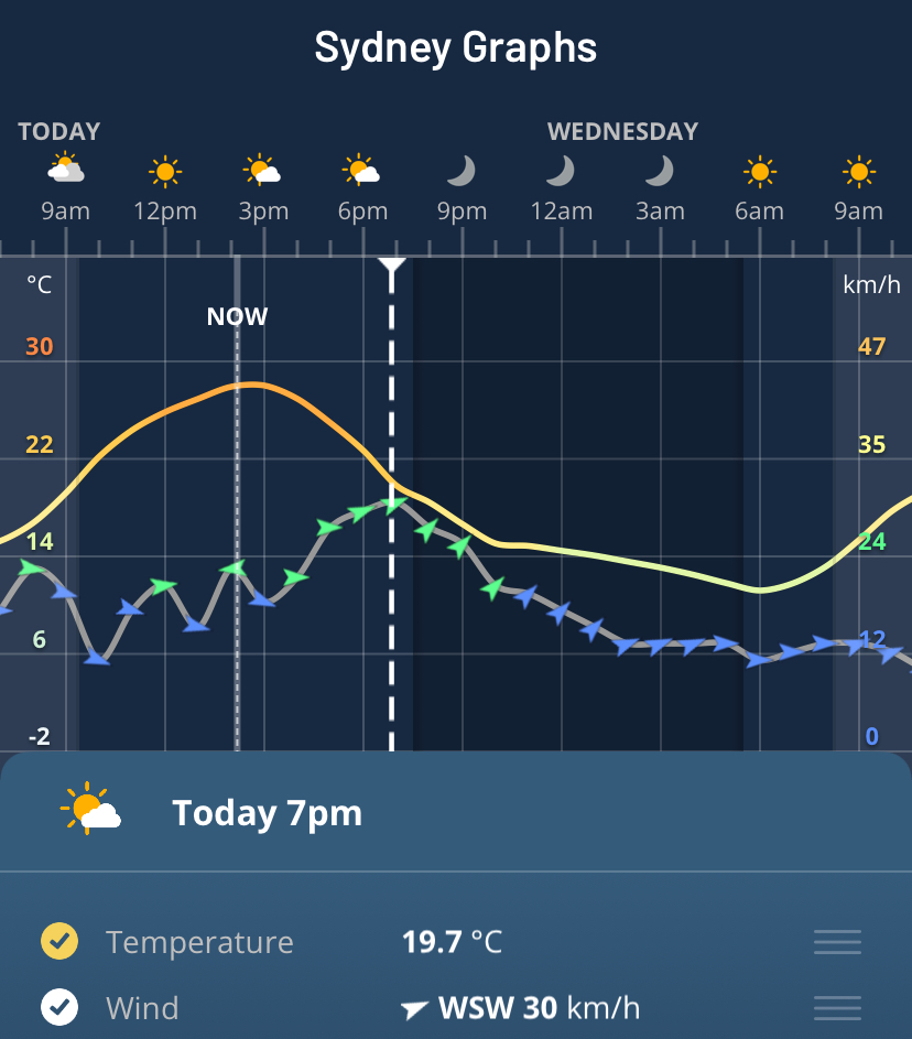
Image: Hourly temperature and wind forecasts for Sydney on the Weatherzone app.
Another hazard associated with this system will be a brief period of Extreme fire danger in the Greater Hunter and Upper Central West Plains districts in NSW on Tuesday. This spike in fire danger will be caused by a surge of warn and dry winds ahead of the approaching cold air mass.
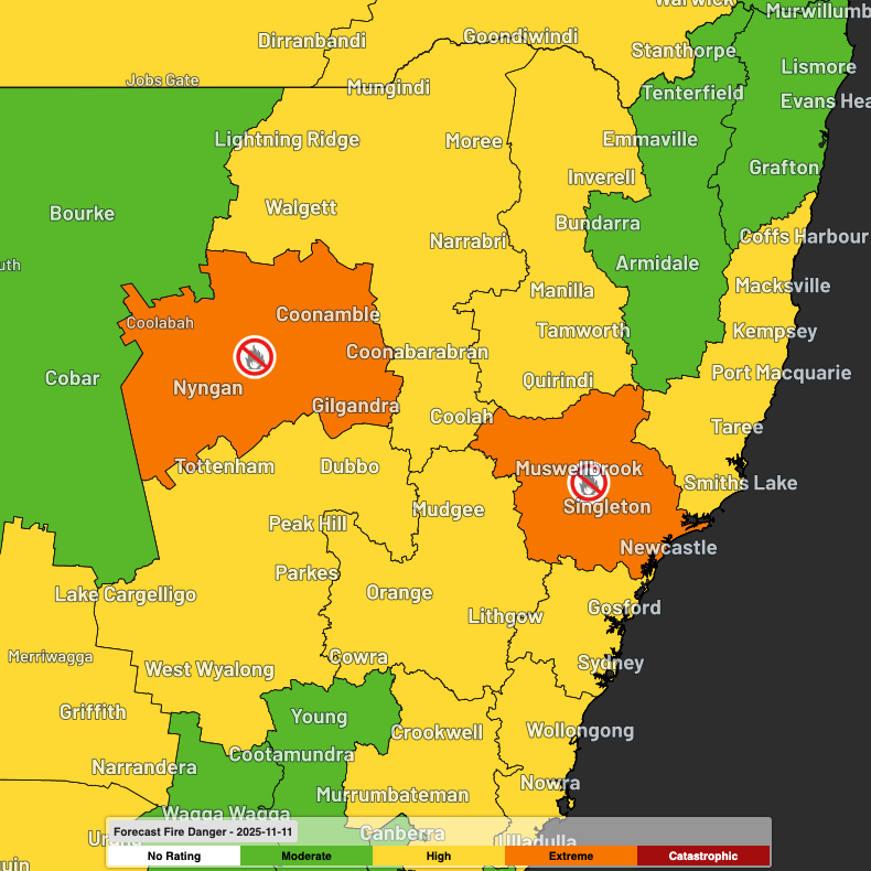
Image: Forecast fire danger ratings and total fire bans on Tuesday.
Warnings for sheep graziers are also in place for parts of Vic, Tas, NSW and the ACT on Tuesday, while Tasmania’s low-level snow potential has prompted a Road Weather Alert and Bush Walkers Weather Alert in parts of the state.