
Late-summer snow in Tasmania
A dusting of snow could settle on mountain tops in Tasmania during the middle of this week.
A cold front crossing Tasmania on Wednesday morning will bring a burst of wind, rain and frigid air as it surges across the state.
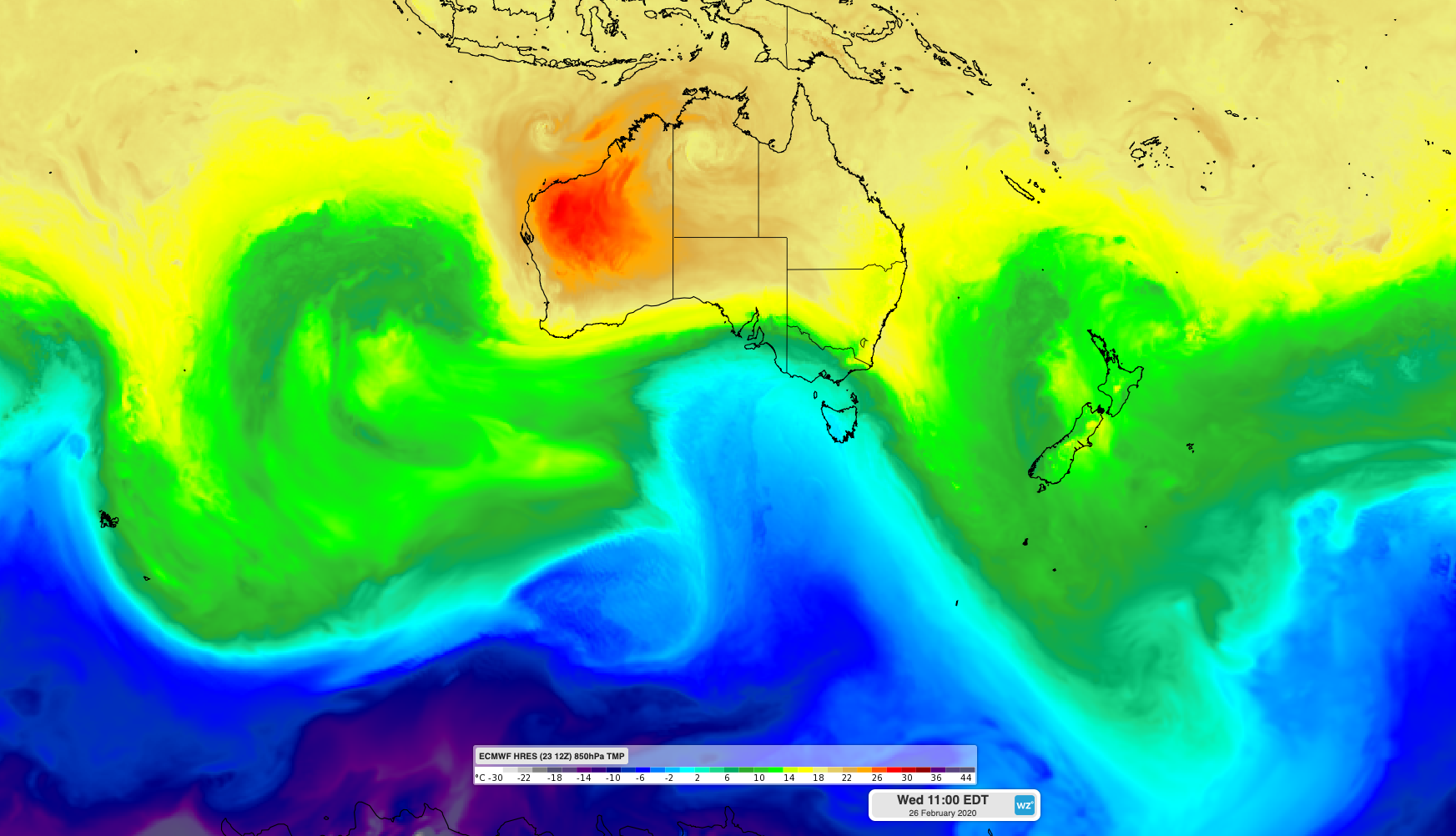
Image: ECMWF-HRES model showing cold air surging over Tasmania on Wednesday in the wake of a front.
In Hobart, temperatures are forecast to reach the high-twenties on Tuesday afternoon ahead of the approaching front. By Wednesday afternoon, the mercury will only be in the mid-to-high teens across the city.
At higher elevations, a pulse of cold air behind the front should drop temperatures enough to cause snow above an elevation of about 1000 metres on Wednesday. This snow is most likely to fall in elevated areas of western and southern Tasmania that are exposed to southwesterly winds.
While snow won't reach Hobart, there could be some on top of Mount Wellington by Wednesday afternoon.
Snow is not uncommon in Tasmania during summer and it can fall over the state during any month of the year. These blasts of cold, snow-bearing air typically start to become more frequent as summer transitions into autumn.