
Late-spring chill in southeastern Australia
A burst of cold, wet and windy weather will hit southeastern Australia during the second half of this week, with Melbourne forecast to have its coldest November day in 12 years.
A series of cold fronts passing over southeastern Australia will drag a mass of frigid Southern Ocean air over Tasmania, Victoria, SA and NSW between Wednesday and Saturday.
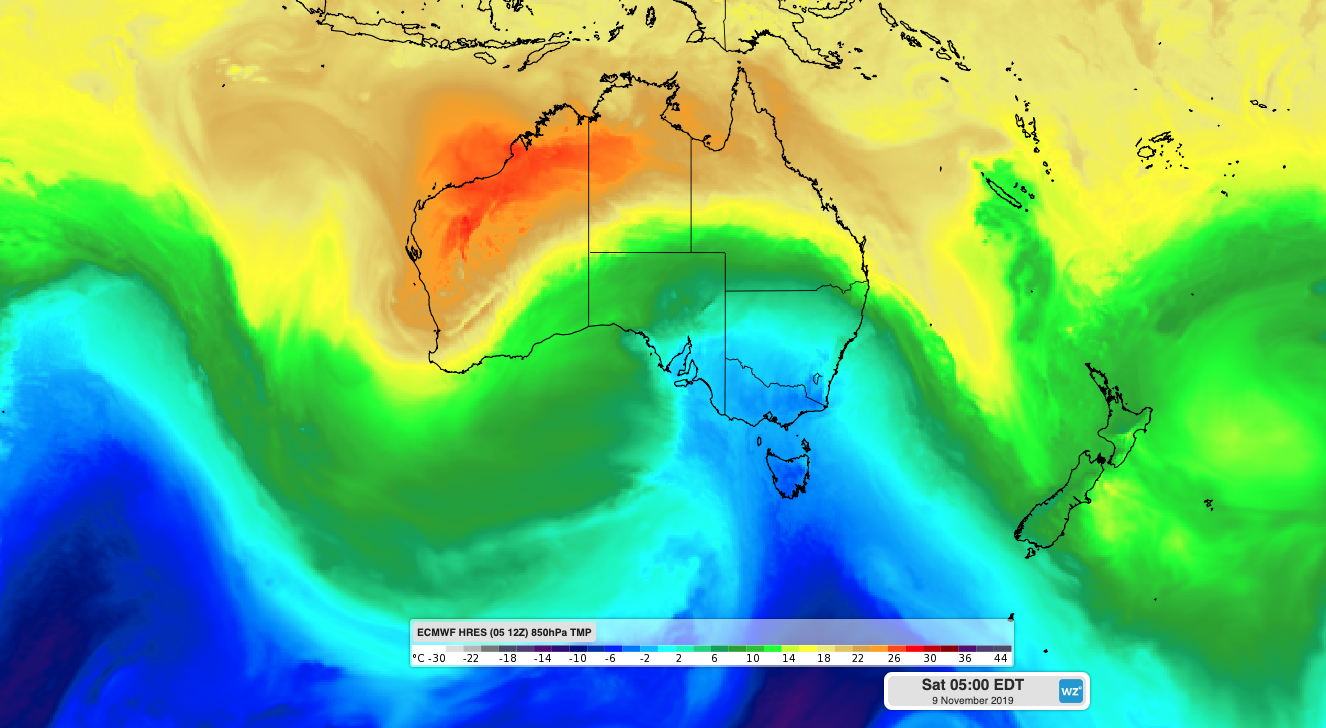
Image: ECMWF-HRES model showing cold air moving over southeastern Australia on Saturday morning.
This frontal precession is more typical during early spring than November. However, a negative phase of the Southern Annular Mode (SAM) is responsible for this week's chilly weather pattern.
The SAM is an index that measures the north-south displacement of a westerly wind belt that surrounds Antarctica, flowing between Antarctica and Australia throughout the year. When the SAM is negative, these westerly winds shift towards the equator, which can cause cold fronts to become more active over southern Australia.
Image: Southern Annular Mode (SAM) index values during the last four months, showing a sustained period of negative values since mid-October. Source: NOAA
This week's flurry of cold fronts over southeastern Australia is a consequence of a negative phase of the SAM, which has been occurring since mid-October.
The impending cold weather should cause temperatures to drop low enough for snow to settle on highland areas of Tasmania, Victoria and NSW later in the week.
Snow could reach about 600 metres above sea level in Tasmania from Thursday and lower to 500 metres on Saturday. Further north, snow could fall to 800-1000 metres in Victoria and southern NSW when the coldest air arrives on Friday night and Saturday morning. There's even a chance of a few snow flurries in elevated areas of central NSW on Friday night or Saturday morning, although this depends on how much moisture makes it this far north.
Melbourne is only forecast to reach 14 degrees on Friday, which is eight below average and would make it the city's coldest November day since 2007. Melbourne's coldest November day on record was 11.0 degrees in 1913.
The impending cold fronts are also likely to cause blustery winds, with damaging gusts possible in some areas. As of midday EDT on Wednesday, severe weather warnings had already been issued for parts of SA, Victoria, NSW/ACT and Tasmania.
Showers, thunderstorms, small hail and raised dust should also be a feature in southeastern Australia during the next several days.
Visit https://www.weatherzone.com.au/warnings.jsp for the latest warnings.