
Last wintry burst for at least a week across southeast Australia
After heavy rain on the weekend and a spell of cooler, windy conditions in the first half of the working week as a pair of cold fronts surged across the southeast, a period of drier, stable, warmer weather lies ahead for much of the country’s most heavily populated corner.
There are even signs of an unseasonable spike in warmth early next week, with Melbourne and Adelaide expected to peak around 20°C next Tuesday.
But before that happens, residents of both cities will have to cope with wintry weather this Wednesday. Let’s take a closer look at today’s conditions before focusing on what’s in store from the end of the week onwards.
Cold, wintry conditions in Melbourne, Adelaide, Canberra and the high country
Melbourne and Adelaide can both expect maximums of around 15°C this Wednesday. That’s exactly the long-term August average maximum temperature for Melbourne, and a degree or so below it for Adelaide.
Showers are also part of today's mix for both cities in the unstable westerly airstream behind a “decaying” (or weakening) cold front, which surged across Victoria, southern NSW and Tasmania on Wednesday morning.
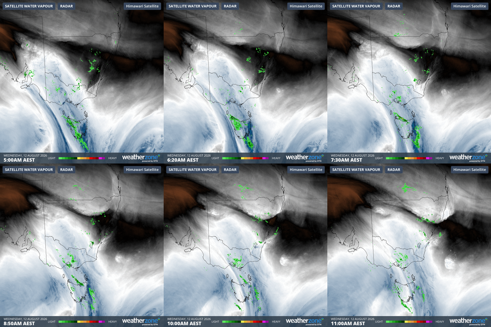
Image: Rain radar and atmospheric water vapour loop across SE Australia for the six hours to 11 am (AEST) on Wednesday, August 12, 2026. Source: Weatherzone.
Because it's located east of the mountains, Canberra rarely receives much (or any) rainfall from relatively weak cold fronts like this one, as there’s precious little moisture remaining once the cool airmass has crossed the mountains.
But the national capital is still enduring a relatively chilly Wednesday, with a maximum expected around 13°C (long-term August average 14.4°C) with apparent or "feels like" temperatures that will stay well into single digits all day due to those gusty westerlies.
In the alpine region, snow showers are falling above about 1400 metres this Wednesday, after overnight accumulations of around five centimetres at the higher resorts. The snow flurries should persist till this evening, but they will likely be the last fresh flakes of any significant quantity for at least a week.
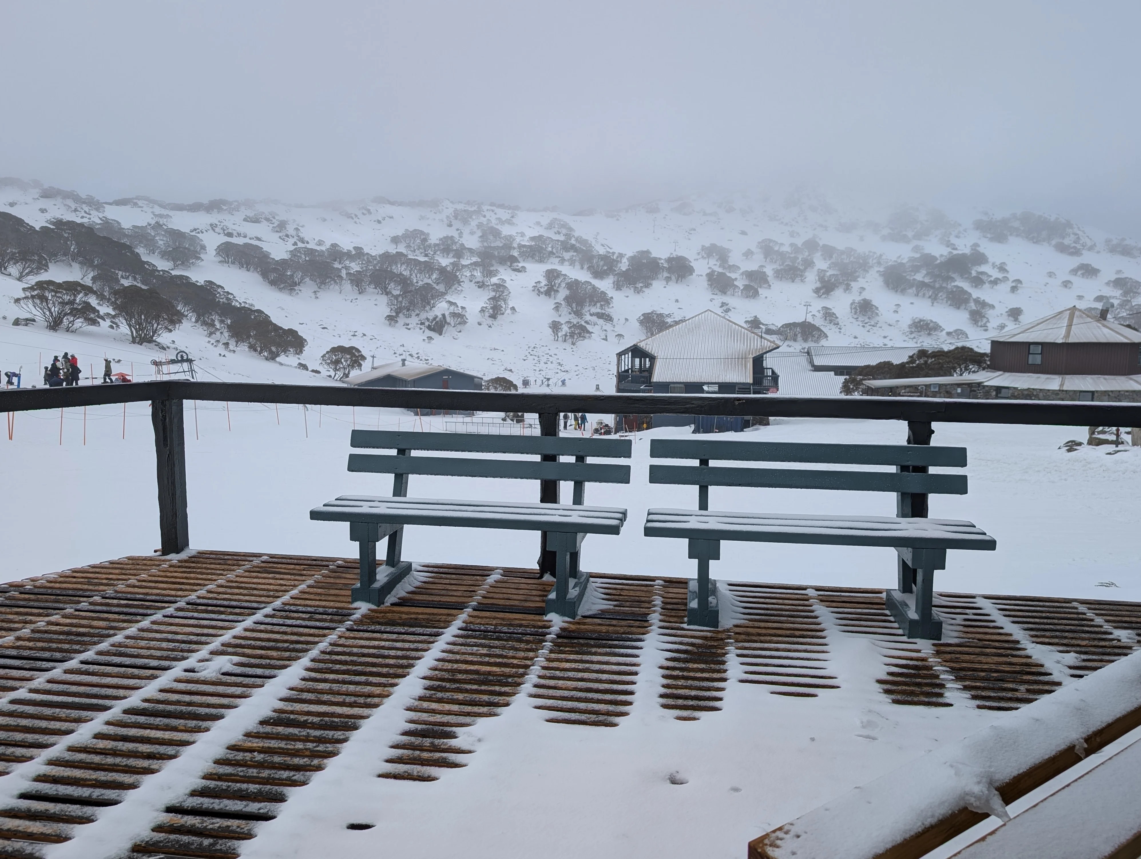
Image: A little fresh snow at Charlotte Pass, NSW, on the morning of Wednesday, August 12, 2026. Source: Fozzie Bear via ski.com.au.
Warmer and drier in Vic, SA, ACT before wet spell dampens east coast
While a shower or two may persist for a day or two in coastal areas of Victoria and southeastern SA, days will gradually warm up with drier conditions setting in as the week progresses. But for Sydney and Brisbane, the reverse is likely.
The east coast tends to be insulated from the harshest conditions associated with winter cold fronts that cross the southeast of the continent – and as Weatherzone meteorologist Jess Miskelly points out, westerlies tend to warm when running down the slopes of the Great Dividing Range towards the east coast.
For example, despite gusty westerlies in Sydney this Wednesday, the harbour city should still reach 20°C, after topping 21°C on Tuesday. Highs of 20°C are also expected on Thursday and Friday.
But on the weekend, winds will swing around to the southeast and Sydney maximums will drop by a degree or two as a period of showery weather sets in that could last into at least the middle of next week, as moist Tasman Sea air pushes onshore.
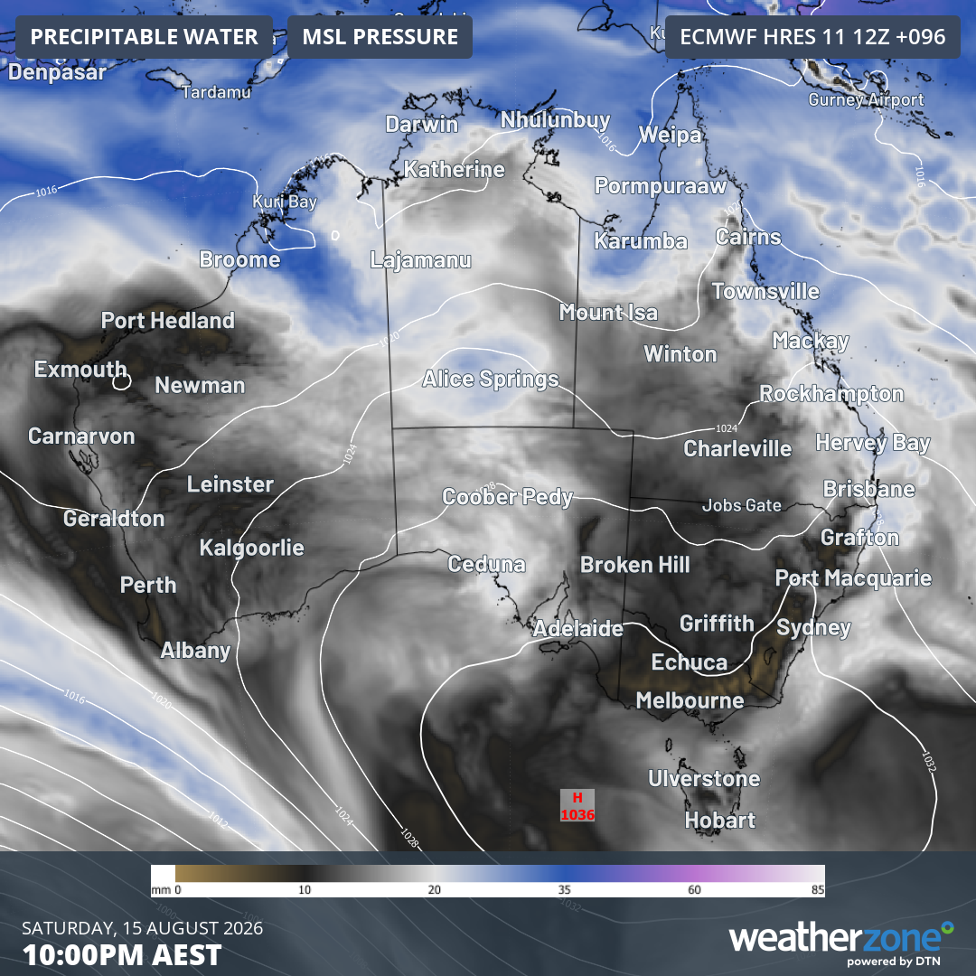
Image: Precipitable water and mean sea level pressure forecast for 10 pm (AEST) on Saturday, August 15, 2026, according to the ECMWF model.
Brisbane will also likely see a spell of showery weather from Sunday through to at least Tuesday.