
Large parts of Queensland shiver through their coldest morning of 2026 to date
Residents of Qld were finally enticed to break out the doonas last night as cold and dry air spread over much of the state, leading to the coldest morning of 2026 to date.
Clermont in Central Qld was the state’s coldest location, dropping to -0.4°C this morning. Charleville followed closely behind, falling to 0.0°C.
Amongst the many other locations that endured a relatively frigid morning are:
- Roma (0.4°C)
- Thangool (1.5°C)
- Williamson (1.7°C)
- Blackall (2.4°C)
- Hughenden (2.6°C)
- Mount Isa (3.6°C)
- Proserpine (3.9°C)
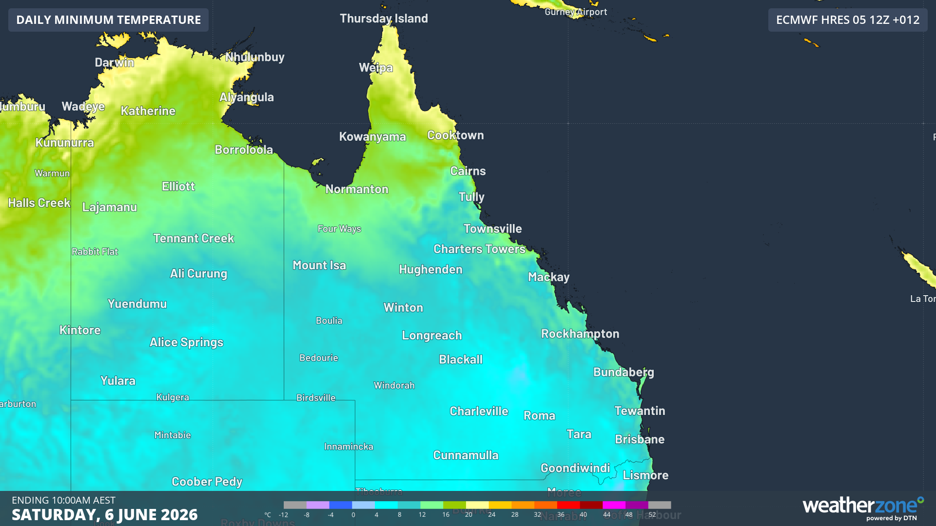
Image: Forecast minimum temperatures for Sat 6th June 2026. Source: Weatherzone
Even adjacent parts of the NT and northern NSW were subjected to single digit temperatures. Glen Innes (a usual suspect on the NSW Northern Tablelands) dropped down to -3.0°C this morning. Further afield, Cobar (0.3°C) and Bourke (0.7°C), as well as Borroloola (6.6°C) in the NT’s northeast all clocked in their coldest morning of the year so far.
Additionally, parts of Far North Qld were included in the early morning chill, with Burketown (9.3°C), Palmerville (9.9°C) and Kowanyama (10.0°C) dropping well below what they’re used to experiencing. In fact for Kowanyama and Palmerville, it was the coldest June morning in 7 years.
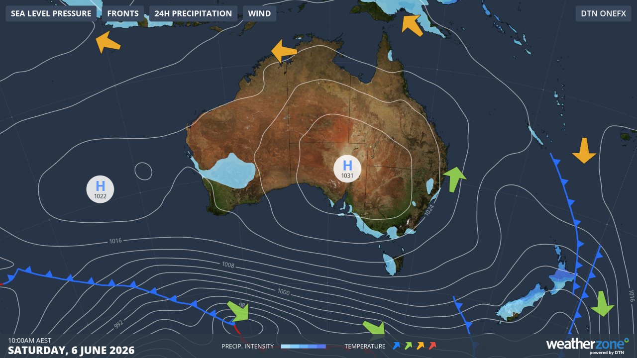
Image: Synoptic chart for Saturday, June 6, 2026. Source: Weatherzone.
People in these towns can blame a high pressure cell currently sitting over Eastern Australia for the chilly morning they experienced, with cold air being transported north from southeast Aus combining with clear skies to enable rapid overnight cooling. These cold mornings, however, are a small price to pay for the warm and sunny days that will no doubt be enjoyed by many over the weekend.
Looking ahead, another similarly cold morning is likely across much of east and northeast Aus on Sunday. By the start of next week, the high will begin to move over the Tasman sea, bringing warmer easterly winds and a warming trend to the nights.