
Large mid-week swell on the way for Sydney
While surf is barely breaking across Sydney beaches this weekend, an impressive southerly swell will bring a polarising difference this week.
A low pressure trough moving across the southeast on Monday will push offshore and develop into a significant Tasman Low on Tuesday this week. Gale to storm force S/SW’ly winds on the western flank of this system are expected to develop off the NSW coast late on Tuesday (Fig 1 below). While this peak in wind strength should ease on Wednesday, we will see an extended fetch of gale strength S’ly winds stretching from Tasmanian latitude, aimed at our coast, through much of Wednesday (Fig 2). Significant wave height across open ocean should reach 8-10 metres with a broad area reaching 5 metres (Fig 3).
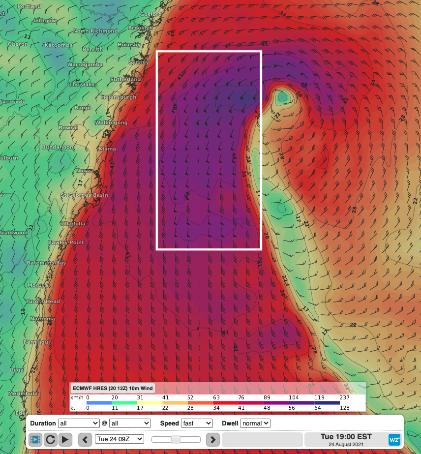
Fig 1: Gale to storm force winds on the western flank of the deepening Tasman Low generating swell height reaching 8-10 metres on Tuesday evening.
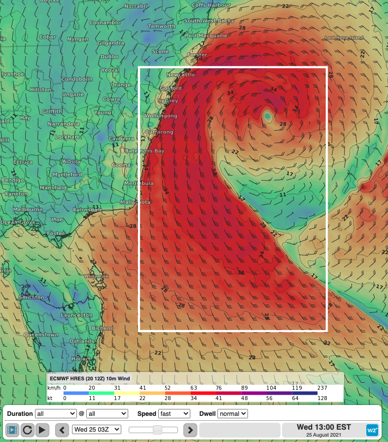
Fig 2: Extensive fetch of southerly winds stretching from Tasmanian latitude generating large swell directed towards the Sydney coastline throughout Wednesday.
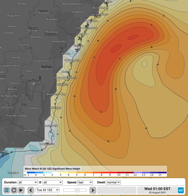
Fig 3: Significant wave height on Wednesday showing a broad area of swell height exceeding 5 metres, and a peak wave height in the vicinity of 8 metres off the Sydney coast.
So, how big will the surf be?
Tuesday should see offshore wave heights reach into the 3-4 metre range from around sunrise. This initial pulse of southerly energy should bring surf into the 6ft range across south facing locations. With fresh-to-strong westerly winds, conditions should be optimal for surfers to fulfil any required exercise within their local 5km radius.
A bigger pulse of southerly energy will push into the region overnight with wave height reaching into the 5-6 metre range late on Tuesday, and slowly easing on Wednesday. This sizeable swell will bring large, dangerous surf pushing the 8-10ft range at exposed south facing beaches. Winds are expected to be fresh W/SW’ly, tending more S/SW’ly as the day goes on. With this unruly surf and wind direction, surfers will find themselves hiding across less exposed locations with a reduction in swell height due to headland sheltering.
Thursday will see a continuation in this easing trend, with wave height in the 3-4 metre range. Conditions should be best in the morning with moderate W/SW’ly winds helping clean up the 4-6ft surf.