
Kirrily produces 5000 km cloud band off Australia's east coast
A stream of tropical moisture carried south by Ex-Tropical Cyclone Kirrily has created a colossal cloud stretching more than 5000 km between Australia to the South Pacific Ocean.
The remnants of Tropical Cyclone Kirrily have been hovering over eastern Australia for the past 12 days after the system made landfall near Townsville on January 25.
Video: Tropical Cyclone Kirrily approaching the Qld coast near Townsville on January 25, 2024.
However, Kirrily’s reign over Australia is coming to an end as the system gets dragged off the NSW coast by a cold front and low pressure trough.
Remarkably, the moisture associated with ex-Tropical Cyclone Kirrily is now being carried thousands of kilometres across the Tasman Sea, New Zealand and South Pacific Ocean by the polar jet stream.
The satellite images below show this massive cloud band on Tuesday afternoon, extending more than 5,500 km to the southeast of Australia.
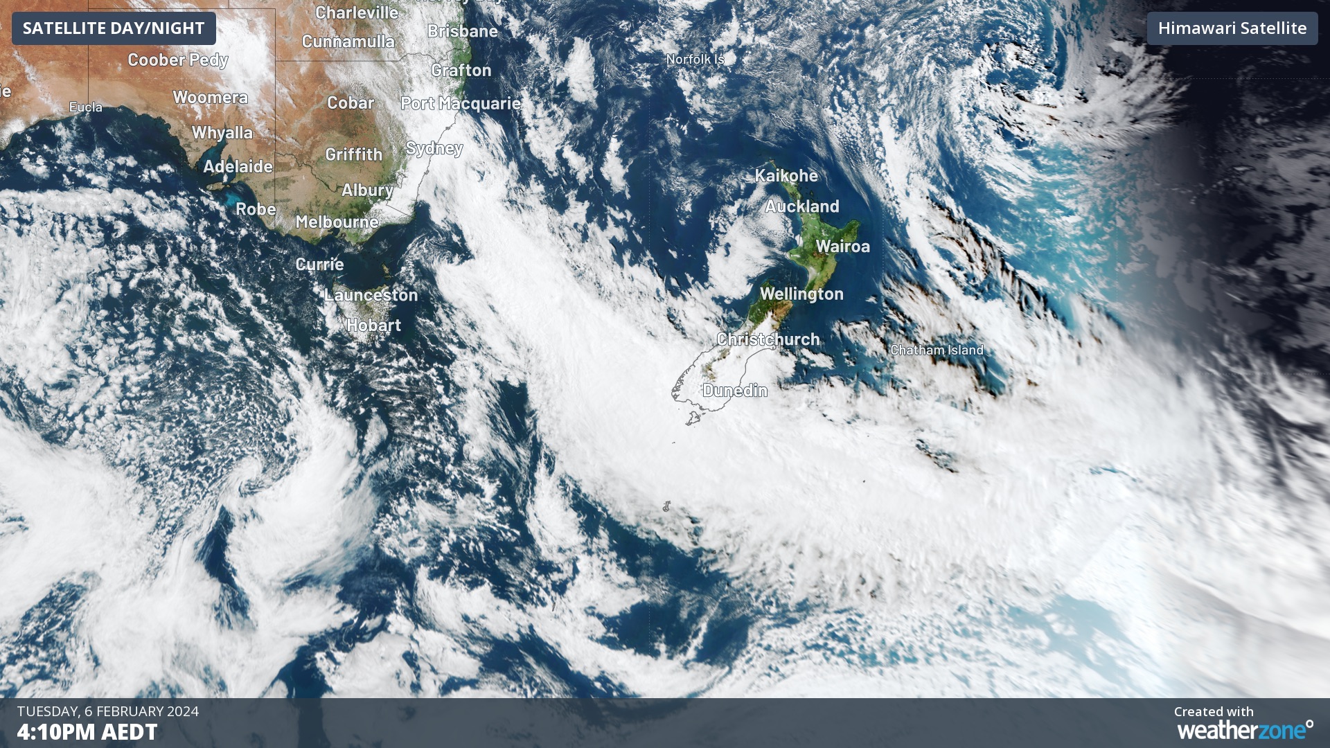
Image: Day/night satellite image captured at 4:10pm AEDT on Tuesday, February 6.
Over the past 48 hours, moisture associated with this system caused more than 100 mm of rain in parts of Qld, Vic and NSW. This included 106 mm at Falls Creek, which is more than its February monthly average, and 86 mm at White Cliffs, its wettest February day in 92 years.
With the tropical moisture now traversing the Tasman Sea, heavy rain warnings have been issued for parts of the Lower South Island in New Zealand.