
Is there a cold snap ahead? Pattern change could bring big changes to your forecast
Temperature forecasts could chop and change across parts the U.S. next week as lingering heat gets flushed out by a pool of much colder air. However, this dynamic weather pattern will be tricky to predict, so expect local forecasts to jump around from day-to-day.
With the change in the seasons getting deeper into fall, the atmosphere becomes a little more chaotic as colder air building up near the Arctic contrasts with hotter air lingering in the tropics.
This major difference in temperature affects weather patterns across the U.S. as the atmosphere does its best to even out the stark difference in temperature between north and south.
It happens every fall and spring to a greater degree than during the summer and winter, as cold fronts are bringing colder air southward while warm fronts are shifting warmer air northward.
With such big swings in temperature being possible and a lot of energy floating around in the upper atmosphere, models can sometimes do a poor job at forecasting changes in the weather at this time of year. So, when you’re looking at your daily forecast from your favorite weather app, you can probably expect to see some changes from day-to-day, especially into the second week’s forecast.
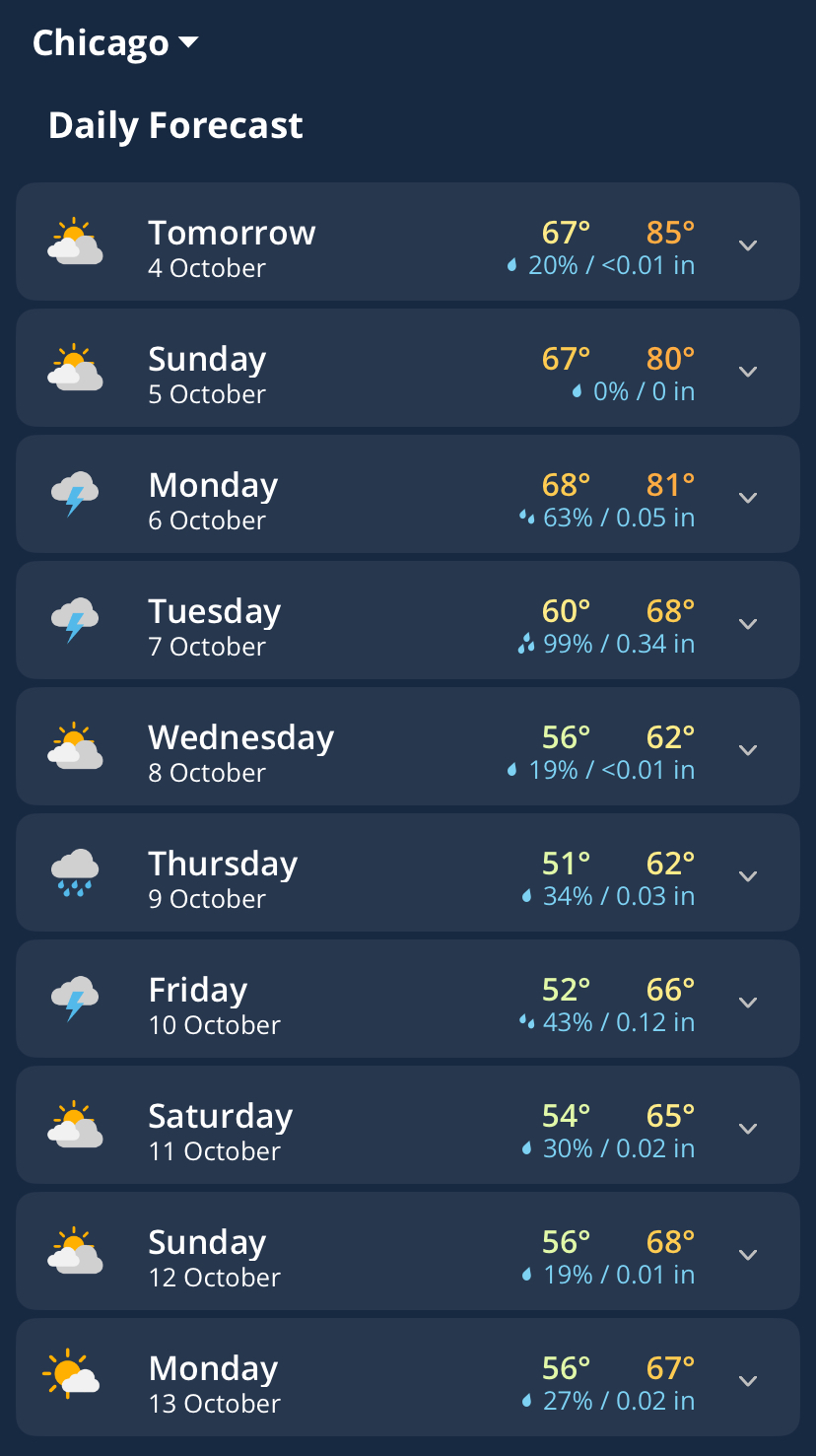
Image: Daily forecasts for Chicago, Il on the Weatherzone app, showing variable temperatures over the next 10 days.
It’s a meteorologist’s job to point out where these changes may happen and to what degree, even if models or the official forecast isn’t calling for it.
In the last few days, both the European ECMWF and American GFS models have been showing an upcoming cold front pushing through the U.S. On the European model, this is expected to occur next weekend, Oct. 10-12. On the GFS model, it’s a few days later.
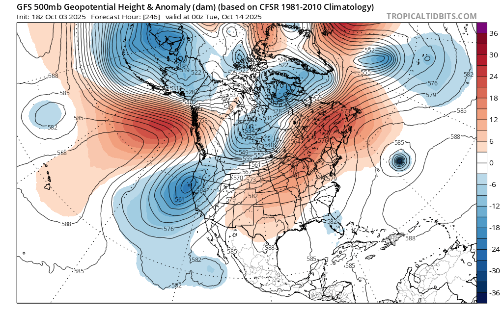
Image: Upper-level forecast from the American GFS model suggests a trough in central Canada during mid-October, which could be a source of some colder air. Source: tropicaltidbits.com
Both models are hinting at a big change to the weather, although there is a fair amount of uncertainty within these model predictions. This is where a meteorologist can add value.
Many industries rely on input from meteorologists to augment the raw forecast data they use from weather models. Articles on the Weatherzone news feed are also written by DTN meteorologists, giving anyone an opportunity hear what a meteorologist is thinking about upcoming weather events.
Models suggest that big changes may occur next week in the second week but the forecasts may change frequently in the lead-up. Be sure to keep an eye on th latest forecast in your area over the next couple of weeks.