
Intense frontal system to impact WA

Western Australia is enjoying clear skies across the state today, however don't get too used to it as the next winter frontal system is making its way toward the southwest.
Light winds circulating around a high will begin to strengthen into this evening with potentially damaging winds developing over exposed parts of Central West, Lower West and South West by mid-morning on Sunday. Winds of this magnitude are possible into the evening, including across southern parts and elevated parts of South West and South Coastal, before a slight reprieve from the early hours of Monday morning.
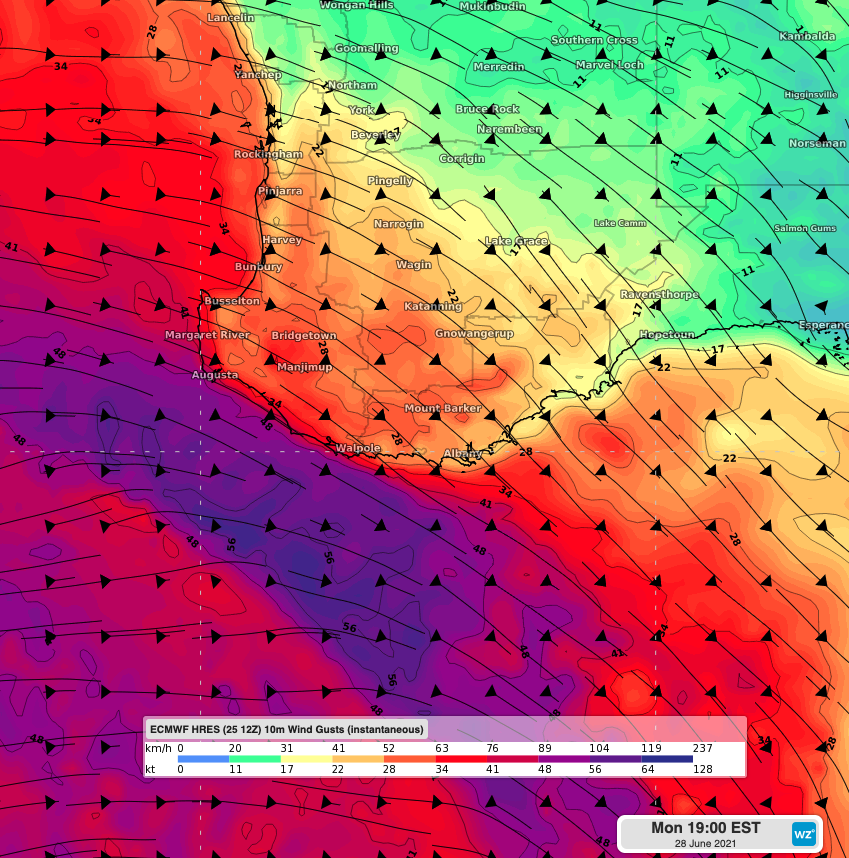
10m Wind gusts over southwest WA using ECMWF Fri 12Z
Another burst of damaging winds is expected on Monday evening into the early hours of Tuesday, particularly for the coasts of South West and South Coastal when gusts exceeding 90km/h are possible.
Thick cloud and heavy rain will accompany these winds, with 25-50mm possible over Lower West and South Coast, including the Perth area. Heaviest falls are expected on Sunday afternoon and evening when 15-30mm is possible over the southwest coast and adjacent inland.
High pressure will gradually rebuild from late on Tuesday, however the cold airmass looks to linger, which should bring a run of cold mornings across the southwest as skies begin to clear and winds drop.