
Intense complex low to pummel eastern Australia this weekend
Heavy rain, strong winds and powerful waves will hit eastern NSW this weekend as an intense complex low rapidly intensifies off the coast.
An area of low pressure forecast to be off the northern NSW coast on Friday is expected to rapidly intensify on Saturday. A pool of cold upper-level air and deep feed of moisture triggering this intensification will also bring adverse weather to parts of eastern NSW.
Intense rainfall and strong winds may lash into some areas of eastern NSW as the deep feed of moisture wraps around the system. However, weather forecasting models have yet to pinpoint the exact location and intensity of this system over the weekend.
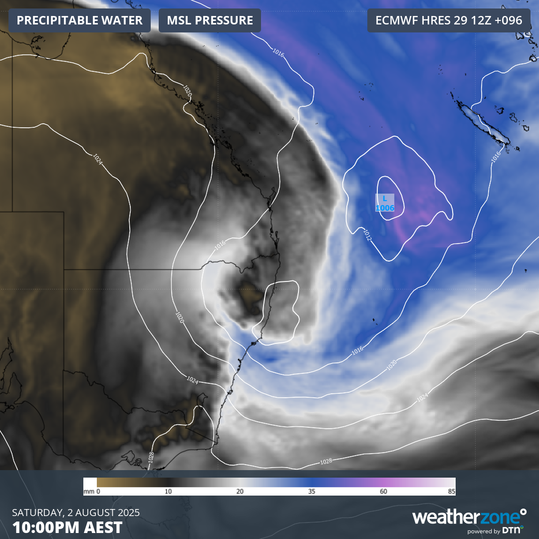
Image: Forecast precipitable water and Mean Sea Level Pressure (MSLP) on Saturday, August 2, 2025 showing a deep feed of tropical moisture wrapping around low pressure into eastern NSW.
Heavy rain over a period of about 36-48 hours between Friday, August 1 and Sunday, August 3, could amount to falls of 100-150mm in some parts, most likely between the Mid North Coast and the South Coast.
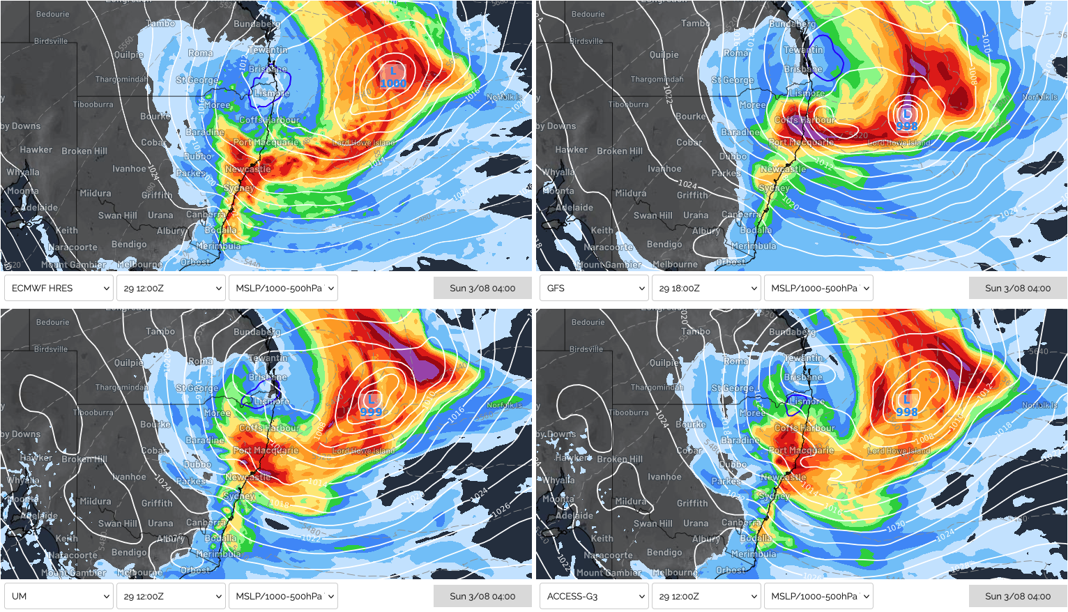
Image: Forecast 24-hour rainfall and MSLP to early on Sunday, August 3, 2025, showing heavy rainfall across parts of NSW's Mid North Coast, Hunter and Sydney regions from four different weather models.
Powerful easterly swell to lash coastal NSW and southeast Queensland
Regardless of where the system intensifies, a broad area of easterly gales will set up across the Tasman Sea over the weekend, directed towards the NSW coastline.
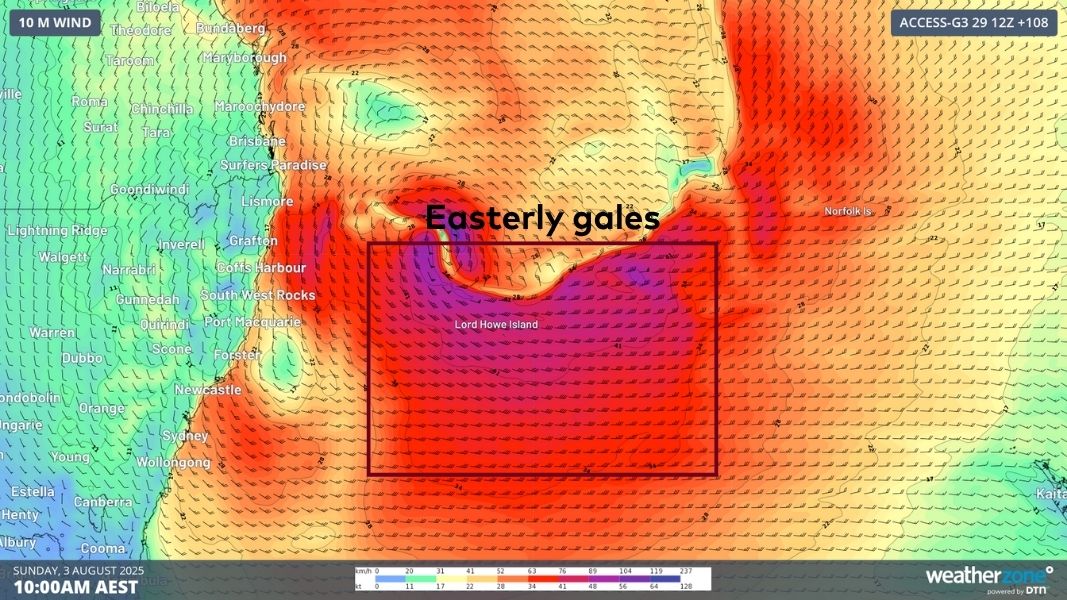
Image: Easterly gales directed towards the NSW coastline on Sunday, August 3, 2025, generating large seas.
Large seas exceeding 6 metres will be generated by these winds across much of the Tasman Sea. Between late Saturday and Sunday, the swell will muscle into coastal NSW and southeast Queensland with significant wave heights reaching 3-4 metres. Parts of the Mid North Coast and Northern Rivers, most likely between Byron Bay and Seal Rocks, should see the largest waves, with the swell reaching 4.5-5.5 metres late on Sunday and into Monday.
Video: OneFX forecast significant wave heights across the Tasman Sea between Friday, August 1 and Wednesday, August 6, 2025.
Significant wave height is the average of the largest third of the waves recorded over the measuring period – a value used to represent the noticeable ocean conditions for mariners. Maximum wave heights usually double the significant wave height, so parts of NSW’s coastline could see maximum wave heights exceeding 10 metres at times.
The swell direction will start off from the southeast but is then expected to swing to a more direct easterly direction during Sunday and Monday. Easterly swells are especially hazardous as they bypass the headlands that protect beaches and harbours from the more typical south swells. This also enhances coastal erosion across hotspots like Byron Bay’s Main Beach, the Central Coast’s Wamberal Beach, and Sydney’s Collaroy Beach, which are usually protected from south swells.
After the peak in swell height, continued longer period easterly swell energy should persist into mid-next week. Easterly swell with peak wave periods of about 12-13 seconds will have less height but carry lots of energy and continue to batter the NSW coastline.
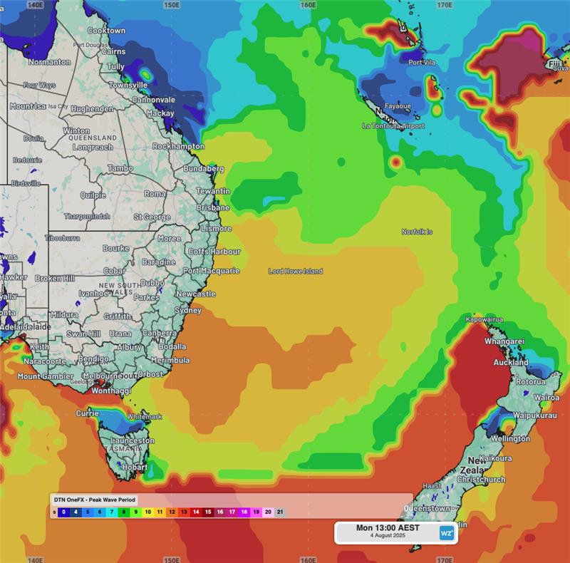
Image: OneFX forecast peak wave periods of 12 to 13 seconds impacting the NSW coastline on Monday, August 4, 2025.
Fortunately for surf riders, the ugly conditions from the weekend strong south-to-southeasterly winds will abate, with cleaner conditions expected at times next week to make the most of the tail end of this sizable swell.