
Incredible satellite imagery shows NSW floodwaters from space
This is what Sydney’s floodwaters look like from 786 kilometres above the earth, as captured by the Sentinel-2 satellite on Thursday afternoon (AEDT).
The first image (below) shows the northern two thirds of the Sydney basin, excluding landmarks like Botany Bay, Sydney Airport, Port Hacking, and the Sutherland Shire.
Sydney Harbour is the body of water in the bottom right of the pic. As you can see, it is comparatively unaffected by muddy, discoloured floodwater.
It's a different story at Broken Bay in the centre right of the image, where the Hawkesbury River meets the sea. Muddy floodwaters can clearly be seen discharging several kilometres out to sea.
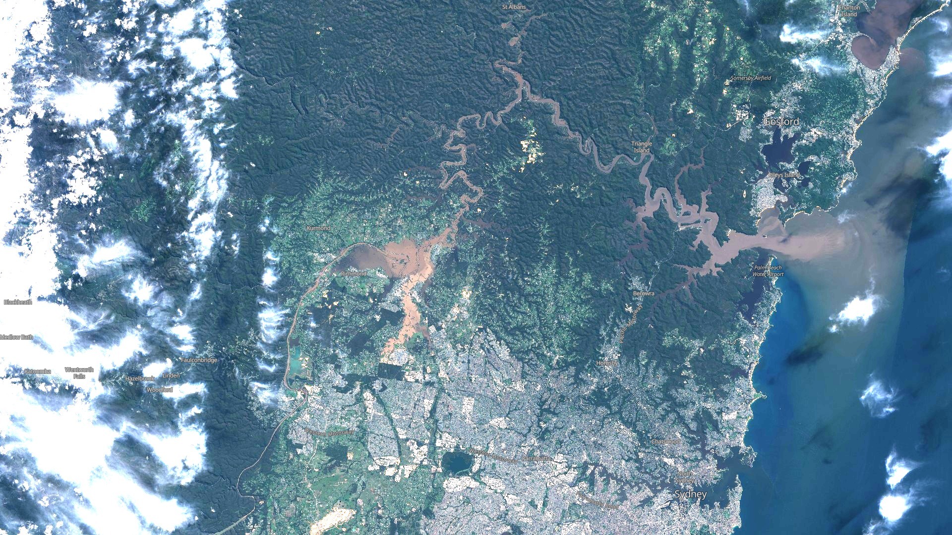
If you follow the Hawkesbury upstream, you can see how much mud and silt the river and its main tributaries are carrying right now. You can also make out the large basin of floodwater in the Windsor/Richmond area which has not yet receded.
Here’s a close-up image of that region, which is about 60 km by road from the Sydney CBD.
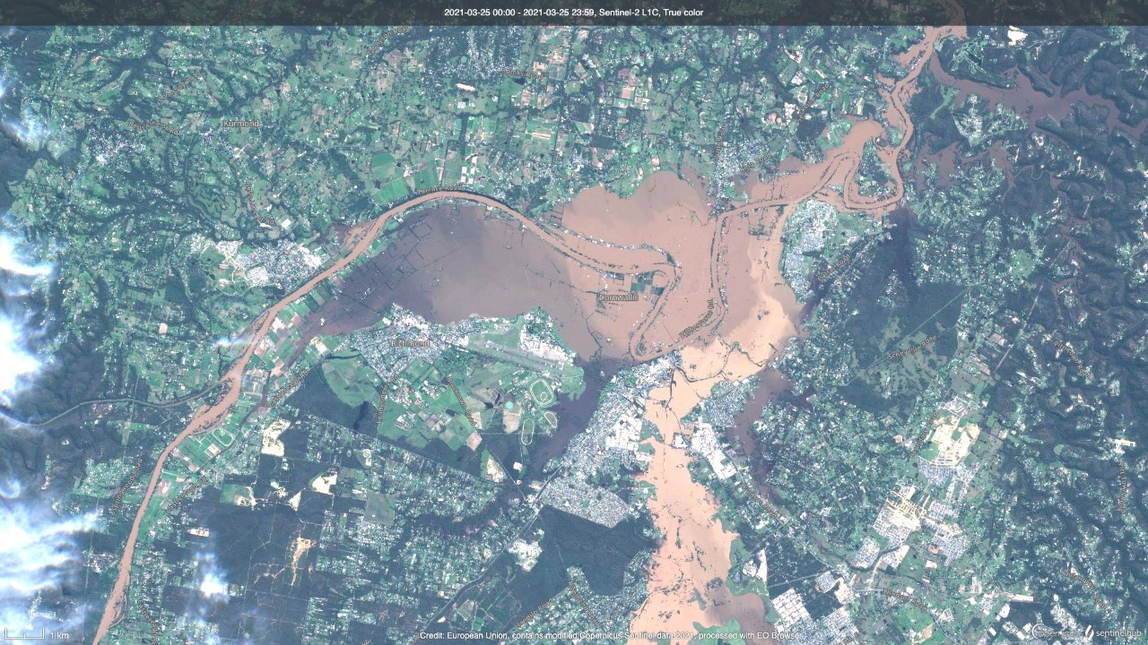
You can also clearly see Hawkesbury Racecourse at Clarendon, where the track right now is probably best suited to mudlarks.
Weatherzone developer Andrew Miskelly has also captured floodwaters in far-flung parts of New South Wales beyond the Sydney basin on his Twitter feed. Here's one example.
Satellite imagery captured on Wednesday and Thursday mornings showing floodwaters in northern NSW gradually draining towards the Barwon River (subsequently the Darling River). pic.twitter.com/EMiKuDffGZ
— Andrew Miskelly (@andrewmiskelly) March 24, 2021
Please remember to avoid floodwaters whether driving, walking, or cycling. You can keep up the with the latest advice from the SES here and the latest warnings from the Bureau of Meteorology here. Minor and major flood warnings remain in place for numerous NSW rivers.