
Impressive thunderstorms in the NT
Intense thunderstorms have affected most parts of the Northern Territory this weekend due to the combination of heat and instability. Showers, significant rainfall, and lightning began to develop from early Saturday and strengthened in the afternoon and evening. It was a welcome event as some areas, like McArthur River Mine in Carpentaria East, hadn't seen any rain since March.
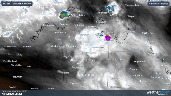
Image: Water Vapour satellite imagery on the afternoon and evening of Saturday,11 October 2025.
To 9am Sunday, Alice Springs (17.4mm) and Jabiru Airport (58.6mm) received the highest 24-hour October rainfall in 15 years. Borroloola (17.2mm) and Rabbit Flat (13.6mm) also recorded the highest rainfall for the month since 2020, and McArthur River (17.6mm) since 2021.
A remarkable number of lightning strikes were recorded yesterday over the NT, with more than 475,000 strikes over the territory and nearby.
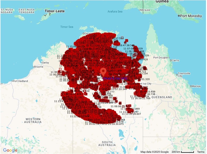
Image: The red squares and crosses show the 475,488 lightning strikes detected within 800 kilometres of Tennant Creek on Saturday, 11 October 2025.
Looking ahead, showers and thunderstorms will continue to affect most parts of the territory today, before contracting to northern and central areas from tomorrow.
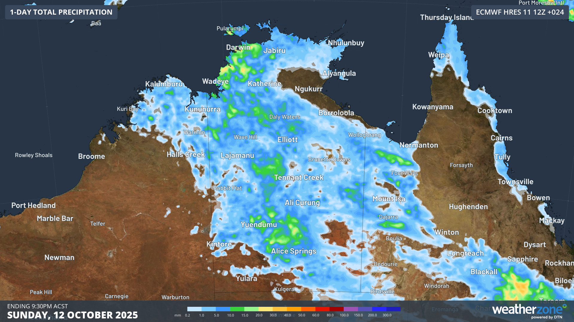 Image: Total Precipitation forecast for Sunday, 12 October 2025. Source: Weatherzone.
To know the forecast for your region, check here.