
Ilsa roars inland after record winds
Category 5 Tropical Cyclone Ilsa roared across WA's Pilbara coastline late on Thursday night, delivering record winds and reportedly causing 'great damage' to local truckstop the Pardoo Roadhouse.
- The BoM reported that Ilsa set a new preliminary Australian 10-minute sustained wind speed record of 218km/h at Bedout Island, a tiny speck of land about 100 km NE of Port Hedland
- Gusts at Bedout Island reached 289 km/h around 9:30 pm Thursday
- One-minute data suggests sustained winds at Bedout Island peaked at 228 km/h at 9:26 pm
- After 9:30 pm, observations stopped being recorded at Bedout Island, probably because the weather station was damaged by the extreme winds, which may well have gotten seven stronger
- According to the BoM, the previous record for 10-minute sustained winds was 194km/h in 2007 at the very same location with Cyclone George
For the people who run the Pardoo Roadhouse, it was a terrifying night which they spent sheltering in a shipping container.
"This has been a stressful and challenging time for our Pardoo Roadhouse team," they posted on Facebook just before dawn.
"Early reports are the roadhouse has suffered great damage, although it's too early to tell the full extent. Thanks again everyone, your support has really lifted our spirits."
Weatherzone will keep you updated on the damage from this system later on Friday. The good news is that Ilsa always looked likely to narrowly miss the largest towns in the region – Port Hedland and Broome – and so it has proven.
Meanwhile Ilsa has now downgraded to a Category 3 cyclone. The Bureau's latest advice issued at 6 am AWT (8 am AEST) said that Ilsa was still generating sustained winds of 140 km/h near its centre, with gusts to 195 km/h.
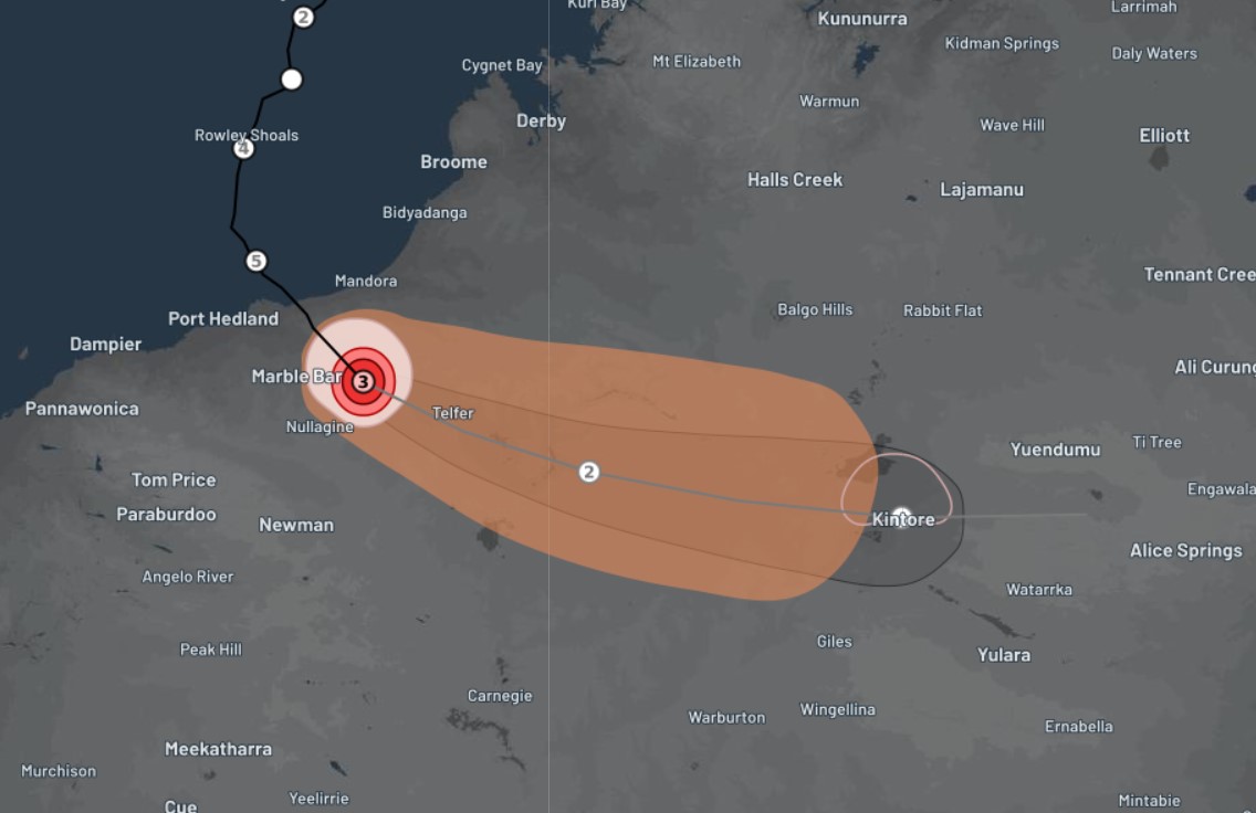
Ilsa is forecast to maintain tropical cyclone intensity as it tracks past Telfer and further inland across WA's Interior forecast districts through Friday. Remarkably, it is likely to remain as a tropical cyclone for at least 800 km of its travels towards arid regions far from its oceanic origins.
It is then expected to weaken below tropical cyclone strength on Friday night as it tracks towards the southern NT.
Please keep checking the latest updates on the tropical cyclones section of our warnings page.