
Huge waves battering the NSW coast
Large and dangerous waves are affecting the NSW coastline, causing wave heights to rise above 10 metres offshore.
A waverider buoy located near Coffs Harbour registered maximum wave heights over 10 metres on Friday night. Another buoy located off the coast of Sydney was hit by an 8.5-metre wave.
Gusty winds are only affecting the coastal fringe of NSW as the strongest winds remain out to sea. Wind gusts reached 85km/h at Wattamolla on Friday evening.
Responsible for the large swell and strong winds is a deep low pressure system over the Tasman Sea approaching New Zealand, which is directing a powerful southerly flow along the east coast of Australia. Astronomy also comes into play to explain the powerful waves as this system coincides with high tides.
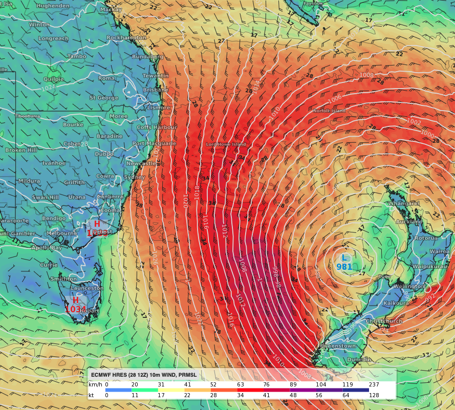 Image: 10-m sustained winds and mean sea level pressure on Saturday evening according to the ECMWF-HRES model.
Another peak in waves is expected Saturday evening, around the high tide. A Severe Weather Warning remains in place for abnormally high tides and damaging surf for most of the NSW coastline. These waves could cause erosion at some south and southeast-facing beaches.
The low will move slowly further away from the Australian coast as a firm high in the south pushes east. Therefore, conditions will gradually ease during Sunday.