
Howling winds and cold air hitting Tasmania
A surge of powerful winds and showers will sweep across parts of Tasmania today as an intense low pressure system passes to the south of the state.
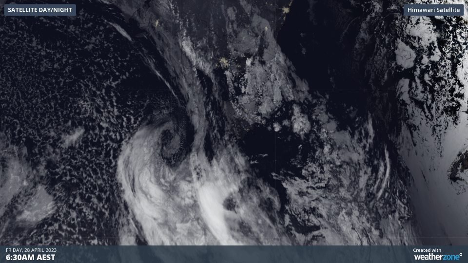
As the sun rose on Friday morning, satellite images revealed a well-defined low pressure system spinning to the west of Tasmania as an associated cold front approached the state’s west coast.
This low and front will cause blustery winds, showers and cold air to spread across Tasmania on Friday, with the strongest winds and heaviest rain occurring during the middle of the day with the passage of the front.
While Friday will be windy for most of Tasmania, the strongest winds will occur in the state’s south, closer to the low, where gusts could reach 100 km/h in some places. At 9am local time, a severe weather warning was in place for damaging winds in parts of the Western, Upper Derwent Valley and South East Forecast Districts.
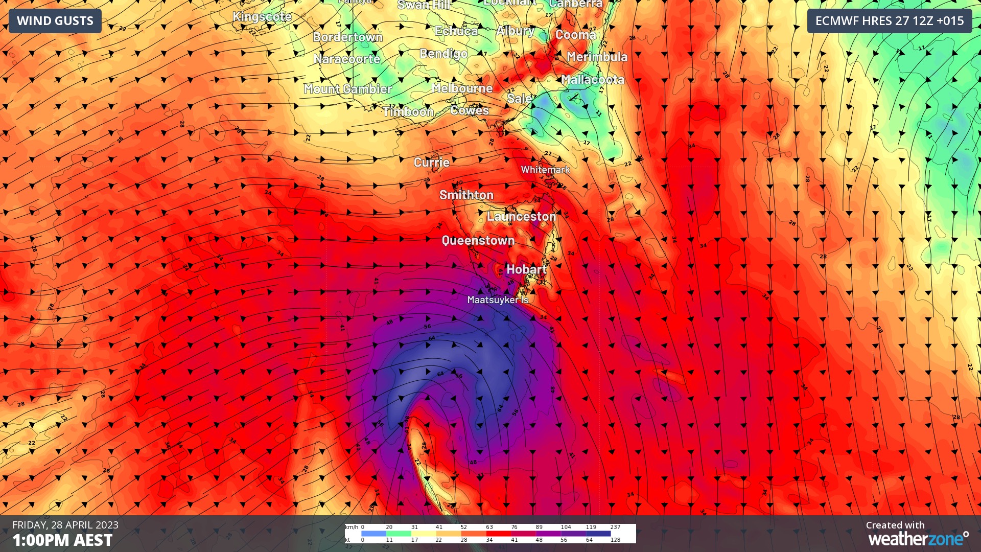
Image: Forecast wind gusts speed and direction at 1pm AEST on Friday, according to the ECMWF model.
There will also be a noticeable drop in temperature as the front and showers sweep across the state on Friday. Hobart is forecast to reach around 20ºC in the late morning before dipping to the mid-teens in the afternoon, although wind chill should make it feel lower than 10ºC throughout the afternoon.
Cold air in the wake of Friday’s front will also bring some snow to elevated areas in southern and western Tasmania, initially above 1100 m elevation on Friday before lowering to around 800 m by Saturday morning.
Calmer weather will return to Tasmania on the weekend as the low and front retreat towards the Southern Ocean.