
How cool are these images of a cold front over SA?
This really cool composite image (excuse the pun!) shows what this morning's cold front looked like as it pushed across South Australia, approaching the town of Ceduna.
- In the left hand image, you can see the the modelled (forecast) 850 hPa temperature, wind and height at the same time. The green shows warmer air, the blue shows cooler air.
- The right hand image shows the band of rain and storms as captured by both radar and satellite imagery.
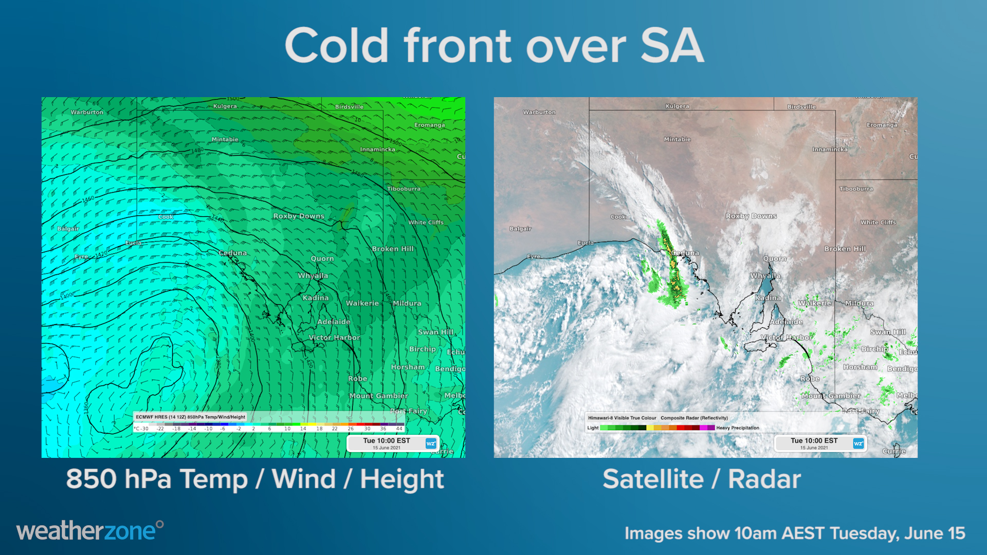
It's not always the case that you see the boundary between warmer and cooler air masses represented so clearly by the narrow band of showers and storms showing up on the radar.
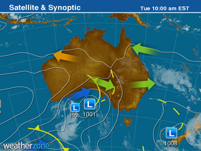
Indeed the rainband almost perfectly replicates the cold front shown on the 10 am synoptic chart.
So what next after this front has passed through Ceduna?
Here's what Weatherzone meteorologist Ben Domensino had to say about the current situation:
"A cold front will cross South Australia today, causing showers and some thunderstorms to develop over the southern half of the state.
"Some of these showers and storms could affect Adelaide, most likely from the afternoon, before the front reaches the city tonight. The cold air behind the front will bring a noticeable drop in temperature, with Adelaide forecast to reach 18ºC today and only 14ºC tomorrow."
At 11:30 am Tuesday SA time, Adelaide had already reached 17.3ºC, so there's every chance the mercury could push beyond 18ºC early this afternoon, given the front is still at least an hour or two off.
The front will continue its march eastwards as the week progresses, delivering another burst of cool, showery weather for southeast Australia later in the week.
A top-up of snow can be expected for the ski resorts of NSW and Victoria on Thursday and Friday ahead of the private school holidays next week, although anything beyond the 10-20 centimetre range looks unlikely at this stage.