
Hot, stormy Sunday for Perth
Perth is set for a very hot and stormy Sunday as a trough near the west coast deepens and moves closer to the city. With meaningful rainfall scarce since October this system finally offers a small but welcome chance of relief.
The morning opened with gusty easterly winds across the higher terrain east of Perth, with winds locally strengthened by descending flow from the Darling Scarp. This is a classic downslope wind effect, where air accelerates as it descends the escarpment, warming and strengthening as it moves downhill. Gusts peaked near 76 km/h at Gooseberry Hill early this morning, while Perth Airport recorded a 67 km/h gust. These persistent easterlies also delivered a notably warm start, with temperatures already reaching 22.3°C near dawn.
Those easterly winds will continue through much of the day, keeping the Fremantle Doctor at bay, and setting the stage for extreme heat. Temperatures are expected to climb towards 39°C, with a chance of Perth touching 40°C if cloud and storms hold off long enough. Whether the city reaches those extremes will largely depend on how quickly showers and thunderstorms develop.
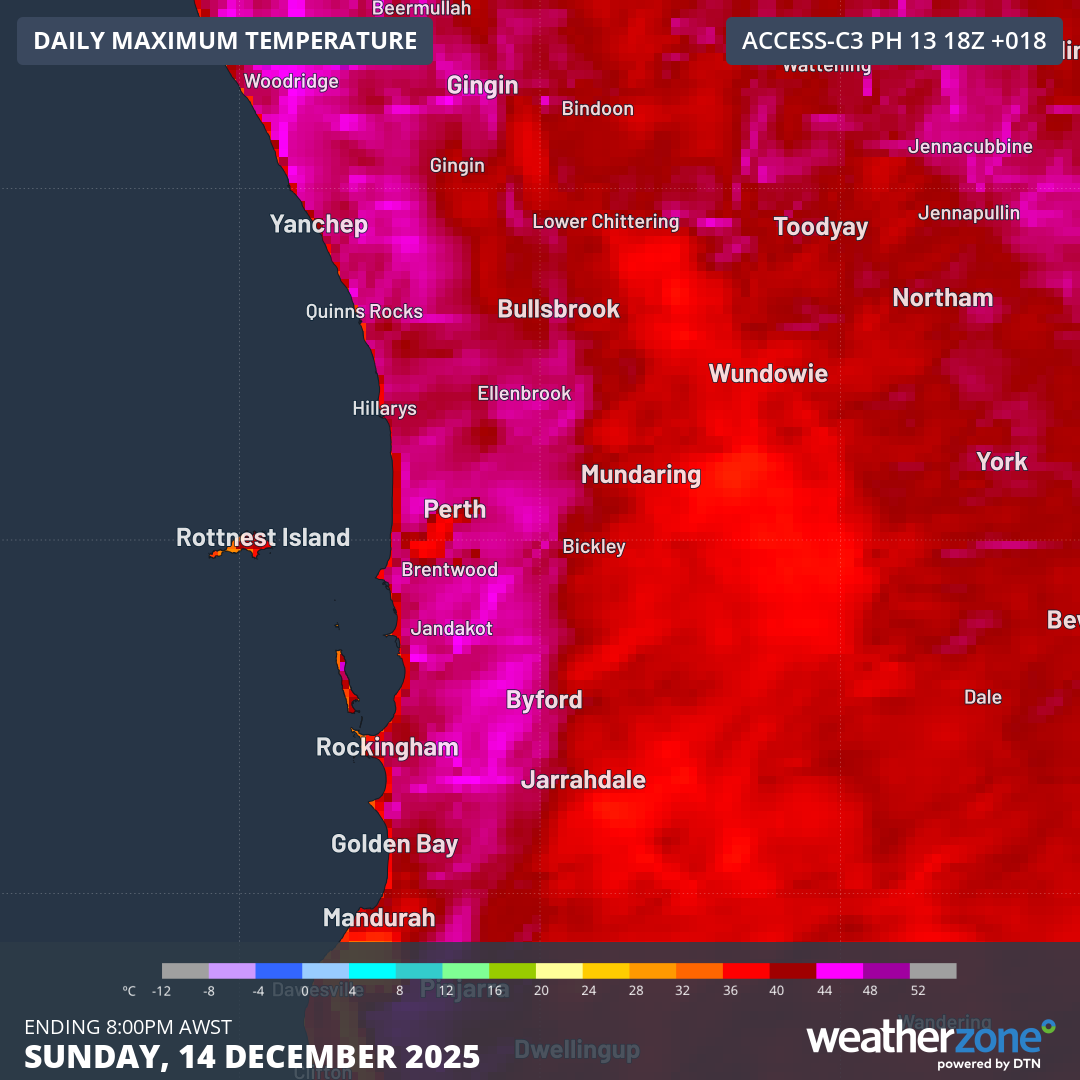
Image: Forecast maximum temperatures for the Perth area for Sunday 14th December (Acc-C model).
As the trough deepens further through the day, gains moisture and interacts with an upper-level disturbance (a feature higher in the atmosphere that enhances rising air), conditions will become favourable for severe thunderstorms across parts of western WA. For the Perth metropolitan area, severe storms are possible from mid-afternoon into the early to mid-evening, with damaging wind gusts the main threat. Rainfall totals may not be impressive — generally 5–10 mm, with isolated falls up to 15 mm — but after meaningful rainfall has been scarce since October (the last day exceeding 10 mm being 21st October), including virtually no rain so far this December, this would be enough to deliver a small but welcome break in the dry spell.
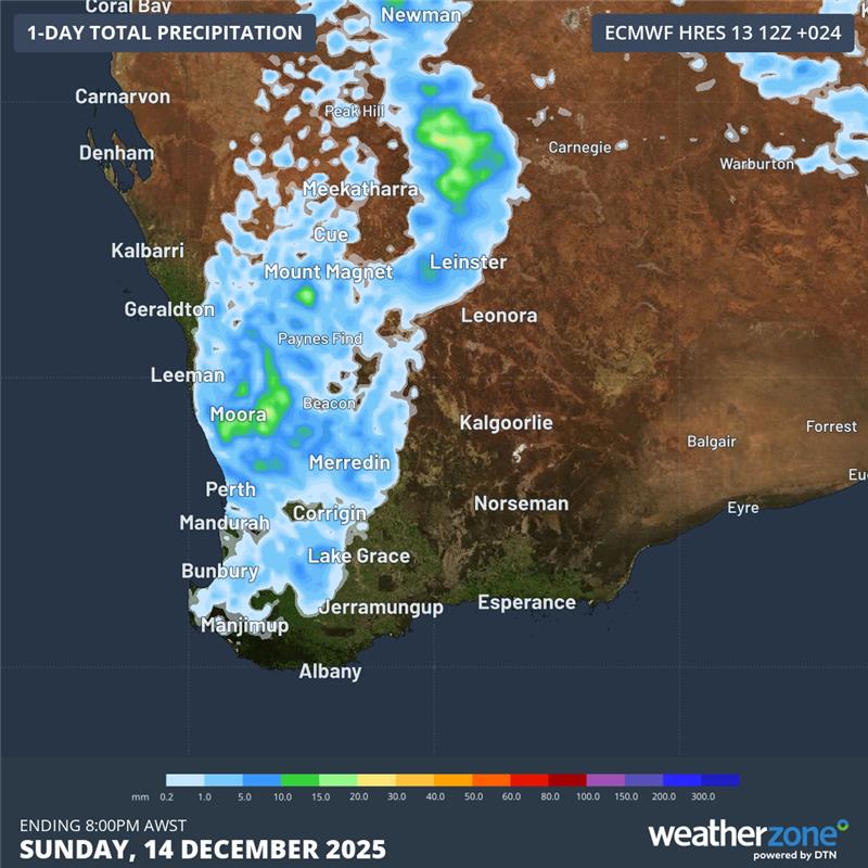
Image: 24-hour rainfall for Sunday 14th according to the ECMWF model.
Looking ahead, northeasterly winds will linger into Monday morning, bringing another warm start with minimum temperatures around 23°C. Temperatures will rise quickly into the mid 30s by late morning and early afternoon before the trough shifts east and a sea breeze develops. That sea breeze should take the edge off the heat compared with Sunday, although it will still be hot. Thunderstorms remain a chance on Monday, most likely east of Perth or over the hills rather than the city itself.