
Hot end to spring in Australia
An intense late-spring heatwave will sweep across Australia during the final week of November, challenging maximum temperature records for this time of year in some places.
A hot air mass originating over central and northern Australia will pass over the nation's south and east towards the end of this week. While hot weather is normal in Australia during November, this spell of heat will be harsher than we usually see at this time of year.
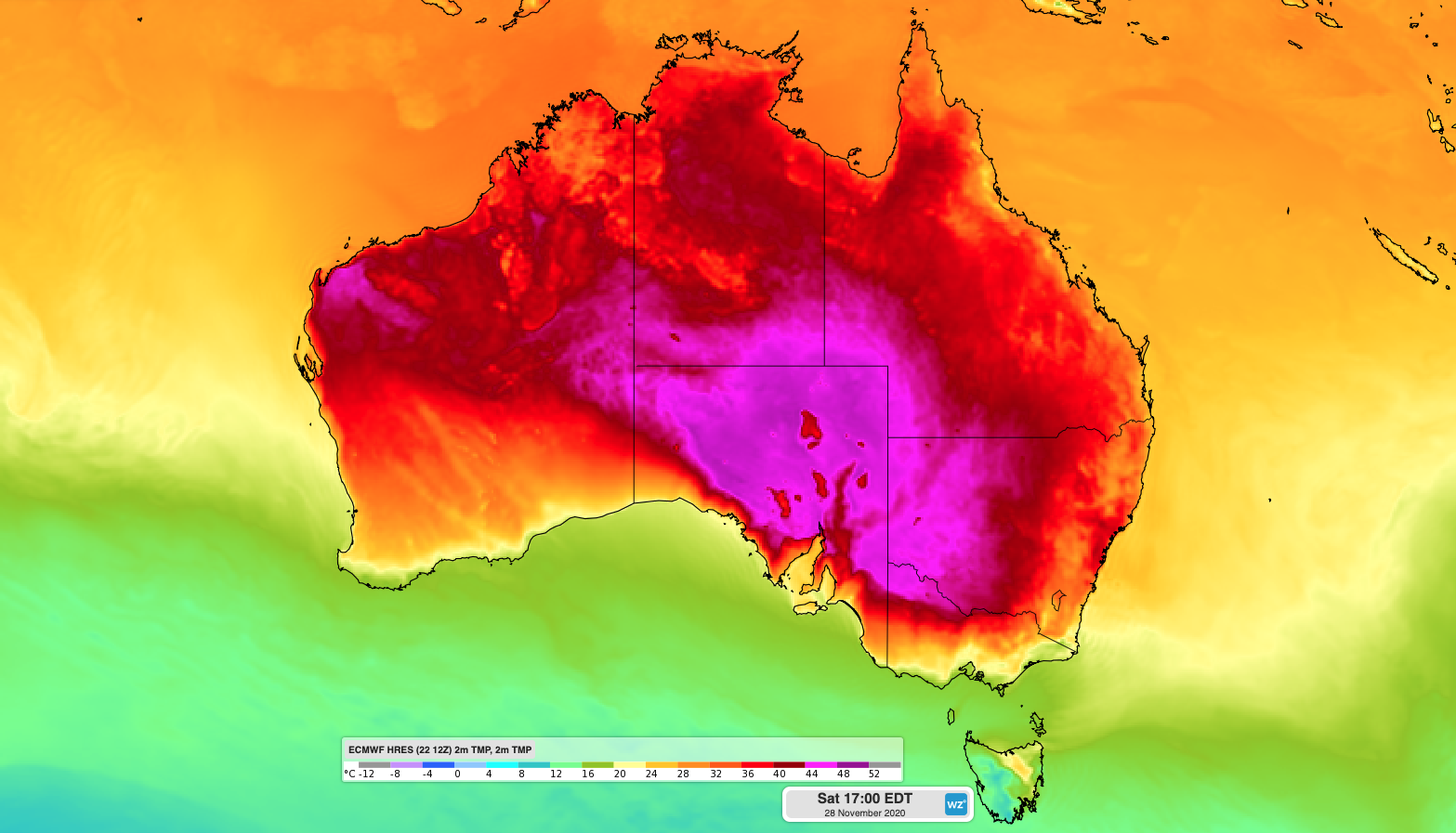
Image: Forecast surface temperature on Saturday afternoon, with widespread heat over central and southern Australia.
Temperatures are forecast to reach 45ºC in some outback areas of SA, Victoria and NSW this weekend. This heat will be capable of challenging springtime maximum temperature records.
In Victoria, the highest temperature on record in spring was 45.8ºC at Ouyen in 2012. Mildura is forecast to reach 45ºC on Saturday.
In NSW, the record stands at 46.8ºC from Wanaaring in 2009. The mercury could get within a couple of degrees of this on the weekend.
South Australia's spring record of 47.9 at Tarcoola in 1993 looks hard to beat, although the same location is tipped to hit 46ºC on Saturday.
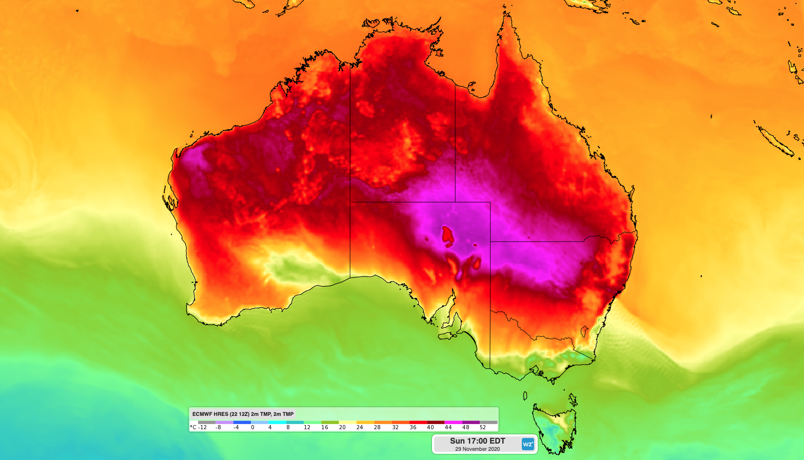
Image: Forecast surface temperature on Sunday afternoon. A hot day for inland areas of central and eastern Australia.
While this week's most severe heat will occur in the outback, temperatures are likely to reach the mid to high thirties in parts of Adelaide, Melbourne, Canberra and Sydney during the second half of this week. A few suburbs could even nudge 40ºC on their hottest day of the week.
The torrid heat is likely to linger over Australia’s eastern inland into the beginning of next week as well, delivering a scorching start to December in some outback areas of NSW and Queensland.
One of the main reasons for this week’s severe heat is the position of the Madden Julian Oscillation (MJO).
The MJO is a region of increased stormy weather that travels around the world every 30-60 days, moving from west to east near the equator. When the MJO is near Australia, it can cause more rain and storms to develop over the continent. However, when the MJO is over the Indian Ocean – like it is now – we typically see less rainfall over Australia, which produces hotter air masses in the tropics.
Australia's late-spring heat is also being affected by the background influence of climate change. The national average maximum temperature in November has increased by 1.32ºC since 1910.