
Hot air to spread across Australia, raising fire danger
A mass of hot air will sweep across Australia during the next week, elevating fire danger ratings in multiple states and territories.
Temperatures have been soaring over Western Australia this week, with Perth on track to register four consecutive days at or above 35 degrees by Saturday. This feat hasn't happened during November since 1933. Further inland, Kalgoorlie is forecast to reach 44 degrees on Sunday, which would be a new November record in more than 100 years of observations.
This intense late-spring heat is being caused by a large mass of hot air that has built up over WA, on the western side of a high pressure ridge.
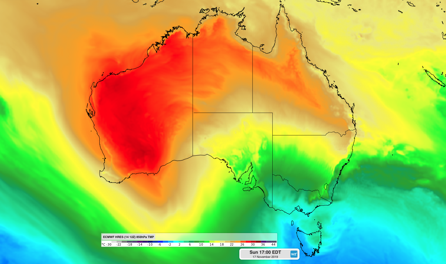
Image: Hot air over Western Australia on Sunday.
Unsurprisingly, the hot weather is causing Severe to Catastrophic fire danger ratings in parts of WA, which are forecast to persist into the start of next week.
From Tuesday, the hot air mass will start to spread further east as a cold front moves in from the Indian Ocean.
This hot air and strengthening northerly winds will target South Australia on Tuesday and Wednesday, elevating fire danger ratings across the state. Adelaide could reach the high thirties or low forties on Wednesday, possibly getting within a few degrees of the city's November record of 43 degrees from 2009.
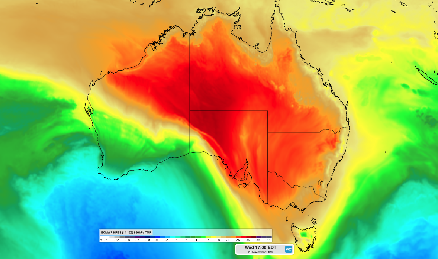
Image: Hot air over central and southern Australia on Wednesday.
The transient heat will also break Victoria and Tasmania out of a spell of cool weather that brought hail and snow earlier this week. While most days have failed to reach 20 degrees in Melbourne this week, the city could reach the low thirties on Wednesday and Thursday amid the warmer air mass.
Further east, fire-ravaged parts of NSW and Queensland won't see much relief from hot weather over the coming week.
A lingering warm air mass will cause Severe fire danger ratings in parts of northeast NSW and southern Queensland on Friday, with Very High fire danger likely to persist in parts of both states over the weekend. Unfortunately, the hot air mass approaching from the west will cause temperatures to climb even further next week.
Large areas of inland NSW and southern Queensland should see temperatures reach the high thirties and low forties by the middle of next week. While sea breezes will interrupt next week's heat near the coast, Sydney could exceed 30 degrees on Tuesday and Thursday, with temperatures likely to be even higher in western suburbs.
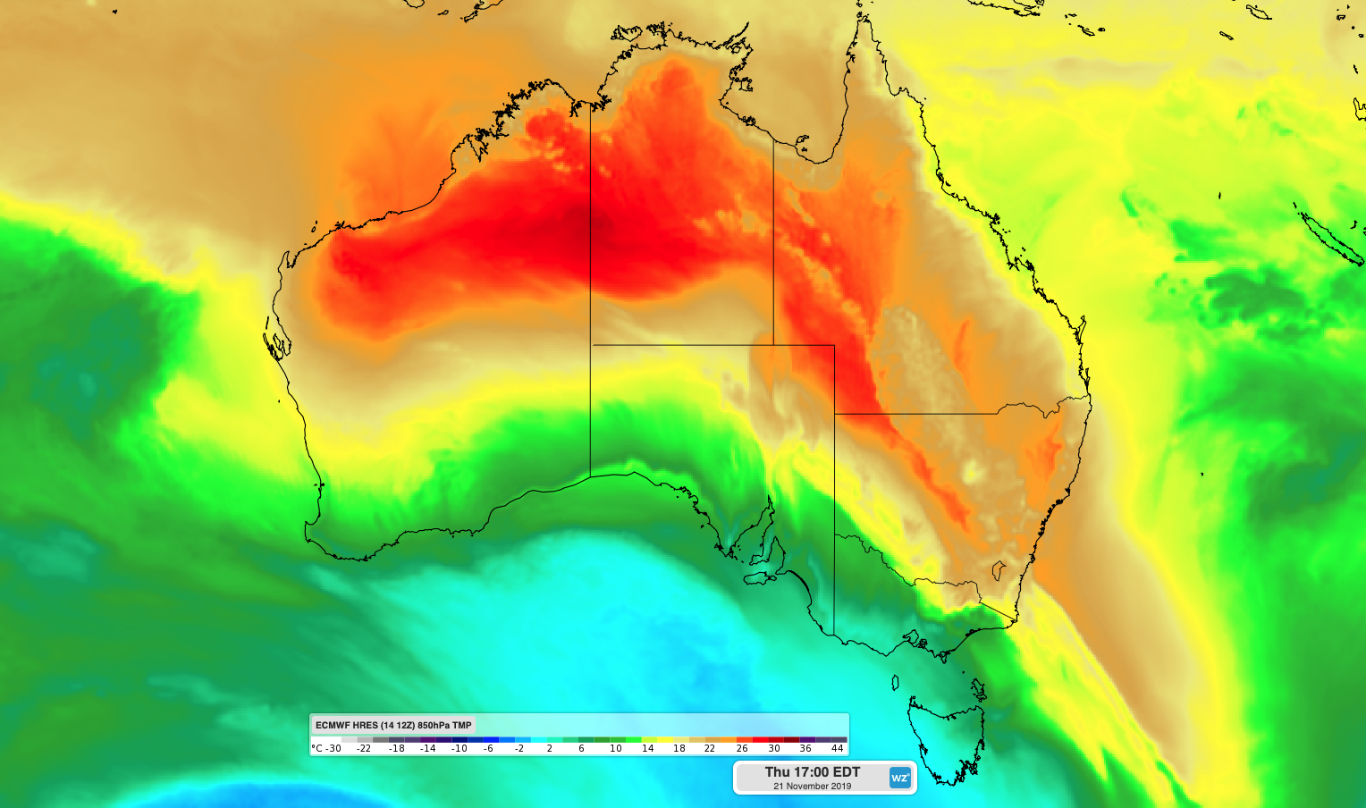
Image: Hot air spreading over eastern Australia on Thursday.
The hot weather over eastern Australia today and next week will elevate fire danger ratings in both states. Be sure to keep up to date with the latest weather forecasts and fire weather information during the coming week.
There are early indications that a low pressure trough could cause some showers and thunderstorms in parts of eastern Australia during the second half of next week. However, it's too early to know if and where this wet weather will occur just yet.