
Hints of a negative Indian Ocean Dipole (IOD) on the horizon
There are signs that a negative Indian Ocean Dipole could develop during the middle of this year, raising the odds of wet weather in some parts of Australia.
The Indian Ocean Dipole (IOD) refers to an index that measures the difference between sea surface temperatures on the western and eastern sides of the tropical Indian Ocean.
When the IOD is negative, warmer-than-usual water sits on the eastern side of the Indian Ocean, near Indonesia, while cooler-than-average water lies in the west, near Africa. This pattern enhances the amount of moisture in the atmosphere near Australia, which typically causes more rain in some parts of the country during winter and spring.
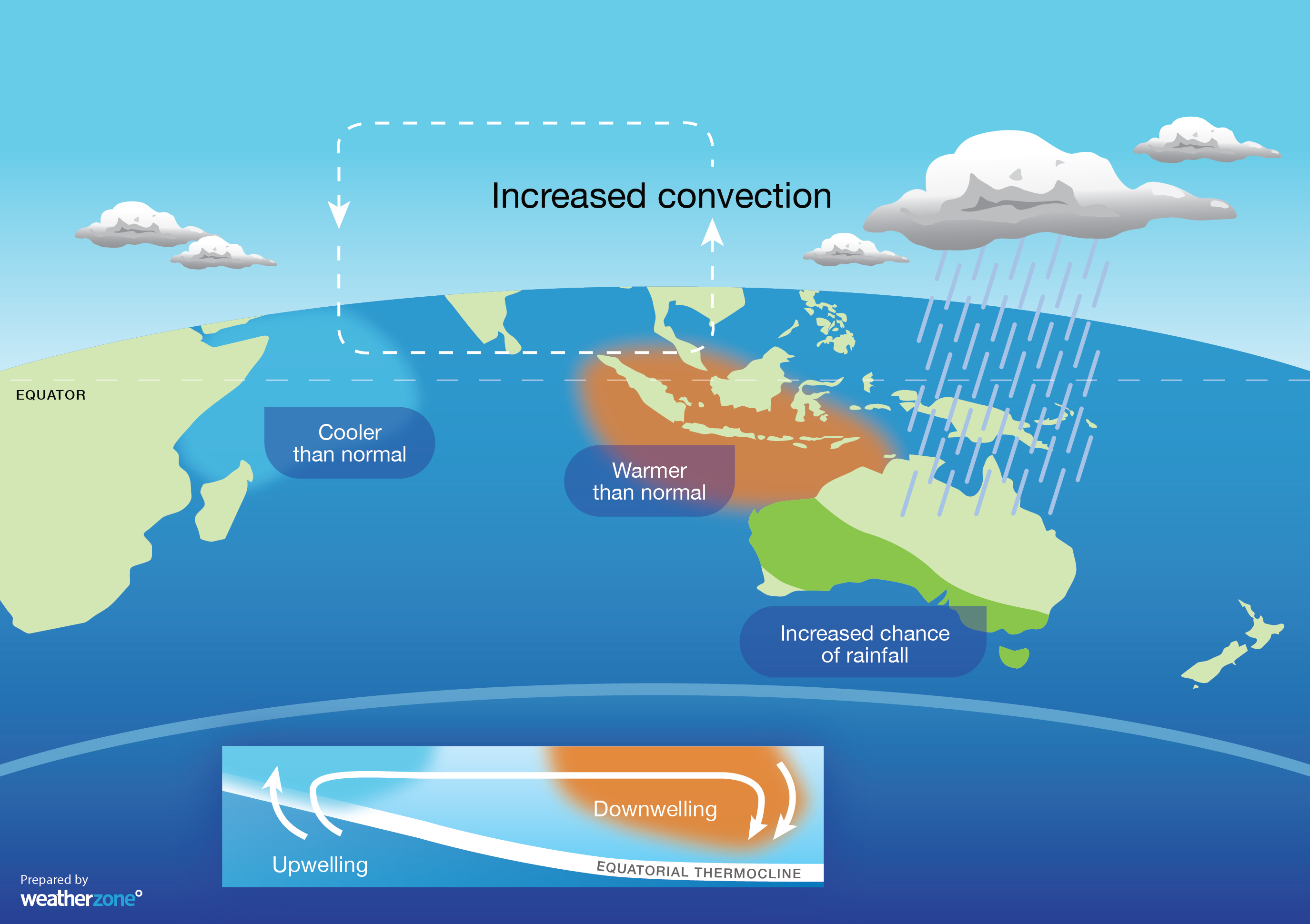
Image: Sea surface temperature anomalies during a negative IOD. This pattern can enhance rainfall over large parts of Australia.
When the IOD is positive, unusually warm water near Africa and cooler water near Indonesia suppresses the amount of atmospheric moisture in the Australian region, which can limit rainfall during winter and spring.
The IOD is currently in a neutral phase. However, some seasonal forecast models suggest that it could swing into a negative phase during the second half of winter.
The image below shows the latest IOD forecast from the Bureau of Meteorology's ACCESS-S model. The thin grey lines show the predictions of 99 different 'ensemble members' from the same model. This spread of grey lines is essentially the realistic range of what the model thinks will happen.
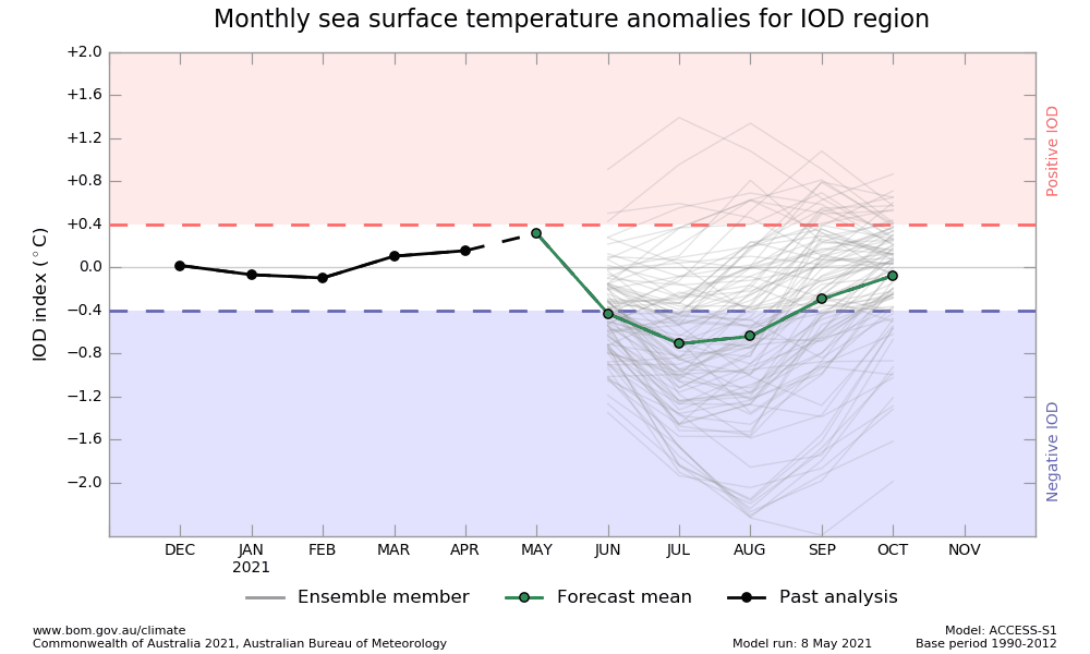
Image: An IOD forecast from the ACCESS-S model. Source: Bureau of Meteorology.
The green line in the graph above shows the average of the 99 ensemble members, which is the most likely future scenario. In this case, it's hinting that a brief dip into a negative IOD phase could occur this winter.
However, one of the most important things to note in the above image is the large spread in ensemble member forecasts. Some of the thin grey lines are all the way up in positive IOD territory during winter. This spread means that there is a lot of uncertainty in the forecast, which is typical at this time of year.
So, while the prospect of a negative IOD and its associated boost in mid-year rainfall for Australia shouldn't be ignored, it's too early to know if it will eventuate just yet. More reliable forecast information will become available in the next few weeks.