
Heavy spring snow paints Tasmania white
Heavy snow fell overnight to low levels across Tasmania and continues to fall this Thursday as a polar airmass sweeps across our southernmost state.
This was the view of kunanyi/Mt Wellington above Hobart on Thursday morning, with settled snow clearly visible approximately halfway down the 1271-metre peak.
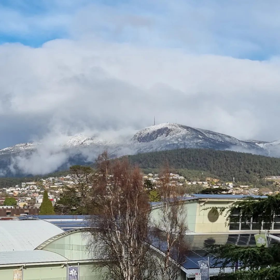
Source: Barbara Iobst-Gonda (@oziobost) on Instagram.
Snow is forecast to as low as 250 metres above sea level in parts of the state this Thursday, with a bushwalkers alert in place for the Western and Central Plateau forecast districts.
The loop below shows the polar airmass impacting Tasmania overnight.
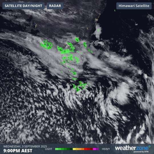
Image: 12-hour combined satellite and radar loop for Tasmania and nearby waters to 9am Thursday, September 4, 2025.
While bands of moisture push in from the northwest (a direction often associated with warmer weather), you can see how the northwesterly feed contains frigid air that has tracked north to Bass Strait – as indicated by the classic speckled cloud pattern associated with polar airmasses.
This system has provided one of the heaviest snowfalls of the year for Tasmania, in what has not been a good snow season compared to the mainland, where an official snow depth of 220.4cm was measured in NSW this week by Snowy Hydro.
The 2025 winter was relatively dry in Tasmania, with statewide rainfall that was 20% below the long-term average. It was also Tasmania’s 6th-warmest winter on record (in records going back to 1910) with average statewide temperatures that were almost a degree above average.
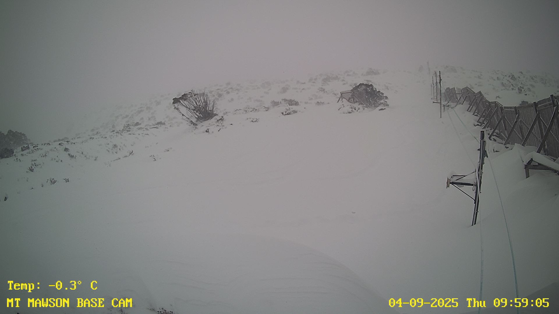
Image: Mt Mawson looking good for sliding, but will it hold till Sunday? Source: Mt Mawson.
At the tiny Mt Mawson ski field about two hours northwest of Hobart, club members are rejoicing in the 35cm snow depth – virtually all of it from the current system – with hopes that the rudimentary ski lifts may spin this weekend on one of the few occasions in 2025.
For Tasmanians looking to enjoy the snow, it would be wise to do so by Saturday, as the weather looks set to warm quickly by Sunday as northwesterlies strengthen – this time without an influx of polar air.
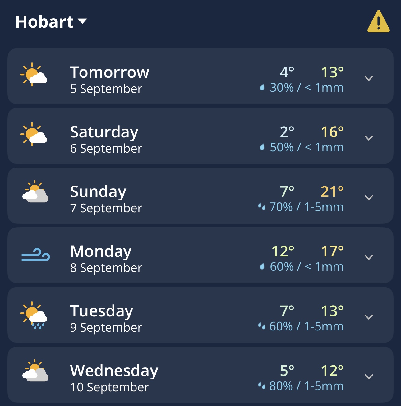
Image: Several days of fluctuating maximum temperatures for Hobart, as shown on the Weatherzone app.
For example, Hobart is heading for a maximum of just 11°C this Thursday but should reach 21°C by Sunday, while kunanyi/Mt Wellington will remain at or below freezing today, but should peak at a showery 11°C on Sunday in the significantly warmer airmass.