
Heavy snow and rain targeting southern NSW
Heavy, persistent rain and snow has fallen in southeastern NSW during the last 24 hours, with more on the way today.
A stream of moisture-laden air is being driven into southeastern NSW as a low pressure system develops over the Tasman Sea. This deep layer of moisture is causing heavy rain at low elevations and hefty snow in the mountains.
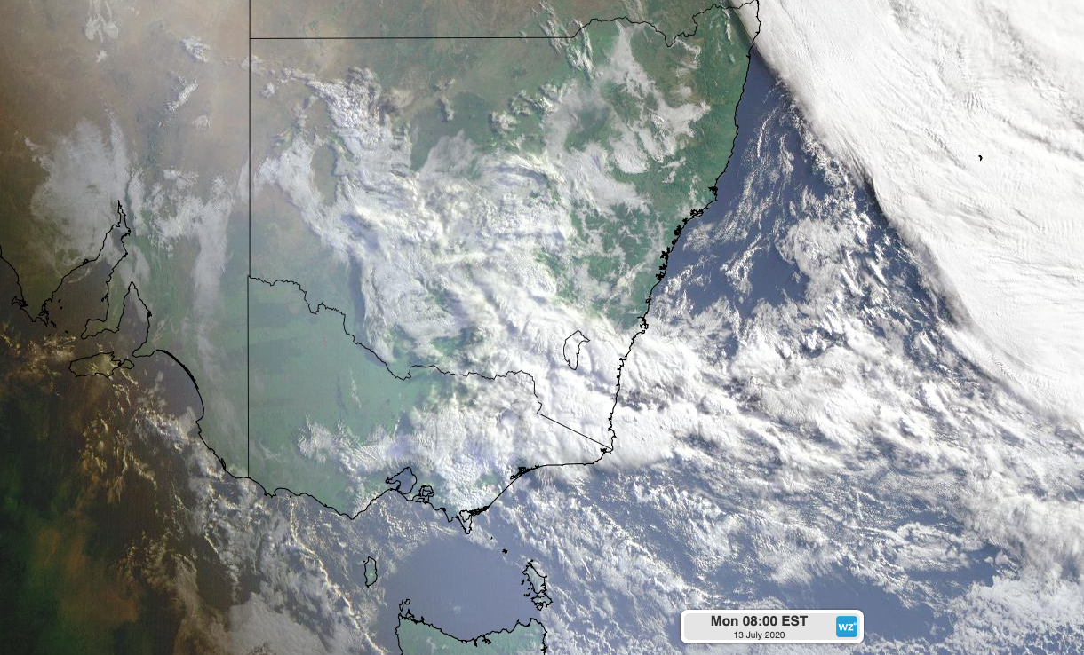
Image: Visible satellite image showing thick clouds over southeastern NSW on Monday morning.
Montague Island's 75.2mm during the 24 hours to 9am on Monday was a new July daily rainfall record for the site, with data going back to 1956. Further inland, Nimmitabel picked up 58.2mm, which is more than a month's worth of rain for this time of year. Across the border, 60-100mm of rain fell in parts of Victoria's East Gippsland District during the 24 hours to 9am on Monday, including 98mm at Mount Useful.
At higher elevations, the last 24 hours has produced the best bout of snow so far this season in NSW, as moisture-laden air fed into a pool of cold air sitting above the alps.
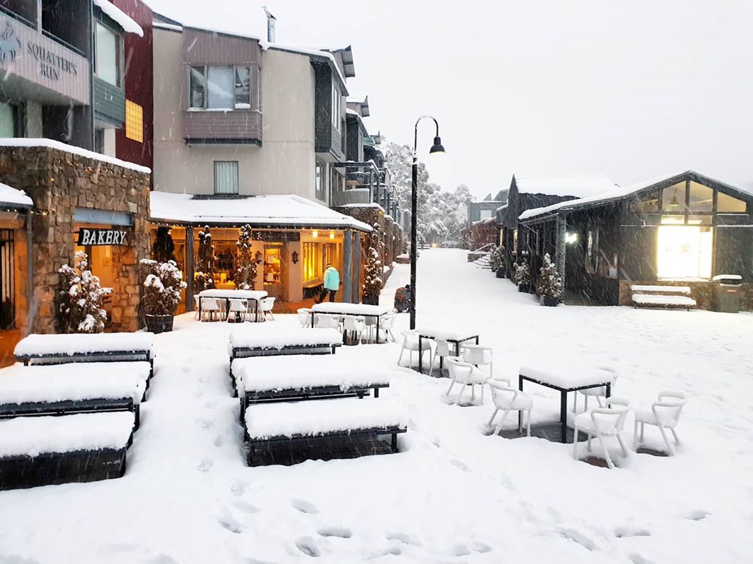
Image: Fresh snow at Thredbo Village on Monday morning. Source: @mabelively / Instagram
Snow started falling on Sunday and continued throughout the night. By Monday morning, some ski resorts had picked up more than 30cm of fresh snow, including higher parts of Perisher, Thredbo and Charlotte Pass.
Snow also settled at lower elevations around Jindabyne and Adaminaby, although the snow was considerably wetter this far down the mountains due to higher temperatures. This wet snow is likely to become heavy as it accumulates, which may cause tree branches to snap under its weight. Take care if you're driving in the mountains today.
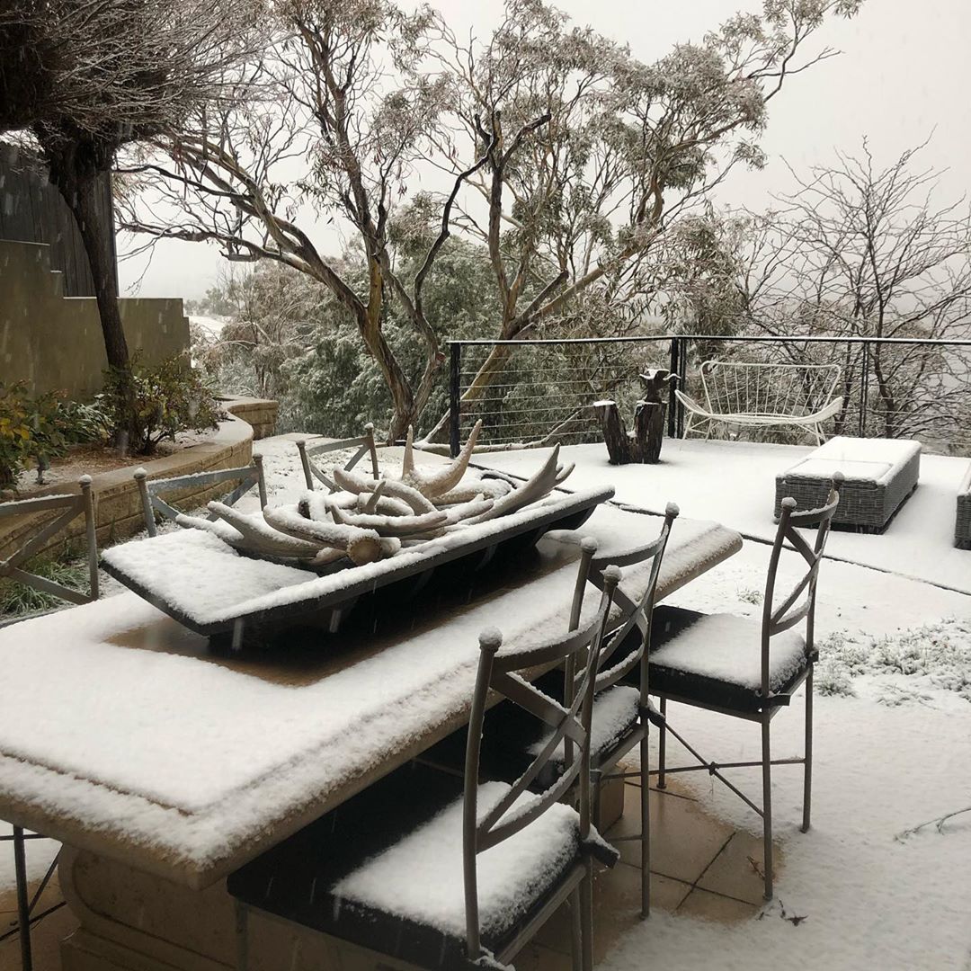
Image: Snow at Jindabyne on Monday morning. Source: @designdetail / Instagram
Snow and rain will continue falling in southern NSW throughout Monday as moisture continues to stream in from the Tasman Sea. Temperatures will stay low enough for this precipitation to fall as snow in the alps, with the best falls likely to occur at higher elevations. Lower elevations will see wetter snow and possibly some rain later in the day.
Snow continues to fall across alpine areas. This has resulted in a number of motor vehicle accidents on the Kosciusko Rd near Jindabyne. There are now a number of road closures in place. Check @LiveTrafficNSW before travelling especially if heading towards the snowfields. #nswrfs pic.twitter.com/7StJBvGpE8
— NSW RFS (@NSWRFS) July 13, 2020
Further north, there's potential for a dusting of snow on higher parts of central and northern NSW as a large pool of cold air passes across the state later today and tonight. This cold air will also produce showers, thunderstorms, and possibly small hail.
Looking ahead, showers, strong winds, and large surf will spread up the NSW coast on Tuesday as the low pressure system deepens over the Tasman Sea. Wind and rain will gradually ease from Wednesday as the low moves further offshore, although large waves will linger into the second half of the week.