
Heavy showers soak NSW coastal fringe
Areas of heavy rain drenched parts of the NSW coast on Wednesday night and Thursday, with some places picking up their best rain in three months.
Moisture-laden onshore winds combined with a low pressure trough making its way up the NSW coast to produce the burst of wet weather.
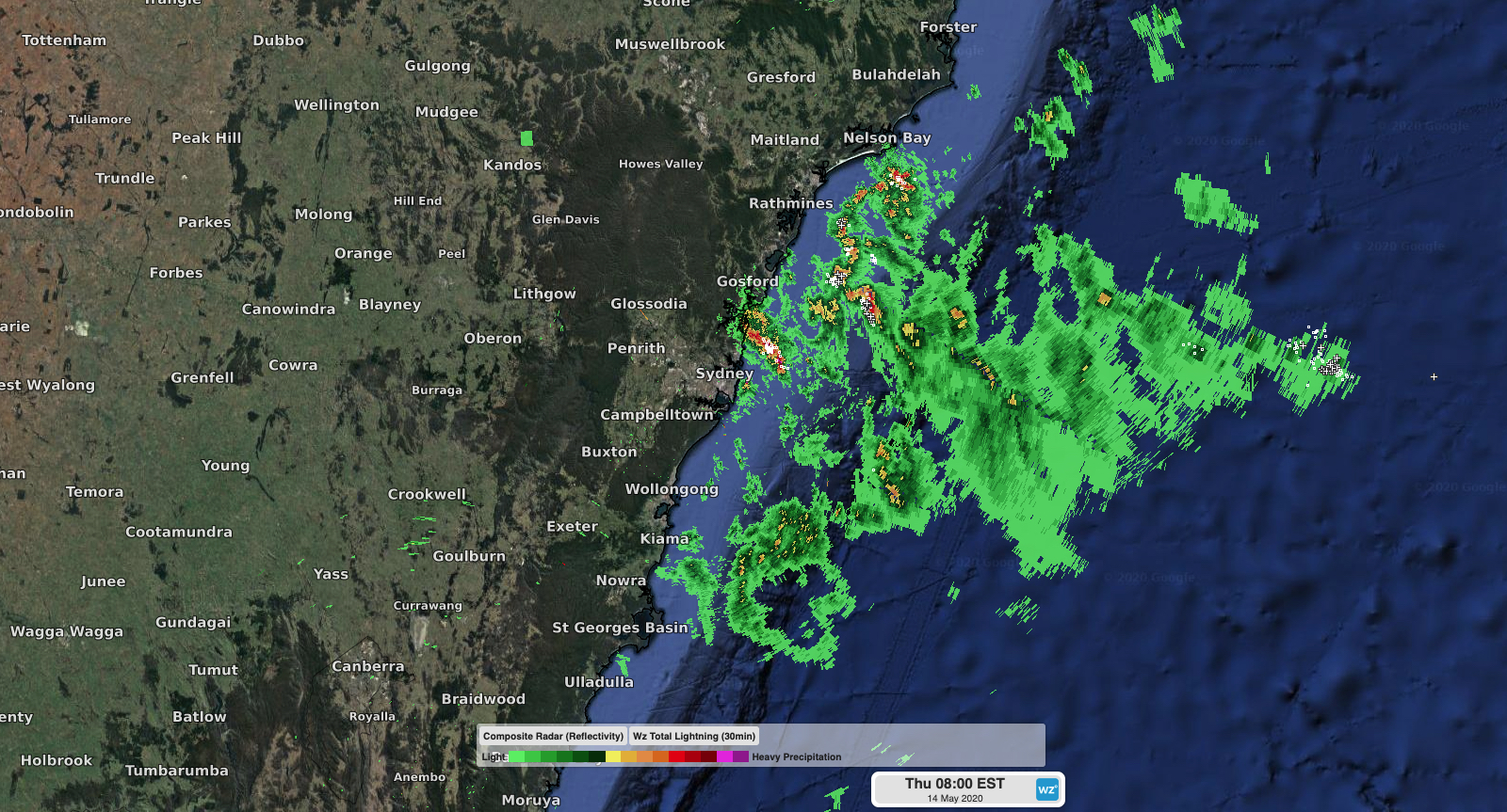
Image: Rain and lightning strikes detected along the NSW coast on Thursday morning.
The heaviest rain on Wednesday night fell along the state's south coast, where Jervis Bay picked up 47mm and Ulladulla collected 45mm. This was the heaviest rain since February at both locations.
Further north, heavy showers and thunderstorms peppered central parts of the NSW coast on Thursday. In Sydney, Avalon received around 36mm between 6am and 3pm, while Avoca received over 13mm in two hours during the afternoon.
The rain was patchy and heaviest along the coastal fringe. Sydney's CBD had only collected 3mm of rain by 3pm.
There were around 1710 lightning strikes within a 100 kilometre radius of Sydney between midnight on Wednesday night and midday on Thursday. However most of these were off the coast.
Showers will continue to spread up the NSW coast on Thursday and Friday as the low pressure trough moves further north. Onshore winds will maintain showers along central and northern parts of the coast this weekend.