
Heavy rainfall continues for the NT's Daly
A persistent and slow-moving low pressure trough is continuing to generate significant rainfall across the Northern Territory's Daly district, with some areas picking up the highest daily rain in 5 years.
Bradshaw, south of Darwin, picked up an impressive 85.8 mm in the 24 hours to 9am Sunday morning. This was the heaviest daily rain for the town out of any month in over 5 years (December 2015 picked up 283.8 mm in one day). The rain hasn't eased just yet either, with almost 30 mm picked up in the gauge as of 12pm CST. These heavy falls have taken this year's February total to almost double the long-term monthly average, and more than the previous 5 Februarys combined.
Other notable 24 hour rain totals to 9am this morning were: Delamere (67.4 mm); Douglas River (56.4 mm); and Tindal (60.6 mm).
Well over 100 mm may fall over the next week for the Daly, including Darwin. Widespread thunderstorm activity is also likely to be a daily occurrence, with the potential for heavy rain and damaging winds a risk with any storms later today and tomorrow.
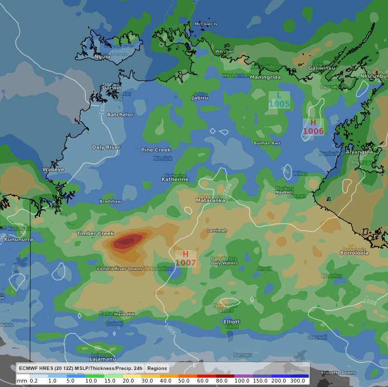 Image: 24 hour rain totals for the Northern Territory's Top End to 7:30pm CST Monday 22nd February. Image displayed using the ECWMF model.
A flood watch is currently active for the region. Keep an eye out for warnings here.
The trough may break down briefly late in the week, bringing some slight relief.