
Heavy rain risk increasing as multiple tropical lows form near northern Australia
Three tropical lows could form near northern Australia this week, with Western Australia facing a moderate risk of a tropical cyclone and heavy rain expected in the Kimberley and northern Queensland.
The satellite images below show cloud forming along a broad region of low pressure to the north of Australia on Wednesday, January 21.
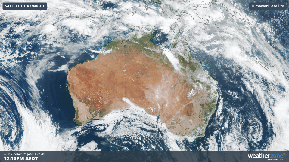
Image: Visible satellite images captured on Wednesday, January 21, 2026. Source: Weatherzone.
Forecast models indicate that three low pressure systems could develop near Australia in the coming days, one to the north of Western Australia and another one or two near northern Queensland.
Western Australia faces cyclone threat and heavy rainfall
The system starting to emerge off WA’s Kimberley coast is expected to develop into a tropical low later on Wednesday or on Thursday. This system should then move towards the south or southeast on Friday and Saturday, bringing it towards the Kimberley coast.
The Bureau of Meteorology currently gives this system a moderate chance of becoming a tropical cyclone on Friday or Saturday before it reaches the coast.
Regardless of whether this system forms into a tropical cyclone or remains a tropical low, it is likely to cause heavy rain, flooding and blustery winds over parts of the Kimberley from Friday into the weekend. Heavy rain could also extend over parts of the Northern Territory and WA’s Interior on the weekend and early next week as the system moves inland after making landfall.
Coral Sea low to move away from northern Queensland
Another tropical low is expected to form over the northern Coral Sea on Wednesday night or Thursday. At this stage, this system is likely to remain at least 500 km away from the state’s east coast later this week and should move further away from the state early next week. This system has a low risk of becoming a tropical cyclone.
Cape York low could increase cyclone risk next week
A separate low pressure system could form to the east of Cape York Peninsula this weekend. Some computer models show this low gaining strength as it moves out over the northern Coral Sea early next week, hinting at the potential for tropical cyclone development at some point next week. However, there is currently a high amount of uncertainty with this system as it is still several days away from forming.
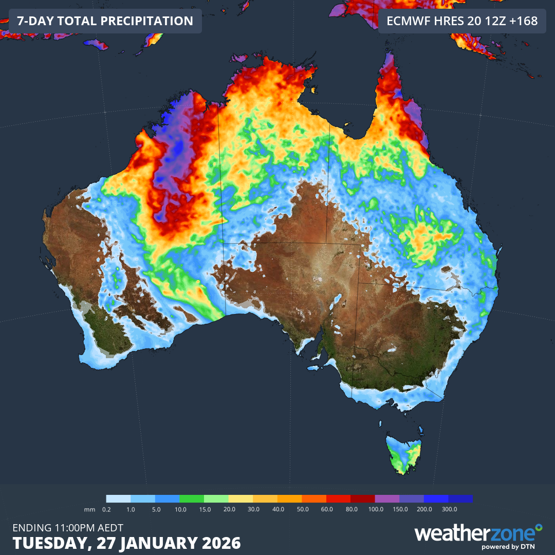
Image: Forecast accumulated rainfall over Australia during the coming week. Source: Weatherzone.
Anyone living in northern Australia should keep up to date with the latest tropical cyclone forecasts and advisories over the coming week.