
Heavy rain returning to Sydney and surrounds in coming days
A low pressure system should develop and will affect east coast NSW from tomorrow. This system will bring heavy rain and thunderstorms, affecting already flooded areas. There is a moderate-to-high chance for thunderstorms and rainfall each day from Sunday 6th to Tuesday 8th, concentrated over eastern NSW.
Tuesday 8th will be the day to watch for widespread rainfall, with the possibility of accumulated precipitation reaching more than 200mm over 24 hours, most likely in the Sydney area. This will exacerbate the flooding problems caused by previous rainfall last week.
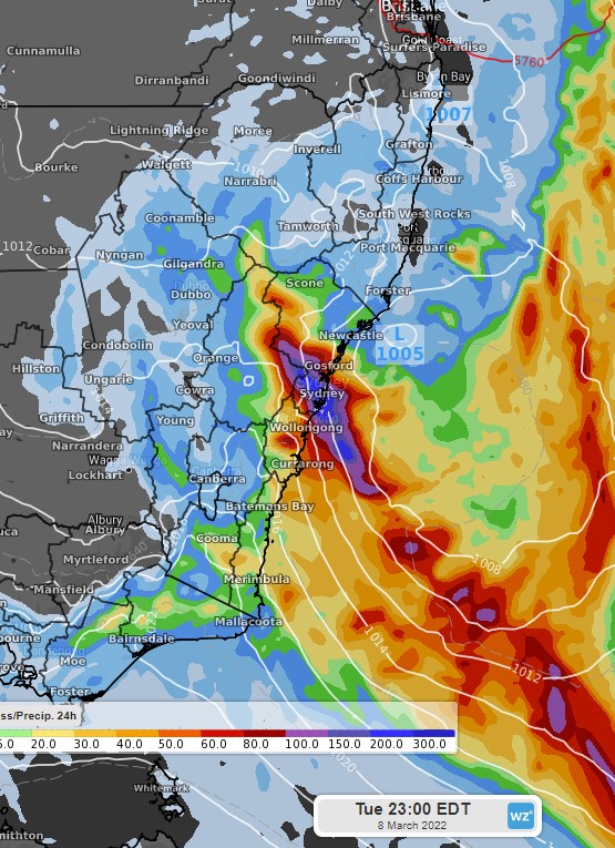
ECMWF model’s forecast 24-hour precipitation to 11pm EDT Tuesday 8th
In addition to rain, this low should also generate damaging winds and large surf over the NSW coast. Southwesterly winds between 60-100km/h will affect the NSW coast, most likely from the morning of Tuesday 8th, to the evening of Wednesday 9th. 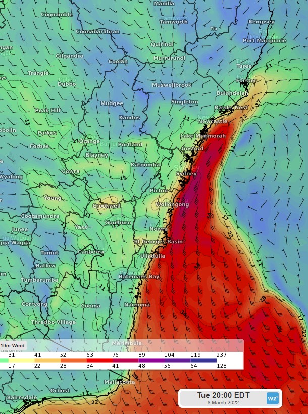
ECMWF model’s forecast sustained winds for 8pm EDT Tuesday 8th
The chances for heavy rainfall and damaging winds should ease from Thursday 10th with the low moving away to the east.