
Heavy rain looms for eastern NSW
Widespread rain and thunderstorms will affect eastern Australia this weekend and early next week, with parts of eastern NSW expected to see more than 100 mm of rain by Monday.
A series of cold fronts and low pressure troughs will cause showers over a broad area of southern and eastern Australia during the remainder of this week.
This wet weather will initially be confined to parts of southern WA, SA, Vic and Tas on Thursday, with most areas only seeing light falls.
Showers and storms will spread further north into NSW from Friday and southern Qld from Saturday, as an upper-level trough pushes north and interacts with a feed of tropical moisture.
Forecast models suggest that rain will become more widespread and heavier over NSW and parts of southern Qld on the weekend as the upper-level trough transitions into a cut-off low above eastern Australia.
At this stage, the heaviest rain is likely to occur in NSW between Saturday and Monday. One area of particular risk for heavy rain and flooding will be the southern half of the NSW coast and adjacent ranges, where a focused stream of onshore winds could produce more than 100 mm of rain and possibly more than 200 mm in some places.
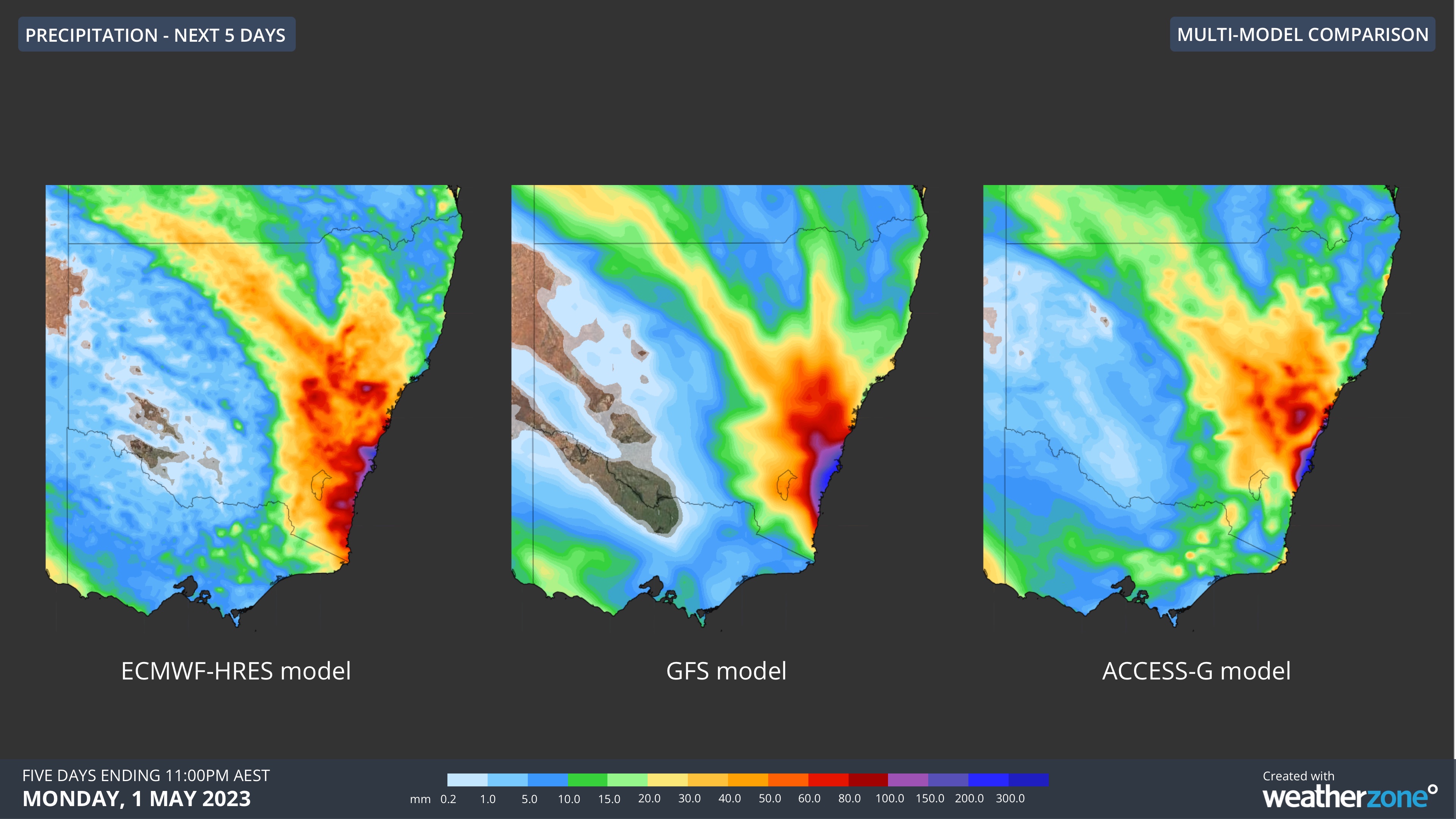
Image: Comparison of accumulated rain between Thursday, April 27 and Monday, May 1 from three different forecast models.
Severe weather warnings, flood watches and flood warnings may be issued for parts of eastern NSW this weekend as we start to get a clearer picture of where and how much rain will fall. Be sure to keep an eye on the latest warnings for the most up-to-date information on this evolving weather system.