
Heavy rain hits northeast QLD as tropical cyclone threat looms
Heavy rain is inundating parts of Queensland's eastern tropical coast ahead of a tropical cyclone that's likely to develop later in the week.
Moisture-laden air feeding into a low pressure trough caused heavy rain and thunderstorms over parts of northeast Queensland on Tuesday and Wednesday morning.
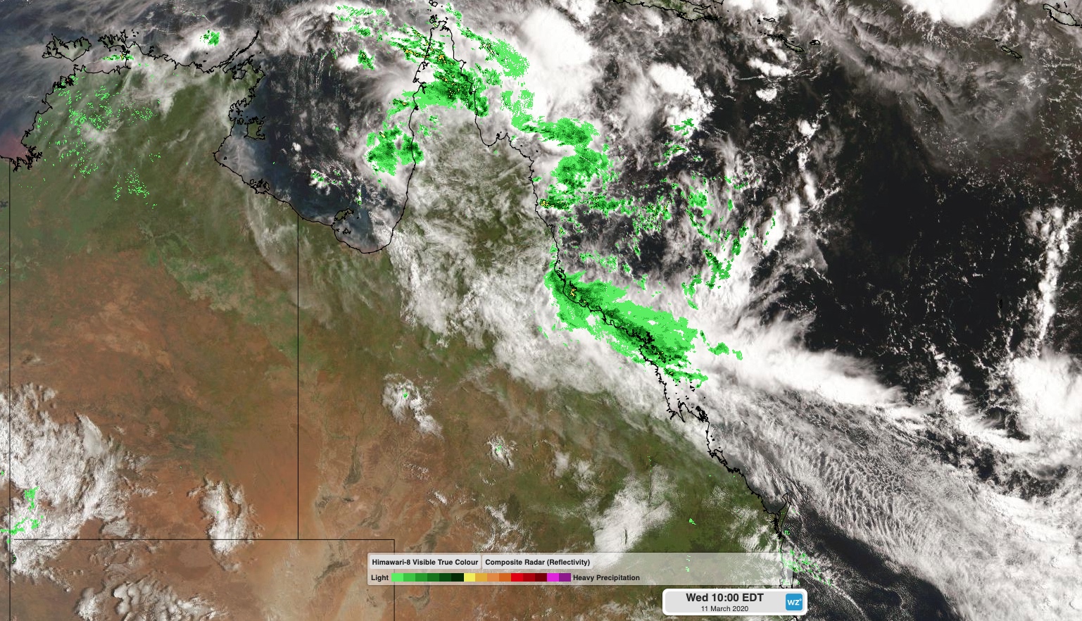
Image: Satellite and radar image showing cloud and rain over Queensland on Wednesday morning.
During the 24 hours to 9am on Wednesday, falls of 50-100mm were recorded along the coastal stretch between Hamilton Island and Ingham. Some rain gauges near and east of Ingham registered over 200mm in this period. This included 264mm at Ingham and 233mm at Hallifax, their highest daily totals in over a year.
Rain and storms will continue to affect areas from Cape York Peninsula down to the Central Coast on Wednesday and Thursday, prompting a flood watch and a severe weather warning for heavy rain and damaging winds.
On Friday a deepening low pressure system over the Coral Sea, which is likely to become a tropical cyclone, will draw the heaviest rain offshore and allow drier weather to return to Queensland. But while rain should ease over Queensland from Friday, blustery south to southeasterly winds will continue along the state's east coast into the weekend. These winds will also whip up large waves, particularly outside the reef.
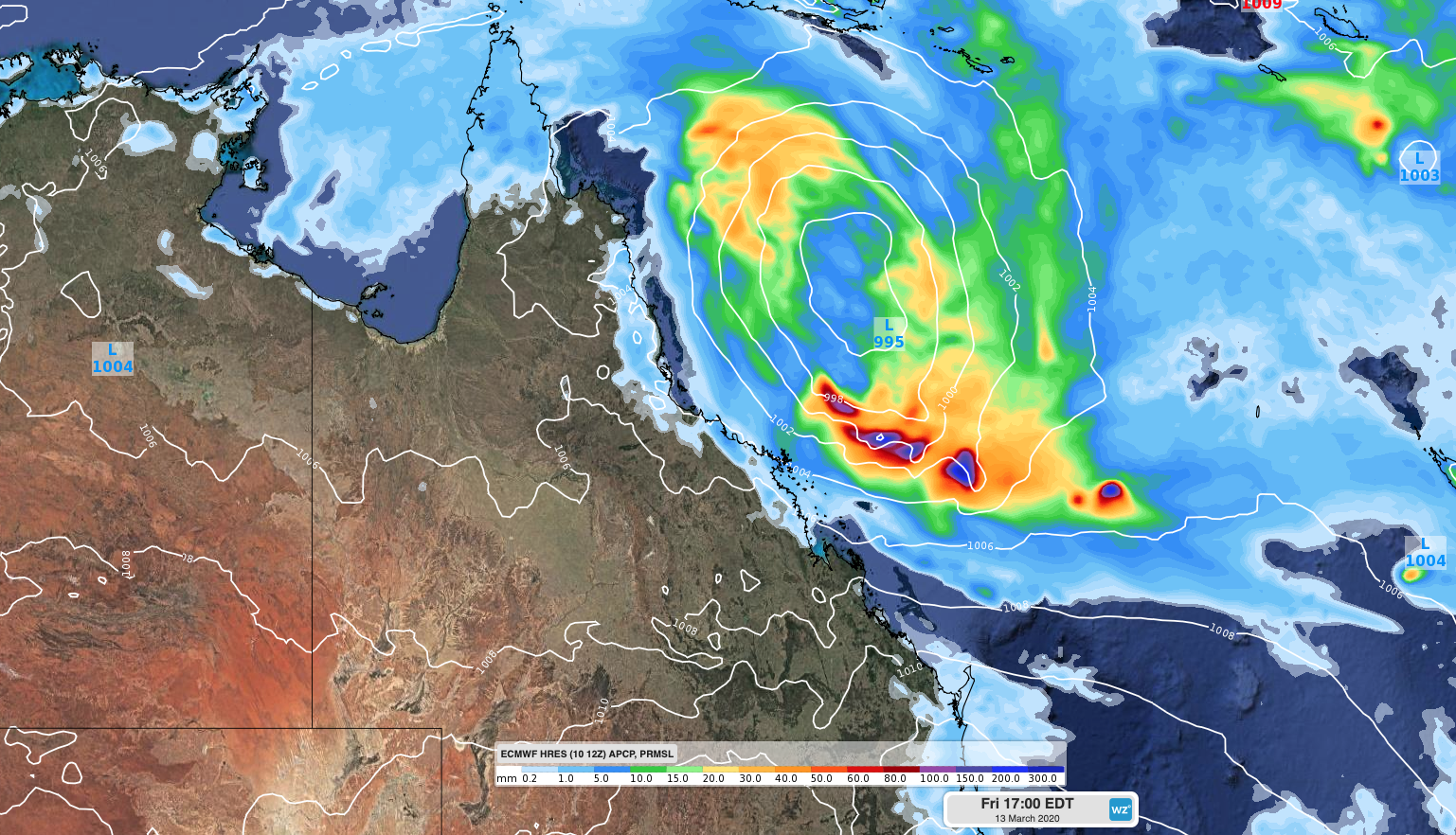
Image: Forecast accumulated 6-hour rainfall and mean sea level pressure on Friday afternoon, according to the ECMWF-HRES model.
At this stage, the low pressure system over the Coral Sea will most likely develop into a tropical cyclone on Friday, before moving towards the southeast and staying away from the Queensland coast through the weekend and into early next week.
The next two tropical cyclones to form in Australia's area of responsibility will be named Gretel and Harold. The name given to the Coral Sea system will depend on whether or not another low, which is currently spinning between Indonesia and Western Australia, reaches tropical cyclone strength first.