
Heavy rain approaching Eastern Tasmania

The mix of a Tasman Low and a trough will direct some heavy rainfall to Tasmania’s east early in the week, possibly leading to some flash-flooding.
As a cold front and complex low pressure system crosses over southeastern Australia this weekend, a Tasman Low looks to form just off Victoria’s east coast and slowly track east.
While this low does not look too significant in terms of wind and waves, it will allow a trough to draw moist air from the Coral Sea, past Lord Howe Island, then wrapping around to condense over Tasmania’s east on Monday and Tuesday; a roughly 2500km journey.
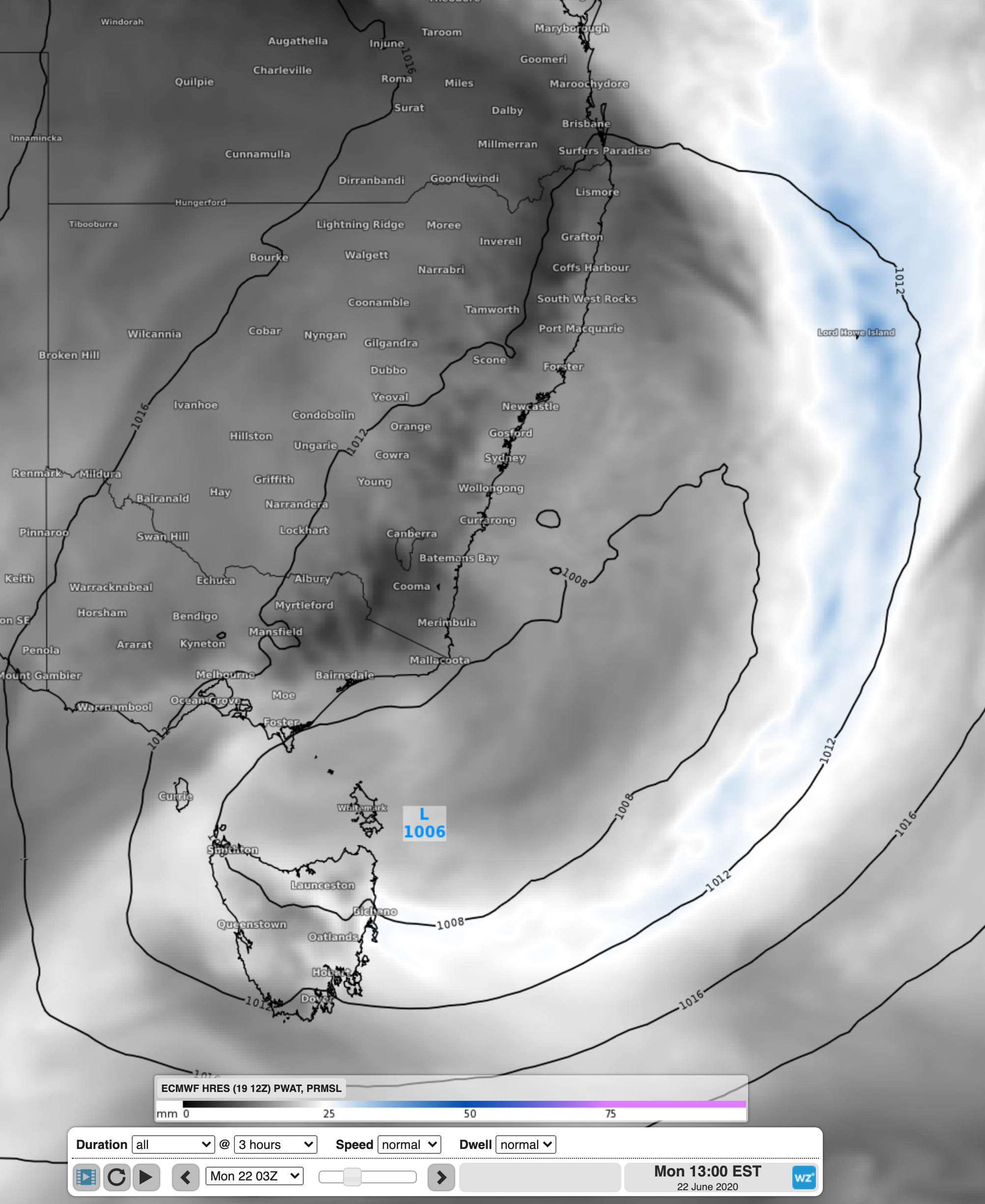
Image: ECMWF showing moisture wrapping around the low from the Coral Sea and into eastern Tasmania
Thanks to the cold pool of air lingering over Tasmania, and convective help from the highlands, a large proportion of this tropical moisture will rain out over the region.
Widespread 2-day rainfall totals of 40-70mm are expected, with some parts possibly seeing more than 100mm. Due to the large amounts, and the possibility of some heavy downpours, some flash-flooding is a significant chance.
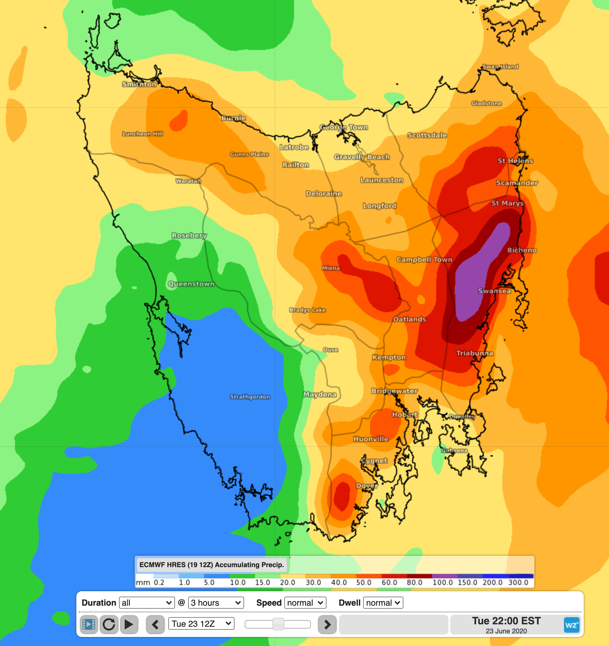
Image: Accumulated rainfall totals falling to 10pm Tuesday, almost all falling on Monday and Tuesday over the east
A flood watch is already in place for the northern parts of the state, with the rain falling this weekend. It is very likely that it will be extended to include eastern Tasmania over the coming days, possibly also with a severe weather warning for heavy rainfall. To stay tuned to the latest warnings, visit the warnings page at Weatherzone.com