
Heaviest rain in years soaks parts of WA, more to come
Some of the heaviest rain in years has soaked parts of Western Australia over the last 24 hours, with more rain on the way on Friday and over the weekend.
A rainband associated with a weakening cold front and low pressure trough delivered more than 50mm of rain to the southwest of WA during the 24 hours ending at 9am AWST on Friday, July 17. This included:
- 65 mm at a rain gauge near Harris Road, Bunbury
- 53 mm at Ferguson Valley, to the east of Bunbury, its heaviest rain in two years
- 51 mm at Old Mandurah Road near Ravenswood
- 39 mm at Badgingarra, its heaviest rain since August 2022
- 24 mm at Perth Airport, its heaviest rain in four months
The trough that caused this rain will continue to trigger moderate to heavy falls over WA’s Central West, Lower West and Central Wheat Belt districts on Friday.
According to a flood watch issued by the Bureau of Meteorology, this ongoing rain may cause localised flooding and overland inundation from late Friday, most likely in the Moore and Hill catchments, including Moora. This flooding may isolate some communities and homesteads in the region.
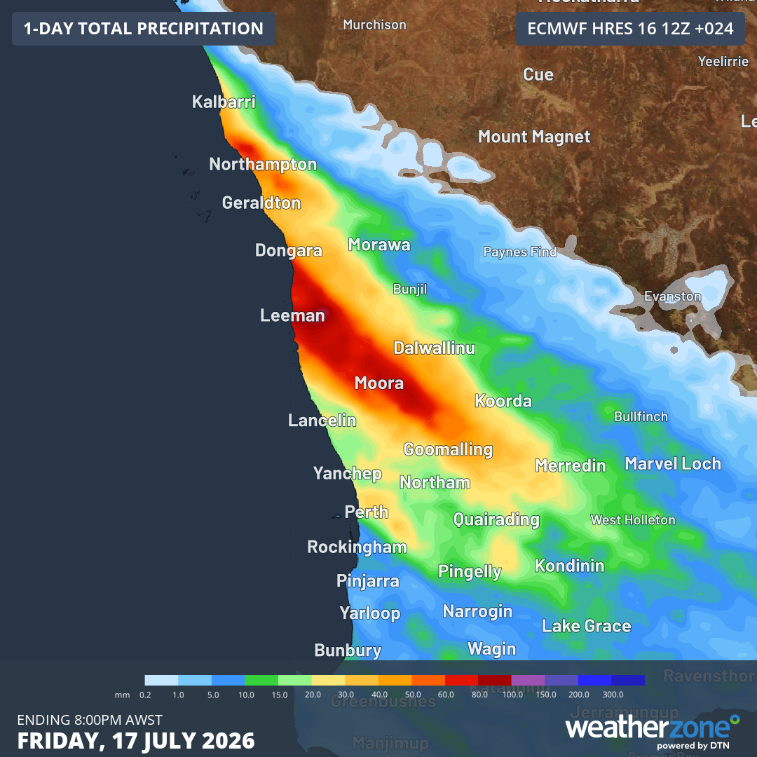
Image: Forecast accumulated rain during the 24 hours ending at 8 pm AWST on Friday, July 17, 2026. Source: Weatherzone.
Rain will continue over a broad area of the state’s west and southwest on Friday night into Saturday morning as the trough moves further inland and another cold front arrives from the Indian Ocean. By Sunday, the rainband is likely to extend across the lower Gascoyne and Goldfields districts, while a few follow-up showers linger in the state’s southwest.
While there may be a few more light showers with the passage of a weak cold front on Monday and Tuesday, a large high pressure system should bring more settled weather for a few days starting from Wednesday next week.