Heatwaves, thunderstorms and extreme fire danger in Australia this week
The final days of summer will feature a dynamic mix of weather across Australia, with widespread rain and thunderstorms in the tropics, heatwaves in multiple states and a return of dangerous fire weather in Victoria.
One look at the satellite images at the start of this week shows areas of cloud over the north and south of Australia and plenty of clear sky in between.

The cloud over northern Australia is being caused by a broad low pressure system and associated monsoon trough, which is producing showers and thunderstorms near the NT’s Top End.
This cloud, rain and thunderstorm activity will spread further south and west as the week unfolds, leading to widespread wet and stormy weather across parts of Qld, the NT and WA. The map below shows how much rain one forecast model is predicting over Australia this week, highlighting the influence of this injection of tropical moisture.
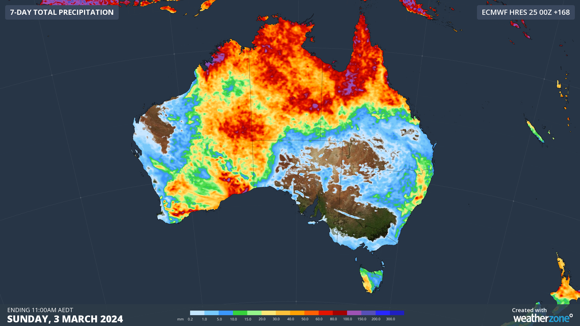
Image: Forecast rainfall over Australia this week, according to the ECMWF-HRES model.
This week’s rain over northern and central Australia will be falling over areas that are still holding a lot of groundwater from Tropical Cyclone Lincoln in February and another tropical low in January. This will increase the risk of flash flooding and outback road closures with any periods of heavy rain over the coming week.
Meanwhile, the southern half of Australia will face a different type of weather threat this week as a late-summer heatwave causes temperatures and fire danger ratings to climb.
A pool of extremely hot air currently sitting over WA will be drawn across southern and southeastern Australia in the coming days, ahead of a cold front.
The tongue of hot air will target SA on Tuesday, Vic and surrounding states on Wednesday and NSW and the ACT on Thursday, making for a sweltering last three days of summer.
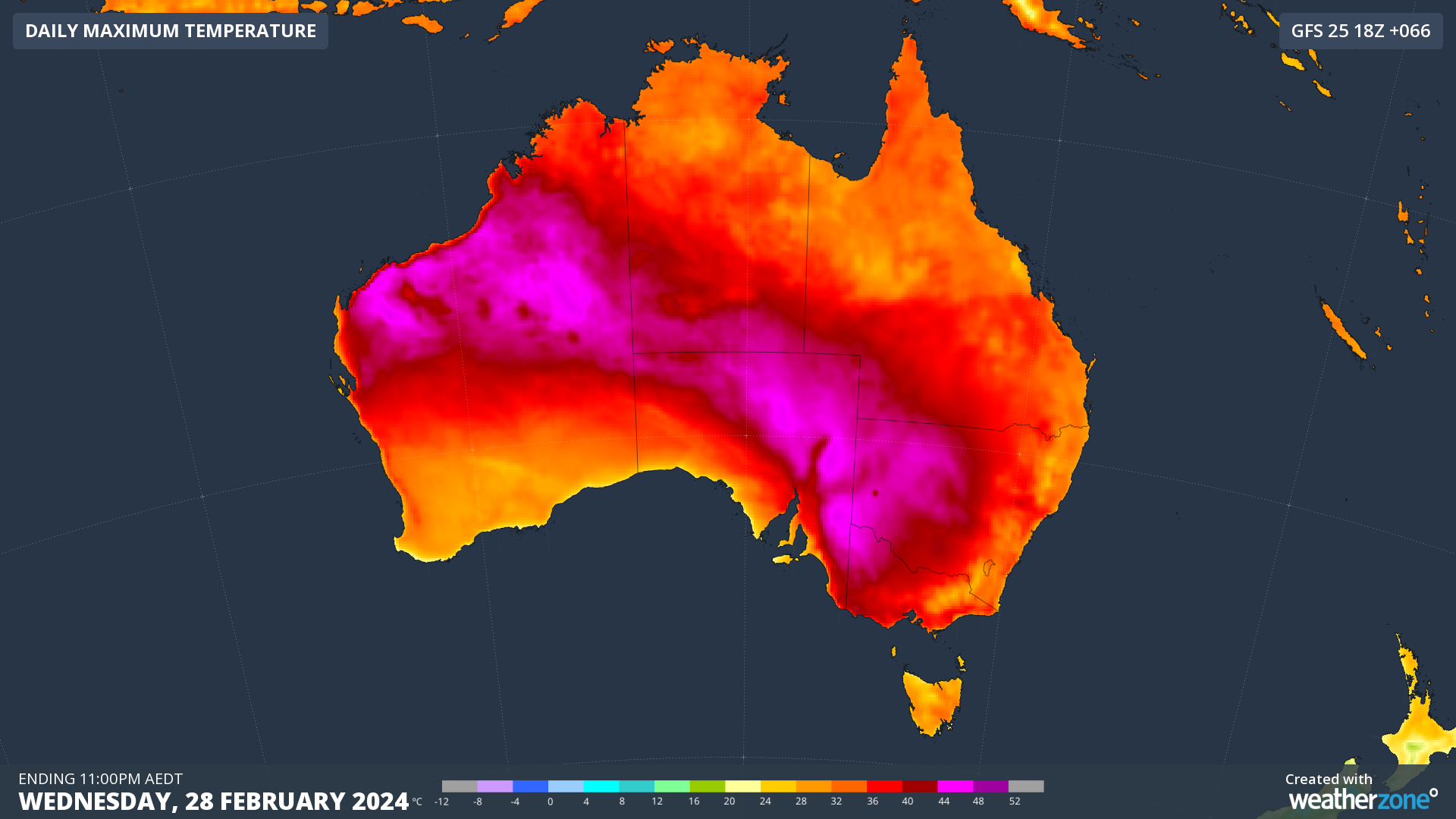
Image: Forecast maximum temperature on Wednesday, February 28, according to the ECMWF-HRES model.
This burst of heat could see temperatures reaching around 36 to 37ºC in Adelaide, Melbourne and Sydney and 34 to 35ºC in Canberra. Outside the capital cities, some inland areas of southern and southeastern Australia are predicted to reach the low to mid-forties during this heatwave.
The hot air will combine with increased winds and low humidity to cause extreme fire danger ratings in central and western Vic, eastern SA and southwest NSW on Wednesday. This spike in dangerous fire weather is being watched closely by emergency services that are still managing fires that started last week in western Vic.
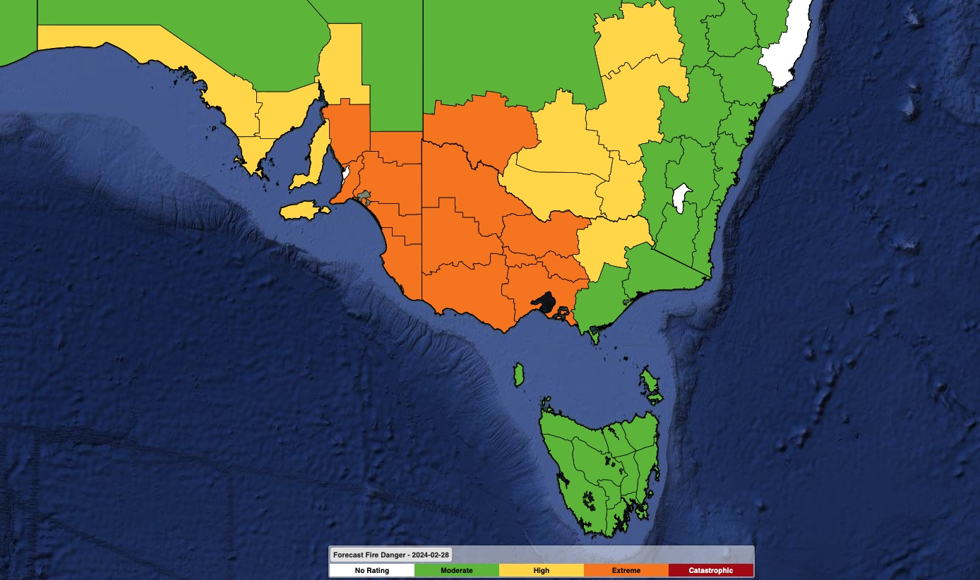
Image: Forecast fire danger ratings in southeastern Australia on Wednesday, February 28. These forecasts may change in the coming days.
With a mix of dangerous weather on the cards for Australia this week, be sure to stay up to date with the latest forecasts and warnings in your part of the country.