
Heatwave sweeping across southern Australia
A heatwave will sweep across southern Australia this week, elevating temperatures and fire danger ratings across multiple states and territories.
A mass of hot air sitting over WA will spread towards the country's southeast during the next several days as a high pressure system moves over the Tasman Sea.
On Tuesday, the hottest air is positioned over WA. Dalwallinu had already reached 43 degrees by 11am and temperatures should reach 45-46 in parts of the Gascoyne, Central Wheatbelt and Great Southern districts in the afternoon. This heat has prompted Severe to Extreme fire danger ratings across a large part of the state on Tuesday.
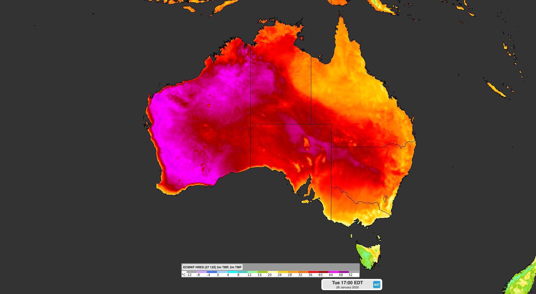
Image: Forecast surface temperature at 5pm AEDT on Tuesday, January 28th.
The hot air will spread further east through the middle of the week, causing temperatures to jump in parts of SA, NSW, the ACT, Victoria and Tasmania.
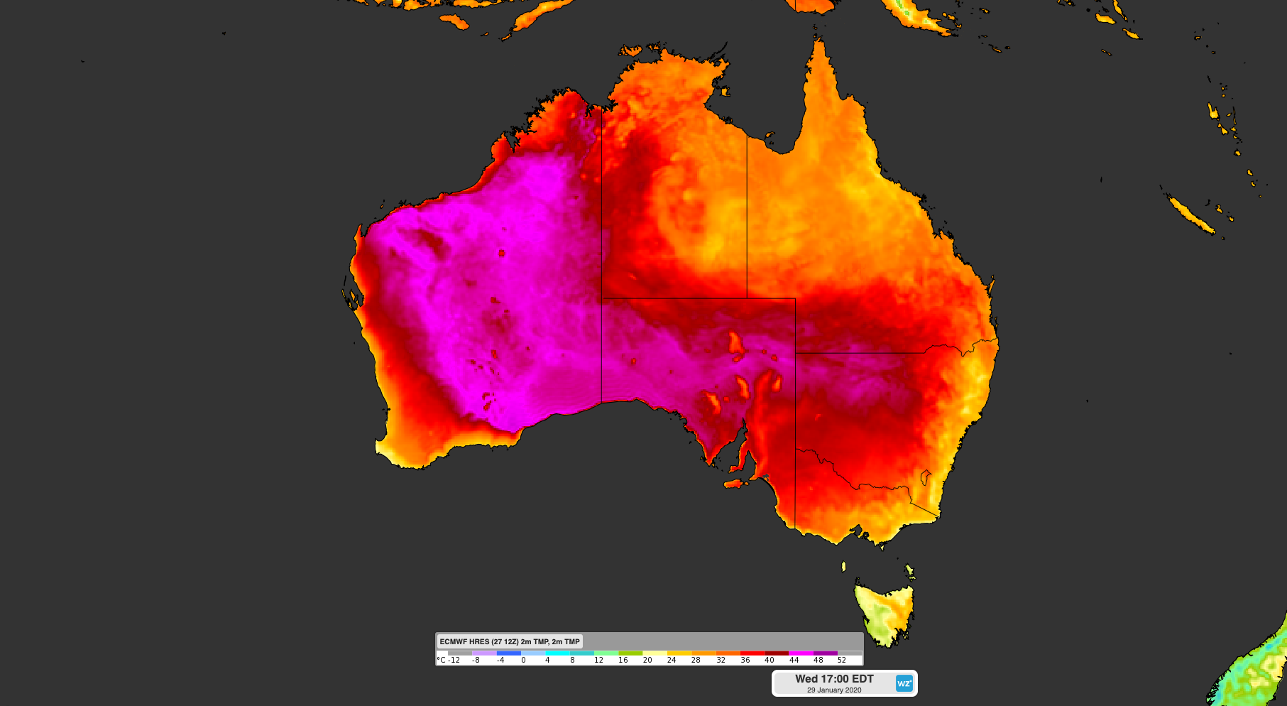
Image: Forecast surface temperature at 5pm AEDT on Wednesday, January 29th.
South Australia's hottest days will be on Wednesday and Thursday, when Adelaide is forecast to reach 38 and 42 degrees respectively. Five of the state's 15 fire danger areas are expected to experience Severe fire danger ratings on Thursday, including the Mount Lofty Ranges and Kangaroo Island.
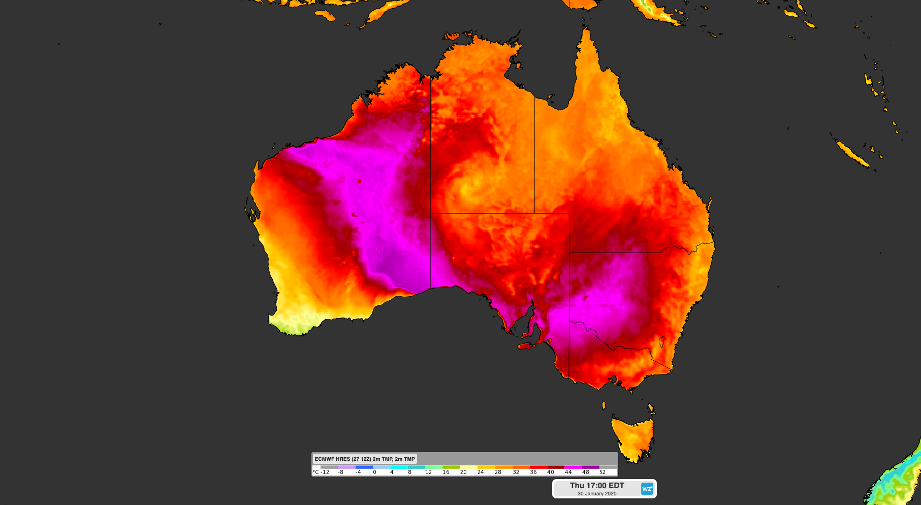
Image: Forecast surface temperature at 5pm AEDT on Thursday, January 30th.
The hottest weather for southeastern Australia will occur during the back half of the week as northwesterly winds strengthen ahead of an approaching cold front.
The hottest days in Tasmania and Victoria will be on Thursday and Friday, with Very High or Severe fire danger ratings likely in both states. On Friday, Hobart could reach the high thirties and Melbourne is forecast to have its first day over 40 degrees so far this year.
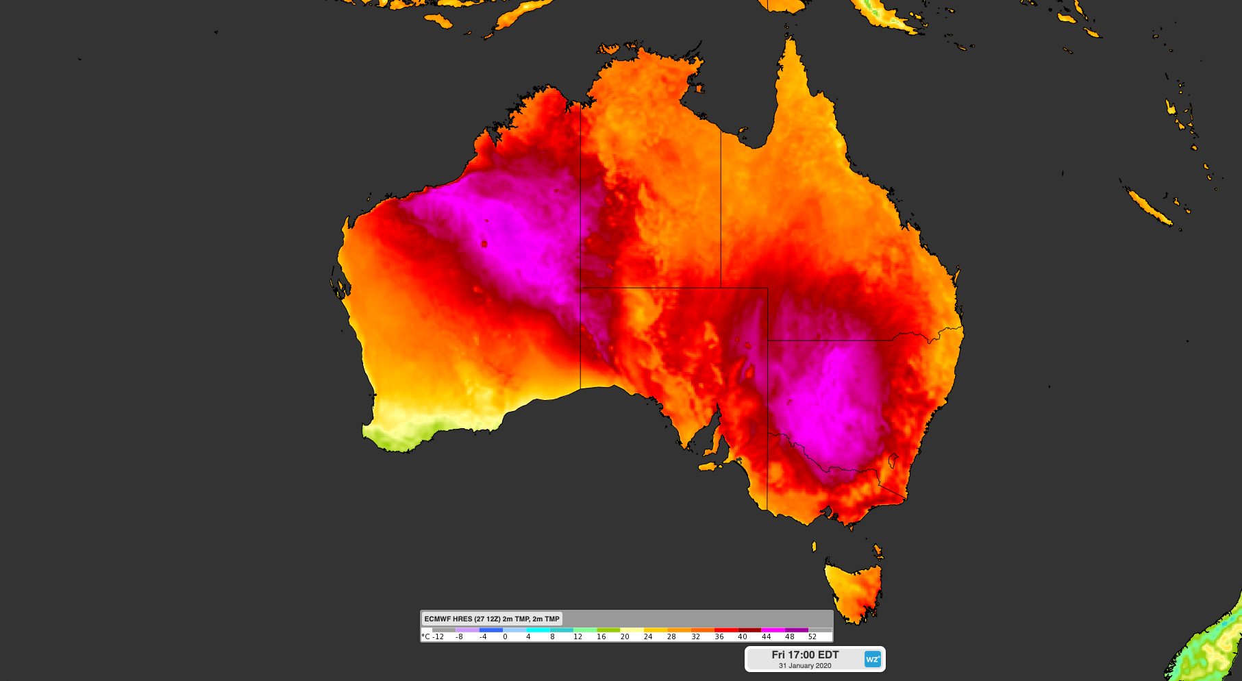
Image: Forecast surface temperature at 5pm AEDT on Friday, January 31st.
Hot air will gradually waft over NSW, the ACT and southern Queensland between Wednesday and Sunday, with the hottest air arriving from Friday. Dubbo is forecast to reach 40-42 degrees each day between Wednesday and Saturday, while Canberra is tipped to hit 39 to 41 degrees for three consecutive days starting Thursday. In Sydney, the mercury could reach the low-to-mid thirties in the city and over 40 degrees in the west each day from Friday to Sunday. This heat is likely to increase the risk of bushfires, particularly on the weekend.
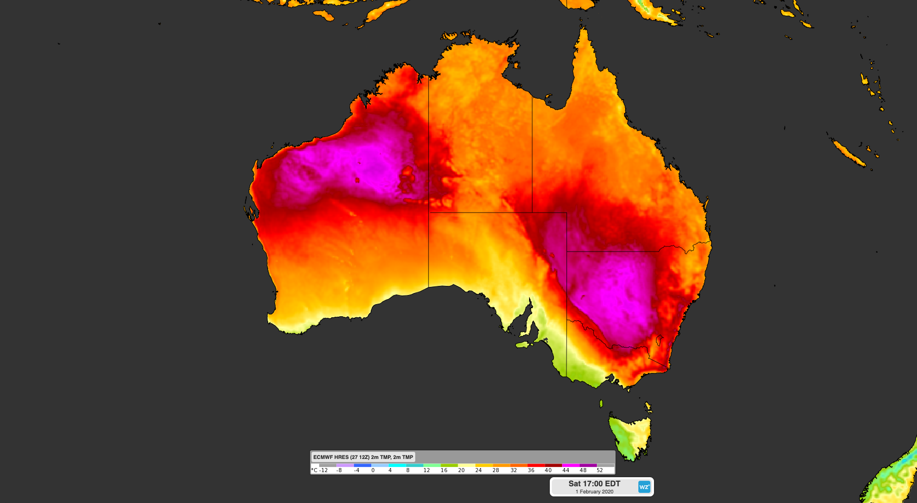
Image: Forecast surface temperature at 5pm AEDT on Saturday, February 1st.
Severe heatwave conditions are forecast to affect parts of WA, SA, NSW, the ACT, Victoria and Tasmania between Tuesday and Sunday, with some places likely to endure Extreme heatwave conditions. The compounding effect of consecutive hot days and warm nights will cause health risks in some communities, so be sure to keep cool as much as you can.