
Heat, rain and storms in southeastern Australia, with snow on the way
Oppressive heat, rain and thunderstorms will sweep across southeastern Australia during the next two days as a tropical air mass plunges south.
A river of moisture-laden air has been dragged across northern and central Australia during the last several days by a slow-moving low pressure system.
On Friday and Saturday, this sultry air will spread across South Australia, Tasmania, Victoria and NSW, where it will combine with a hot air mass to cause a short but stifling heatwave.
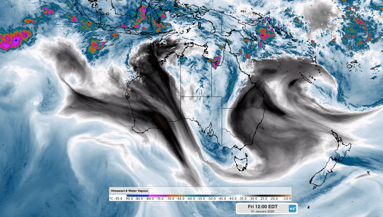
Image: Enhanced water vapour satellite image showing moisture-laden air flowing across Australia from north to south on Friday.
As this pulse of humid air passes over the nation's southeast, it will make high temperatures feel even more uncomfortable during both days and nights.
After reaching 43 degrees on Thursday, Adelaide only cooled to 29 degrees overnight and is forecast to reach 36 on Friday. By 10am, the mercury had already reached 31.7 degrees, although the humidity made it feel more like 34.2 degrees at the time.
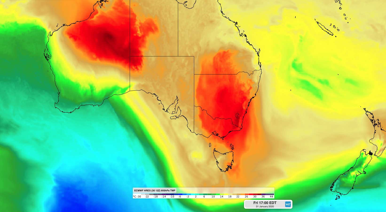
Image: Modelled air temperature at the 850hPa level of the atmosphre, showing a warm air mass sitting over southeastern Australia on Friday.
Further east, temperatures in Victoria and Tasmania will climb quickly on Friday as northerly winds strengthen ahead of an approaching front. The air will also become progressively humid during the afternoon and evening as tropical air sinks deeper into southeastern Australia.
At 11:30am on Friday, Melbourne was already 37 degrees and Hobart had reached 30 degrees. The building heat and humidity should push temperatures into the low forties during the afternoon in both cities, before lingering heat causes an oppressive night.
The hot weather will spread through NSW and the ACT between Friday and Sunday. Canberra is forecast to reach 41 degrees on Friday and Saturday and only cool to 25 each night. Parts of Western Sydney are tipped to reach the low-to-mid forties on Saturday and Sunday, with a restless night in between for the Sydney Basin.
Despite the rising humidity, hot and windy weather will also cause Severe fire danger ratings in parts of Tasmania and Victoria on Friday and in Victoria, NSW and the ACT on Saturday. Blustery winds could also cause dust storms in dry inland areas of southeastern Australia on Friday and Saturday.
Fortunately, this week's injection of tropical air will also produce wet weather in parts of southern Australia. Rain and thunderstorms will spread across South Australia, Tasmania and central and western Victoria on Friday and Saturday, causing widespread falls of 10-30mm and isolated totals over 50mm. Lighter showers and storms will spread through eastern Victoria, NSW and the ACT on Sunday and Monday, with severe thunderstorms likely in some areas.
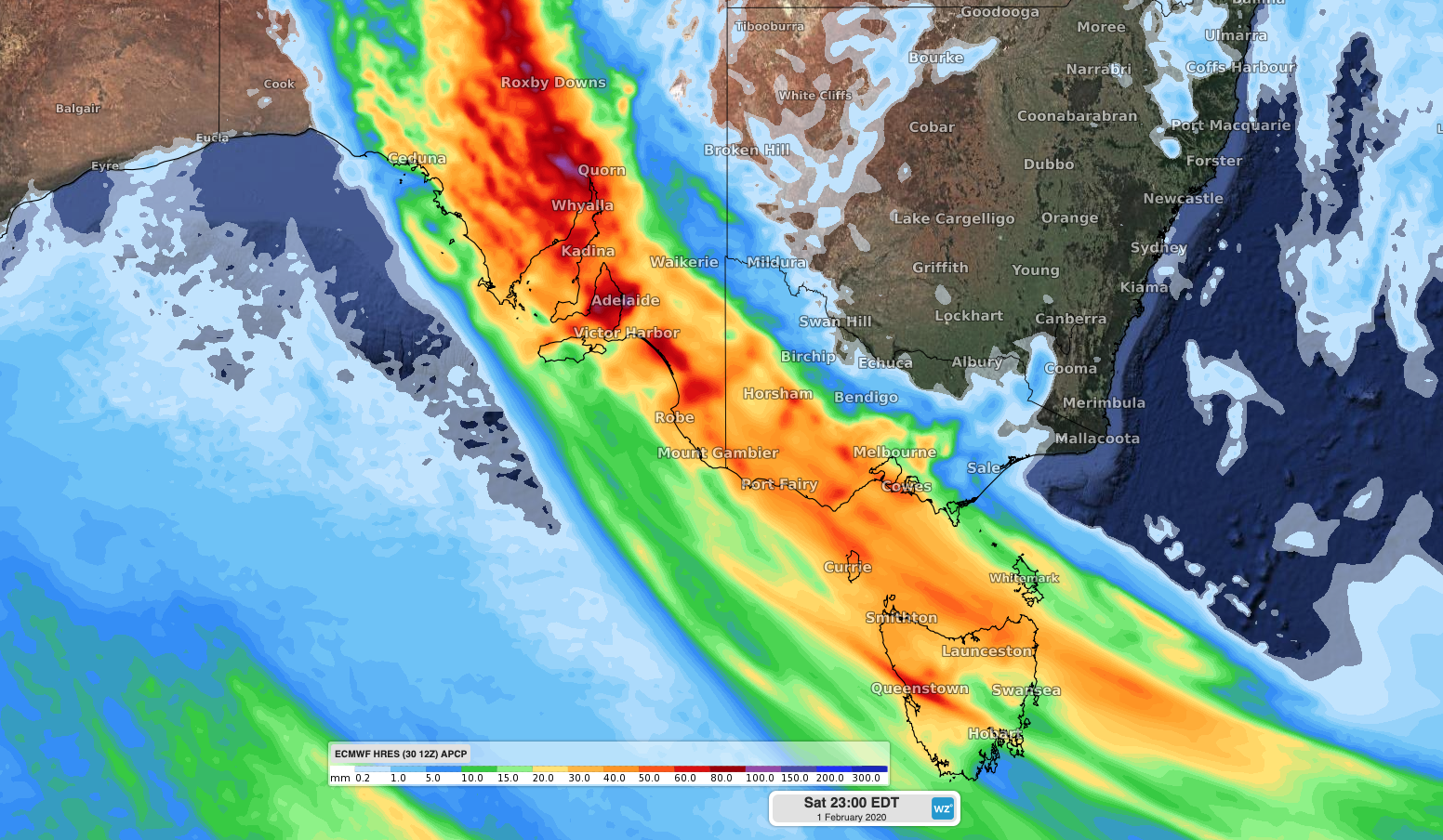
Image: Forecast accumulated rain on Friday and Saturday, according to the ECMWF-HRES model.
To cap off this complex mix of weather, much cooler air will spread over southeastern Australia between Saturday and Monday as a pair of cold fronts pass over the region. The air behind these fronts will be cold enough to cause snow in highland areas of Tasmania by Monday.
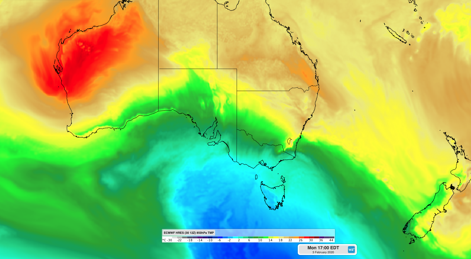
Image: Modelled air temperature at the 850hPa level of the atmosphre, showing cooler air over southeastern Australia on Monday