
Heat Domes, the Ring of Fire and Derechos
A stubborn heat dome is delivering extreme heat while also fuelling violent thunderstorms across parts of the United States this week, with more hot and stormy weather on the way on the final days of July.
Excessive Temperatures
Extreme heat and humidity have been blanketing large areas of the US, especially central and southern regions. Temperatures have been in the 90s widely and have exceeded 100 degrees in places, with elevated humidity leading to dangerous heat indices between 110 and 120 degrees in parts of the Central and Southern Plains and the Southwest. Very warm and humid nights have limited the chances of some relief.
Even Denver saw unusual heat last weekend, with back-to-back highs above 100 degrees and a maximum temperature on Sunday July 26th of 103 degrees. That was the hottest day of the year so far for the city and tied for the 11th-highest temperature on record.
High Pressure and Heat
Heatwaves such as this are often the result of what is popularly known as a ‘heat dome’ – a large and persistent high pressure system in the middle and upper atmosphere which causes the jet stream to divert around it.
Air within a region of high pressure constantly sinks, and as it does so it gets compressed by the weight of the column of air, which causes it to heat up. Not only that, descending air suppresses cloud formation, allowing strong sunshine to heat the ground, which in turn warms the lower layers of the atmosphere. If conditions persist, then soil becomes dry and heats up more readily than if it were damp.
Heat can fortify the high pressure ridge, and a feedback loop can ensue, leading to the heat dome pattern persisting until a large scale shift eventually breaks it down.
This is what we have seen in the latter part of July, and a resurgent heatwave is expected across the Southwest later this week.
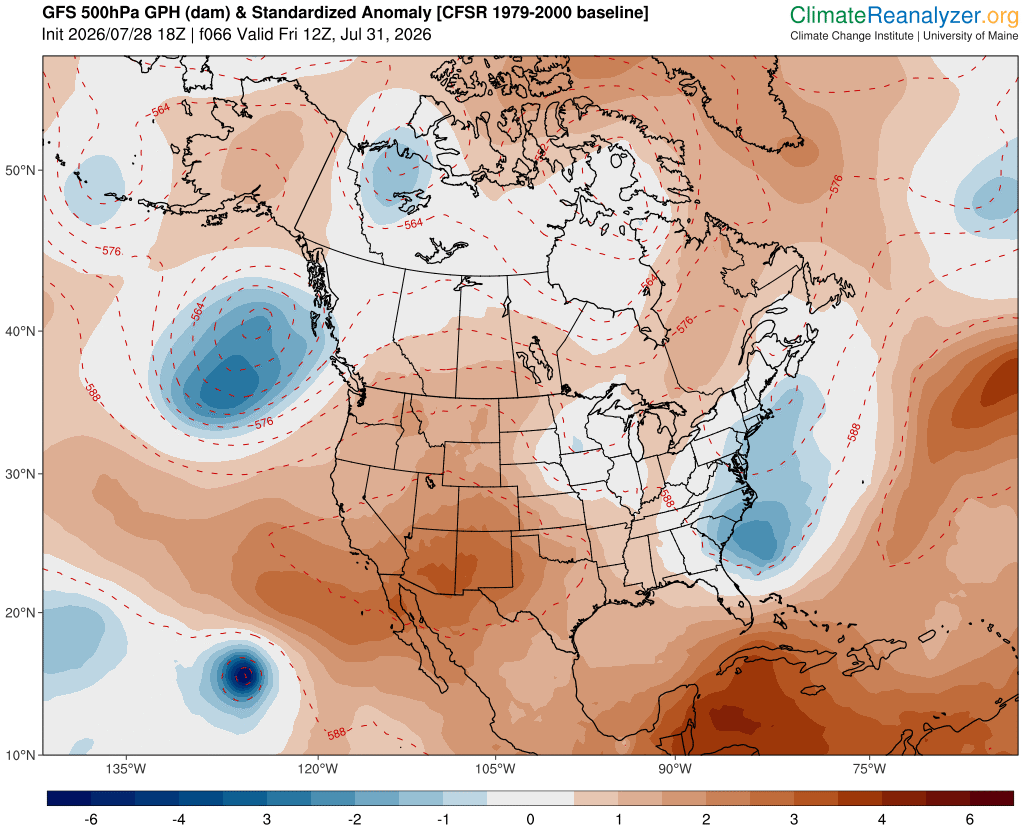
Image: Forecast 500 hPa geopotential height anomalies over North America at 12Z on Friday, July 31, 2026, showing a heat dome centred above the Southwest. Source: ClimateReanlayzer.org
Ridge Riders and the Ring of Fire
Another feature of a heat dome is what happens around its periphery. Although conditions are most frequently dry and sunny within the high pressure area, thunderstorm complexes often develop around the northern and northeastern flanks. These are nicknamed ‘ridge riders’, while the broad pattern of intense heat surrounded by storms is sometimes informally called a ‘ring of fire’.
The sharp boundary between the heat and the cooler air surrounding often induces tremendous amounts of instability, while the proximity of the jet stream can induce the wind shear (change of wind speed or direction with height) required for organized thunderstorms to develop. With a persistent heat dome, repeated rounds of severe weather can affect similar areas day after day.
Derechos
If conditions are just right, then thunderstorm cells can merge into a mesoscale convective system (MCS), which can ‘ride the ridge’ for hundreds of miles. Under more extreme circumstances, a derecho may form.
This is a band of rapidly-moving strong or severe thunderstorms containing potentially damaging straight-line winds, which can sometimes be as destructive as a tornado and deliver gusts in excess of 100mph. By definition, a derecho’s wind gusts must be at least 58mph and it must travel a distance of at least 240 miles.
We haven’t seen a derecho so far, but the current pattern has been exhibiting this sort of behavior, with ridge-riding storm complexes, heavy rain and flood risks from the Great Lakes and Ohio Valley towards the Northeast and the Mid-Atlantic.
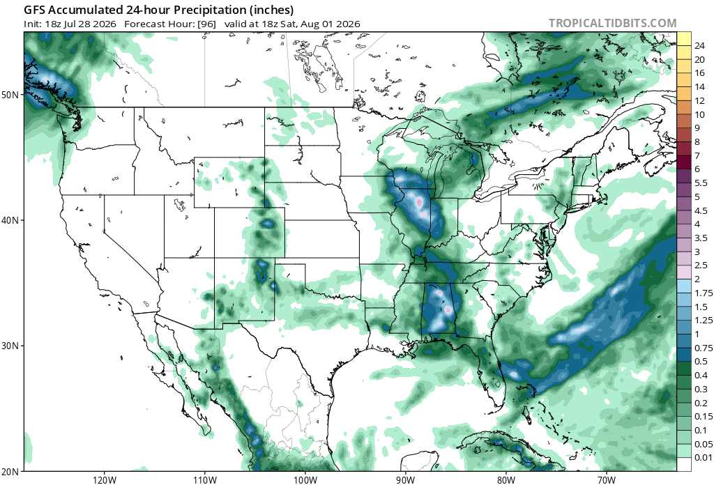
Image: Forecast accumulated precipitation during the 24 hours ending at 18z on Saturday, August 1, 2026, showing ‘ridge rider’ storm complexes extending from the Great Lakes region towards the Gulf. Source: TropicalTidbits.com
Although weakening and shifting around at times, the heat dome across the central and southwestern US may still recur until a potential change in atmospheric patterns after the first week of August.