
Healthy winter rain on the way for Australia's southeast
A significant cold front and low pressure system looks to deliver decent cool season rain to much of Australia's southeast next week, alongside gusty winds, storms and low level snow.
In recent decades, the trend has been towards a reduction in 'cool season' rainfall, the season being April to October. Rain at this time of year is vital for agriculture, and the land as a whole. Highly variable, rainfall at this time of year depends less on the El Niño Southern Oscillation (ENSO) cycle, and more on the Indian Ocean Dipole (IOD) and the northward track of cold fronts from the Southern Ocean. Currently, we are seeing a slight lean towards a negative IOD, which is generally good for increased moisture in the southeast, however it's a cold front which is of most interest in the coming week. This incoming system will help to buck the trend of less winter rain.
From Monday, the cold front will start crossing southern SA and western Victoria. The front itself will bring healthy rain to the southeast states, but breaking away from the front will be a low which looks to hover over a broad area of southeastern Australia for most of the week. This low will maintain a very cold airmass and generate rainfall over a large area. At times during the week, snow will fall to low levels in parts of NSW, Victoria, and Tasmania. The eventual runoff from the melting of this snow will also add to soil moisture and streamflow.
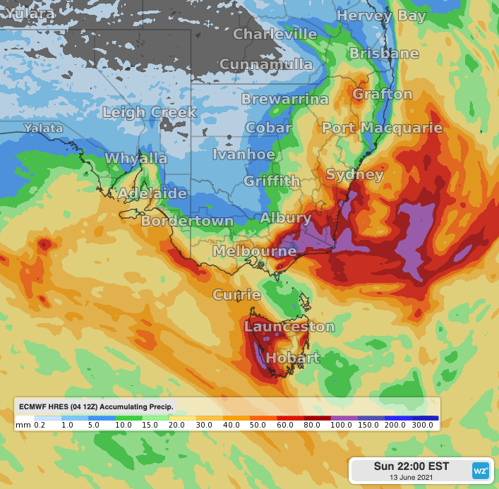 Image: accumulated rainfall totals from Saturday 5th to 10pm EST Sunday 13th using the ECMWF model.
The highest rain totals are likely to be on and near the southern ranges of NSW, central and eastern Victoria and western Tasmania. Once the low finishes its work over southeastern Australia by next weekend, it may only be a short time until the next system arrives. There are signals of another cold front and possible low crossing the southeast from around Monday 14th, however this system looks shorter lived and less intense than the system this coming week.