
Hazardous surf and chilly air hitting NSW as Tasman Low spins
A large low pressure system sitting over the Tasman Sea is sending large waves and cold air towards New South Wales, resulting in hazardous surf and some of the lowest temperatures so far this year.
The satellite images below show cloud spiralling around the Tasman Low on Monday morning, with air circulating in a clockwise direction around the centre of the low pressure system.
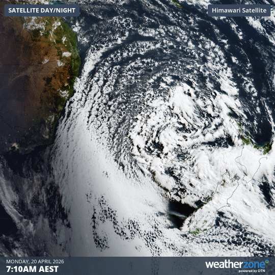
Image: Day/night satellite images captured early on Monday, April 20, 2026. Source: Weatherzone.
Due to this clockwise rotation, the Tasman Low is causing cool southerly winds to flow over southeastern Australia. These winds are also causing a big southerly swell to impact the NSW coast.
Wintry temperatures
The cool air being driven over NSW by the Tasman Low has caused a string of frosty mornings over the last few days.
Monday morning’s -6.0°C at Cooma Airport was the lowest temperature reliably recorded anywhere in mainland Australia so far this year. It was also Cooma’s coldest April morning in 20 years.
Canberra dipped below 0°C on each of the last three mornings, reaching -1.8°C on Saturday, -1.0°C on Sunday and -0.9°C on Monday. This was the first time Canberra has seen three consecutive April mornings below zero degrees for five years.
Parts of Western Sydney cooled to around 5 to 7°C on Monday morning, which is 3 to 6°C below average for April. This followed similarly chilly temperatures over the weekend for the city’s west.
Big waves hitting the coast
Winds associated with the Tasman Low have caused big waves along the NSW coast over the last few days, with this large surf continuing on Monday.
Significant wave heights have been hovering around 2 to 3 metres along much of the NSW coast since Saturday, with maximum wave heights reaching about 6 to 7 metres at times. A waverider buoy near Sydney registered 6 metre waves early on Sunday morning, followed by a 5.8 metre wave on Sunday night.
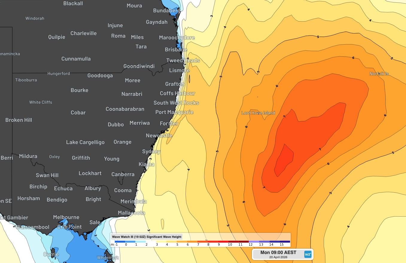
Image: Significant wave height forecast for Monday morning. Source: Weatherzone.
As of 11 am AEST on Monday, a hazardous surf warning was in place for the entire NSW coast, and for southeast Queensland as far north as K’gari (formerly Fraser Island). This warning means conditions are likely to be hazardous for coastal activities such as rock fishing, boating and swimming.
Severe weather warnings are also in place for damaging surf on Norfolk Island and Lord Howe Island on Monday.
Looking ahead, waves will ease along Australia east coast during the next few days as the Tasman Low weakens and moves over New Zealand’s North Island. Overnight temperatures will also climb as southerly winds ease, allowing warmer air to return to southeastern Australia.