
Half a million lightning strikes and many more on the way
Thunderstorms erupted over eastern Australia during the last 24 hours and there is a lot more on the way during the next 2-3 days.
A broad upper-level low pressure system interacting with moisture-laden air from the tropics is causing a multi-day outbreak of rain and thunderstorms over Australia's eastern and southeastern states this week.
Storms started to build over parts of SA, Victoria, NSW and Queensland on Tuesday and by Wednesday morning, there had already been more than half a million lightning strikes.
The map below shows 647,545 lightning strikes that were detected within an 800 km radius of Bourke during the 24 hours ending at 10am AEST on Wednesday. Around 83,000 of these were cloud-to-ground strikes and the rest occurred within or between clouds.
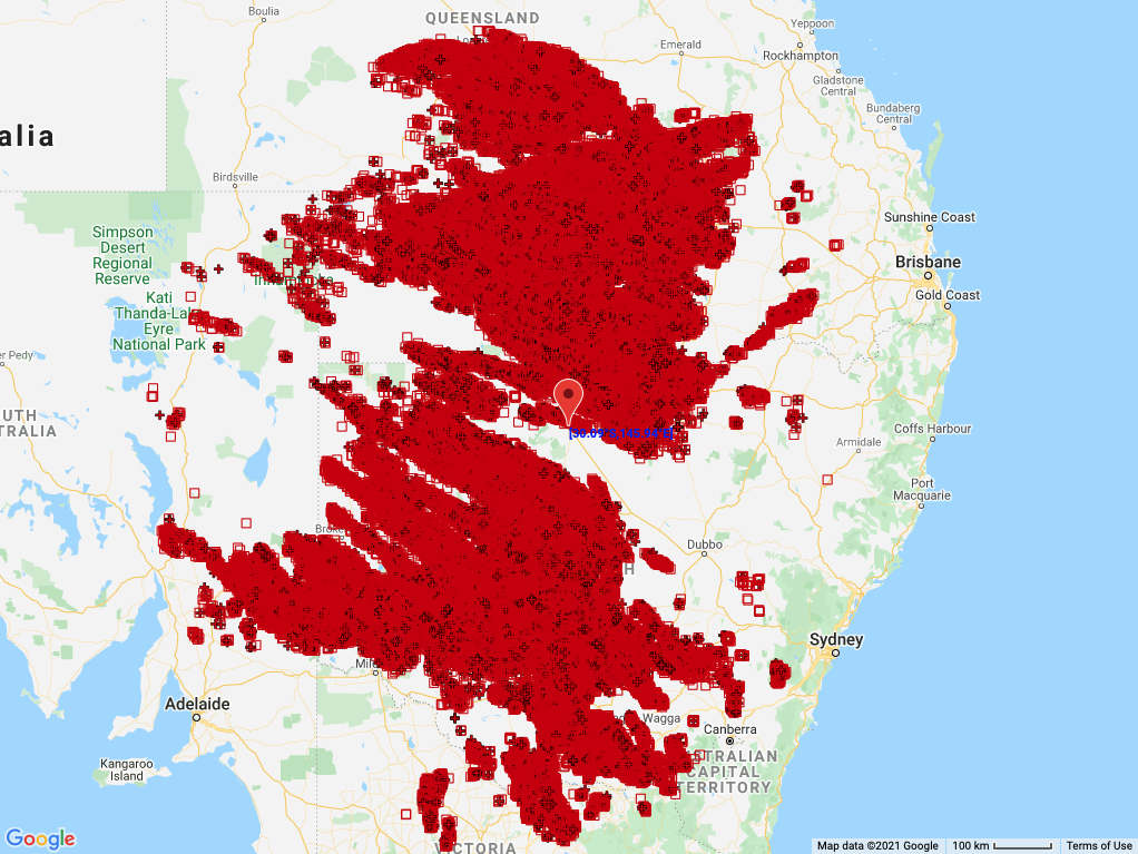
Image: Locations of lightning strikes detected within an 800 km radius of Bourke between 10am AEST on Tuesday and 10am AEST on Wednesday this week.
It is impressive to see this much lightning in September, with large outbreaks of thunderstorms like this more common in October and November.
The video below is a composite satellite and lightning animation that shows how the storms evolved on Tuesday and Wednesday morning.
Rain and thunderstorms will be remain widespread across eastern and southeastern Australia on Wednesday, affecting an area from central Queensland down to Victoria.
Severe thunderstorms are likely on Wednesday, with damaging winds, heavy rain and large hail all a risk. Flooding and damaging wind gusts are also a risk independent of thunderstorms in some areas of Victoria.
Showers and thunderstorms will continue over a broad area of Queensland, NSW, the ACT and Victoria on Thursday and Friday and also spread over parts of Tasmania. Severe thunderstorms are likely in some areas on both days, so be sure to keep an eye on the latest warnings in your area.