
Gulf of Carpentaria tropical cyclone threat looms

A tropical cyclone could develop over the Gulf of Carpentaria as early as this weekend.
A developing monsoon trough will cause rain and thunderstorms to increase over the Northern Territory's Top End and northern Queensland during the second half of this week.
As this monsoon trough deepens towards the end of the week, a number of forecast models suggest that a low pressure system will develop over the Gulf of Carpentaria. Conditions over the Gulf will become favourable for this low pressure system to deepen into a tropical cyclone on the weekend.
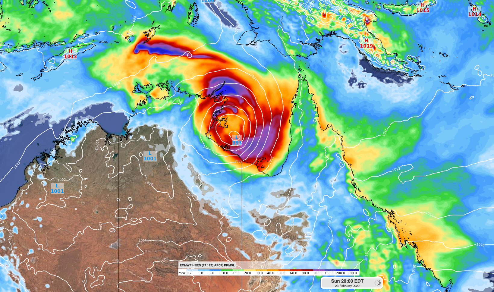
Image: Forecast 24-hour accumuated rainfall and mean sea level pressure at 8pm AEDT on Sunday, according to the ECMWF-HRES model.
If a tropical cyclone does form, it will become the fourth to develop over Australian waters so far this season and will be named Esther.
Most models suggest that the potential tropical cyclone will move over the Northern Territory at some stage next week, although there is plenty of room for this forecast to change in the coming days.
If you live in the tropics of Queensland of the NT, now is a good time to check your cyclone plan and keep an eye on the development of this system as the week unfolds.
Information on how to prepare for a tropical cyclone is available here: https://www.abc.net.au/news/emergency/plan-for-an-emergency/cyclone/