
Frosty Monday morning on the way for the much of the interior
Grass will be crispy under foot tomorrow morning in the central and eastern interior, as frost will be widespread.
A lazy, slow moving high pressure system is currently over central, southern and eastern Australia. It’s keeping winds light, skies clear and nighttime temperatures low. This combination is perfect for frost, and there is a good chance it will form overnight into Monday morning in parts of the NT, SA, southern Queensland, NSW, Victoria and Tasmania.
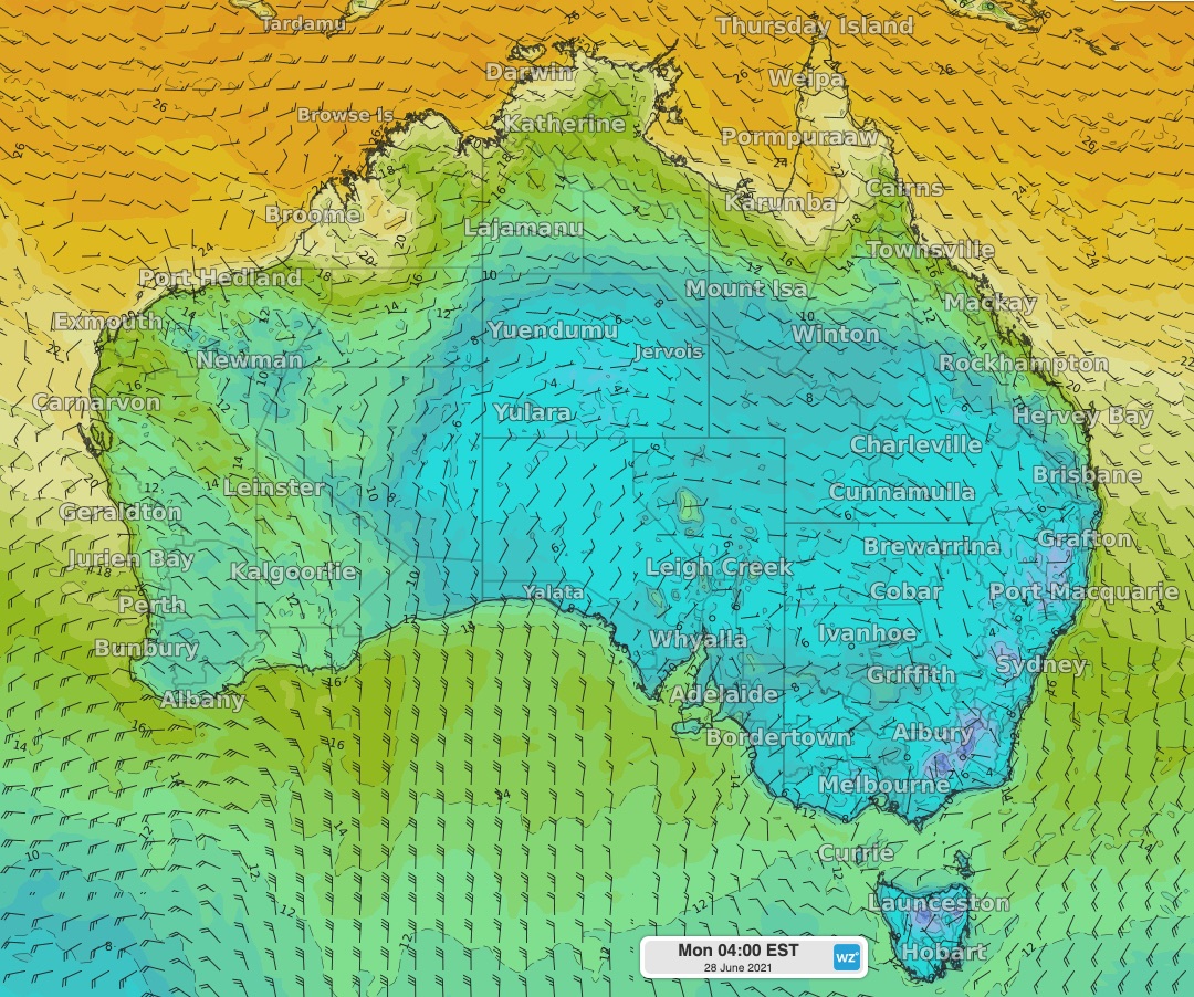 Image: a cold night ahead for much of the central and eastern interior as shown by the ECMWF forecast model.
Frost is an example of what's called 'deposition'. Deposition is the process in which water vapour turns to ice without being a liquid in between. Overnight in many places, humid air will come into contact with a surface at or below freezing, such as grass, and presto! Frost appears.
The frost will melt pretty quickly as soon as the sun pokes it head over the horizon, but there will be plenty more frosty mornings ahead. Frost may be severe in about a weeks' time as we are looking at some cold temperatures following a front.