
Frost: what is it and how does it form?
The United States has been in a colder pattern for the last couple of weeks, with frosts and freezes a regular occurrence in the Canadian Prairies and Northern Plains, even spreading into the Central Plains and Midwest at times. With this cold pattern sticking around, chances for more frosts and freezes will continue this week and possibly next week as well.
Frosts and freezes, when temperatures have fallen to lower than 36 degrees Fahrenheit and 32 degrees Fahrenheit, respectively, have been a regular occurrence in the U.S. over the last couple of weeks.
Three main factors are required to get frosts in early May, which generally become harder to accomplish as the days get longer. A cold, dry airmass, clear skies, and calm winds are usually required in combination to get temperatures to fall near and below freezing. But it all starts with the cold air sitting over an area.
Ingredient 1: Cold air
It’s hard to get frosty when temperatures are too warm, so the first and most obvious ingredient is cold air. This week, an upper-level trough of low pressure has settled over the eastern two-thirds of North America. The flow into this trough is from the northwest, or northwestern Canada, which is a supply of relatively cold air for this time of year. Because the trough is sticky and refusing to move out of the region, the steady supply of colder air continues to move through southern Canada and into the U.S.
But just because the air is cold doesn’t mean it is ripe for frost formation. The amount of moisture in the air is a key factor as well. It may seem counterintuitive, but a drier air mass is more likely to produce frosts than one holding more moisture, as drier air can cool more significantly than moist air.
Ingredient 2: Clear skies overhead
Temperatures cool overnight because heat that had built up during the previous day is radiated away from the Earth’s surface at night. As the Earth’s surface cools, the air near the ground cools as well. This process continues until the sun rises the next morning, at which point the incoming solar radiation from the sun exceeds the amount of infrared radiation being lost into space. The ground, and surface air, then start to increase in temperature as a result.
However, the rate at which the ground cools overnight can be affected by surrounding objects and surfaces, including roads, buildings and even clouds. These objects all absorb and emit radiation, which can limit how much the ground cools at night. Water-laden clouds overhead can act like a blanket, preventing surface air temperatures from falling too quickly at night. This makes cloudy nights less prone to frost than clear nights.
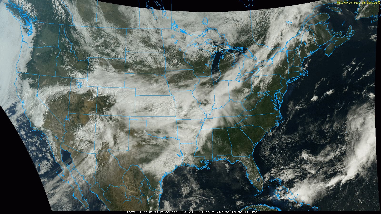
Image: Visible satellite image showing extensive cloud cover over across the U.S. on May 5, 2026. Source: College of DuPage / GOES-19
But even on a clear, cloudless night, one more factor can keep frost from forming: winds.
Ingredient 3: Calm winds
As the Earth’s surface cools, air sitting just above the surface absorbs some of that radiation, keeping it warmer than the ground. It then emits that radiation to air above it and then eventually out to space. This means air closest to the surface gets colder faster than the air above it, and the air 100 feet above the surface is quite typically warmer than the air near the ground during overnight cooling.
If the air is calm, this process becomes more efficient and the air near the ground cools quickly. However, when winds are stronger, the warmer air 100 feet high mixes with the cooler air near the surface. This mixing helps to even out the temperature through the lower atmosphere, cooling the air well above the surface, but warming the air near the surface. In general, the faster the winds, the better the air mixes, and the less likely we are to see frost.
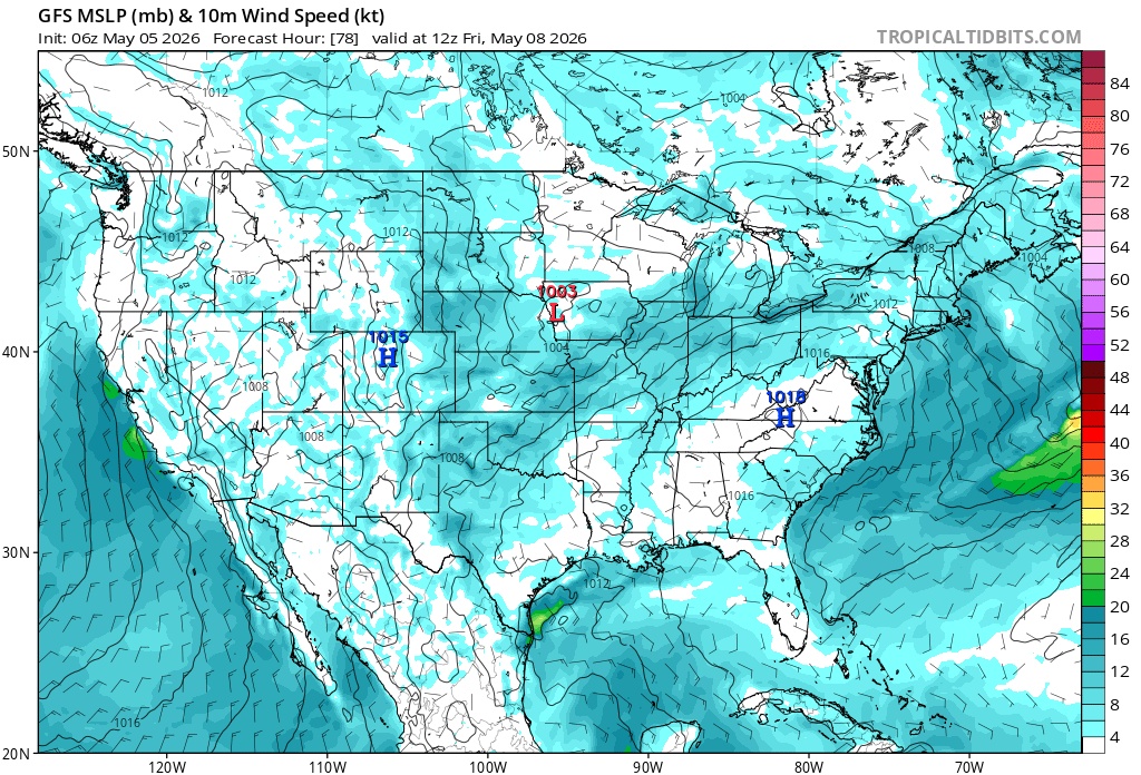
Image: The wind forecast for this Friday shows elevated activity for much of the Plains and Midwest, which may reduce frost development. Source: Tropical Tidbits.
Other factors that can affect frost formation
Topography can also have a significant impact on frost formation. Cooler air is more dense than warmer air and thus tends to pool in lower elevations. Small divots and pockets in the landscape, and around lakes, streams, and rivers, tend to see the colder air pooling more than the tops of hills. This can lead to frost forming in low-lying areas, but not on more elevated terrain.
Soil moisture can also affect frost formation, with wetter soils helping the ground remain warmer at night, while drier soils cool the surface faster.
The presence of fog, either due to radiational cooling as mentioned above, or moving in from a different location due to light winds, can also slow the cooling process further.
Frost forecast this week
This week, we have another surge of cold air pushing through the U.S. behind a strong cold front. Temperatures in the Northern Plains and Canadian Prairies were again below freezing on the morning of May 5. As that front pushes south through the rest of the country over the next couple of days, the cold air mass will settle in, giving the risk for widespread frosts across the Central Plains and Midwest.
However, the other two key ingredients for frost – clear skies and calm winds – are less certain. With the upper-level trough spinning about, other disturbances are rotating around the U.S. and Canada as well. Those disturbances are bringing through occasional winds and patchy areas of clouds and rain. Both of those will be hindrances for frost formation this week.
The best chances for frost in the Midwest are on Thursday and Friday mornings, May 7-8. Though there will be clouds on both mornings, and perhaps some stronger winds on Friday, these days have the best chance for patchy frost and freeze conditions.
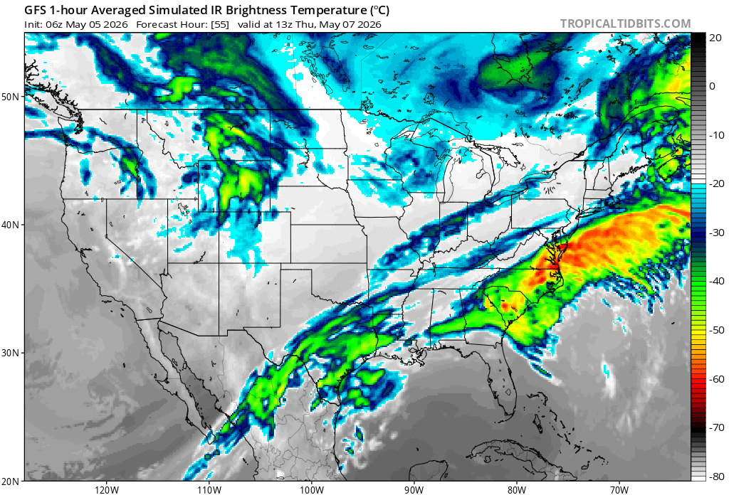
Image: Forecast cloud on Friday morning, suggesting widespread cloud cover for much of the Central Plains and Midwest, which may reduce frost development. Source: Tropical Tidbits.
In areas of the central High Plains, the cold air is pushing up and into the Rocky Mountains. That additional push upward cools the air further, resulting in snow. Heavy snow accumulations are forecast from Cheyenne, WY, down to Colorado Springs, CO. The snow will be less heavy across much of eastern Colorado, but accumulations may still occur in western Nebraska and Kansas for Tuesday night and Wednesday, May 5-6.
Clouds may still be an issue for frost formation for Wednesday and Thursday, May 6-7, but the snow is another excellent emitter of infrared radiation. Surface air temperatures can be significantly colder where fresh snow cover occurs than surrounding areas that have none. The snow is not expected to stick around long, but the additional cooling in Colorado may keep temperatures down a few extra degrees in the surrounding areas as well.
Next week, the upper-level trough remains in Central and Eastern North America, but it is forecast to weaken as it gets pushed eastward. There may still be some frosty temperatures in the Midwest and Northeast at times next week between systems, but clouds and winds will be hindrances, too. Current forecasts have overnight low temperatures in the 40s and 50s F, but they had this week’s temperatures in that range as well. Changes to the forecast should be monitored for those with sensitive plants in the area.