
From fire danger to snow potential in two days

Warm and windy weather has prompted a fire weather warning in southern Queensland today, just two days before temperatures get cold enough for a chance of snow on the Granite Belt.
Thursday’s dangerous fire weather is occurring as a dry and gusty westerly change sweeps across the state.
Severe fire danger ratings have been forecast in the Darling Downs and Granite Belt district today, where winds could average 30-45km/h as temperatures reach the high twenties. Very High fire danger is also tipped in the state’s Central Highlands and Coalfields, Maranoa and Warrego, Wide Bay and Burnett and Southeast Coast districts on Thursday.
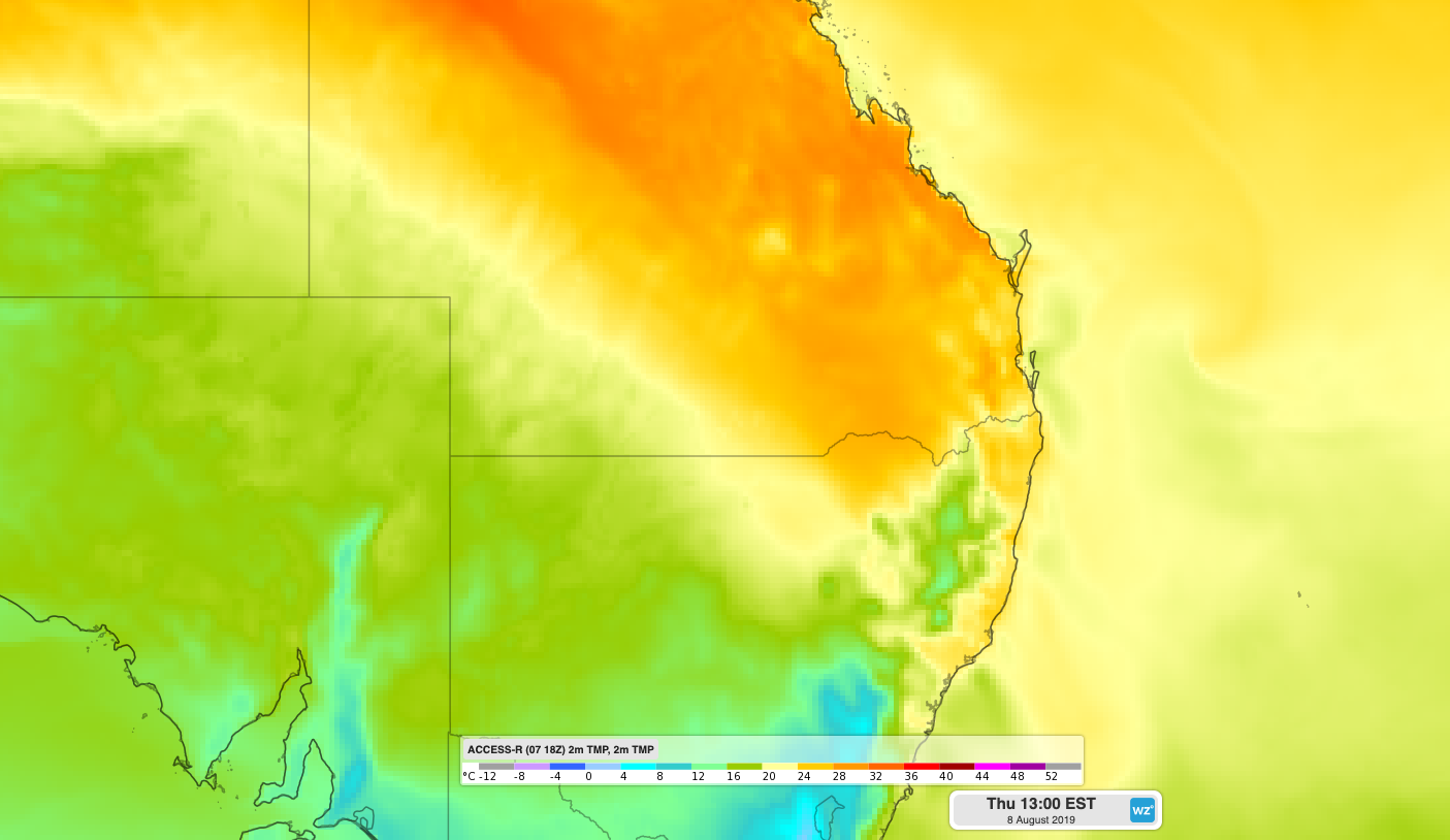
Image: Forecast surface temperature on Thursday afternoon, according to the ACCESS-R model.
Fire danger ratings will drop in southern Queensland during the next couple of days as cooler air spreads into the state from the south.
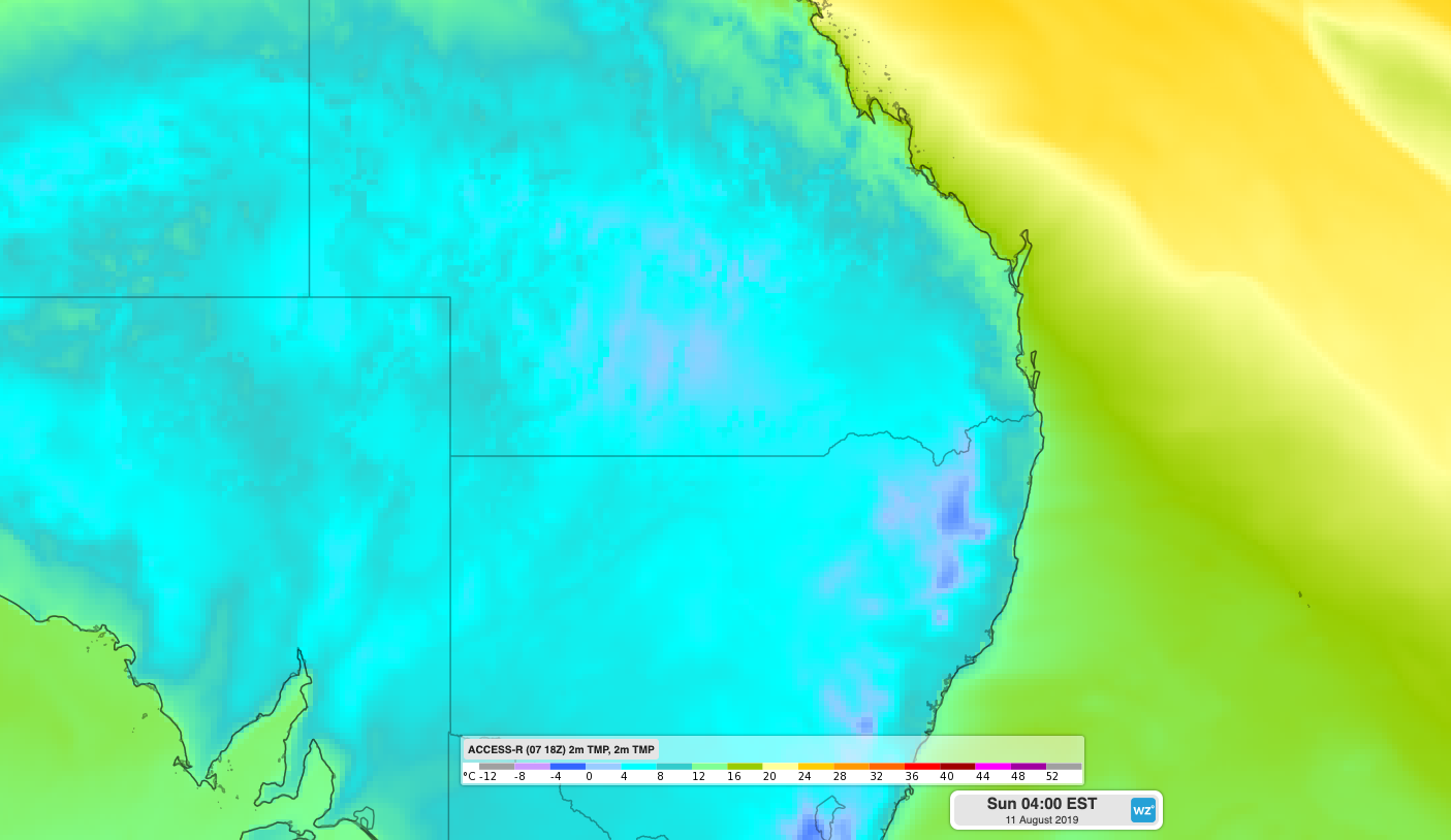
Image: Forecast surface temperature on Saturday night, according to the ACCESS-R model.
This cold air may even allow some sleet or snow to settle on higher parts of the Granite belt during Saturday night or Sunday morning.