
Frigid fog descends on Melbourne and other parts of Victoria
It was a frigid, foggy morning in Melbourne and many other parts of Victoria, and while the overnight minimums in most locations were unremarkable for July, one thing stood out: the persistence of cold temperatures well into Thursday morning.
- After an overnight low of 3.5°C, Melbourne was still just 4.5°C at 10 am as the fog which blanketed the city overnight struggled to lift.
- By contrast, Mt Hotham Airport (which had the lowest recorded Victorian temperature of -3.6°C overnight) had already risen to 9.0°C at 10am under bright sunny skies.
- At 10:30 am, Melbourne was still only 5.6°C.
The satellite image below shows cloud (much of which is fog) and live temperatures in and around the greater Melbourne area at 9:45 am on Thursday. These were very cold readings for the time of day.
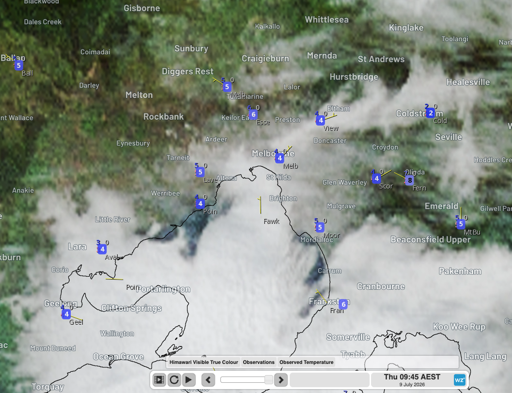
Image: Satellite image with live temperatures at 9:45 am (AEST) on July 9, 2026, across parts of Victoria near Port Phillip Bay, including Melbourne. Source Weatherzone.
Why was Melbourne so foggy last night?
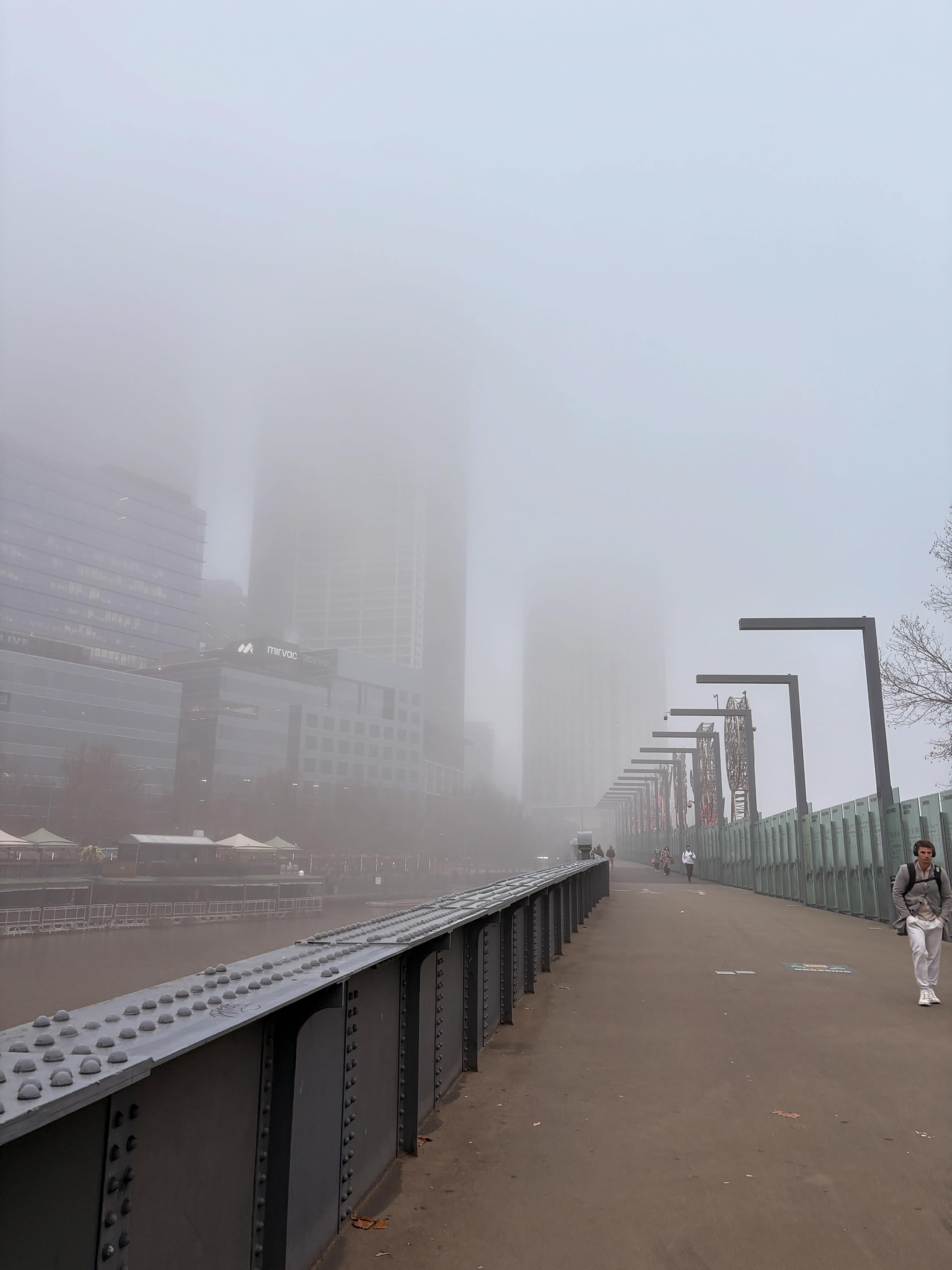
Image: Melbourne's fog was very slow to lift on Thursday morning. Source: @Unravelled_opinions on Threads.
Fog is simply cloud that forms at or near ground level.
When the air temperature cools to its dew point (the point at which air is fully saturated), water vapour condenses into tiny, suspended water droplets. This is cloud, or fog at ground level.
Fog is most common on nights with clear skies and light winds when there is high relative humidity.
Because of the strong high pressure system which has dominated eastern Australia’s weather this week, conditions have been clear, calm and cold over Victoria, Tasmania, eastern SA and southern NSW. This has enabled large areas of fog to form.
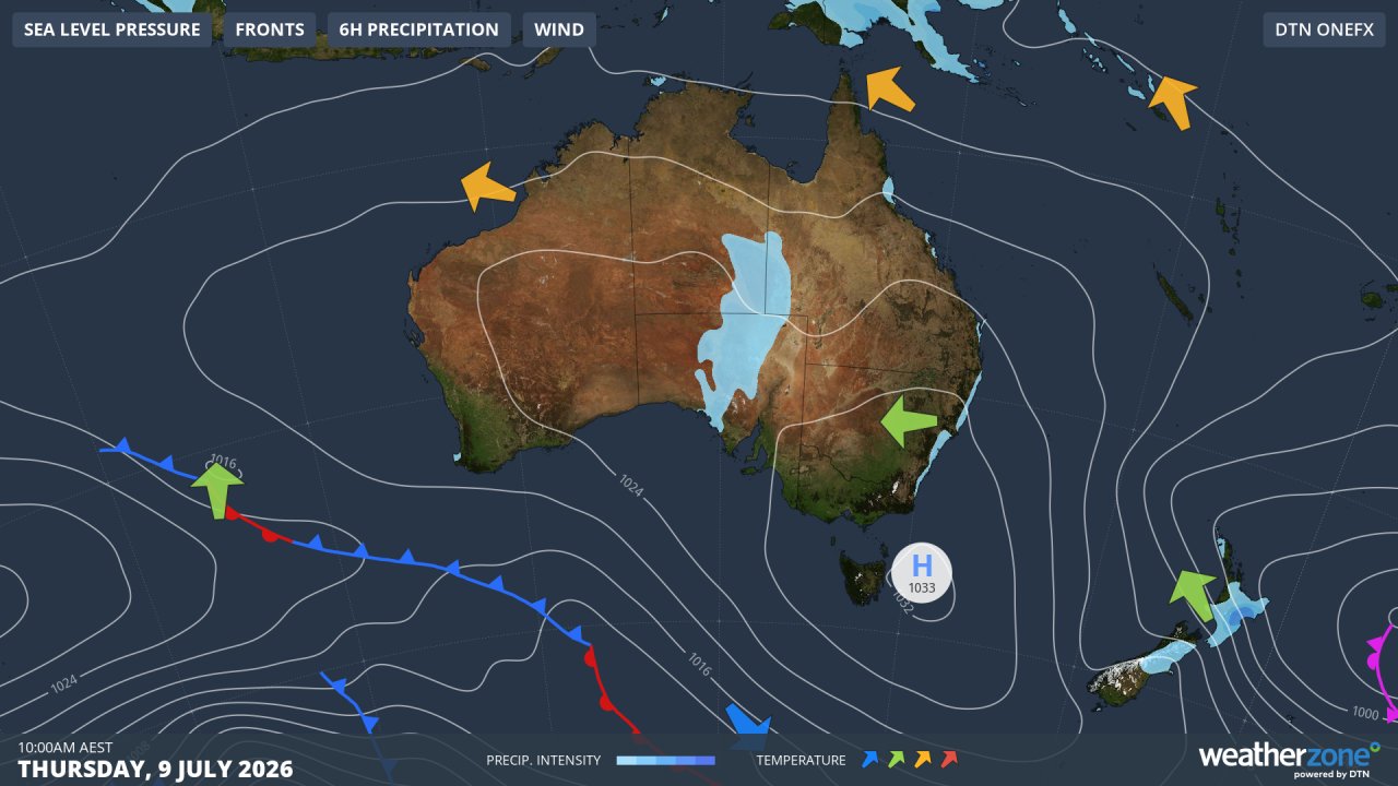
Image: Synoptic chart for Thursday, July 9, 2026. Source: Weatherzone.
The centre of the high pressure system in the synoptic chart above has been more or less parked over Tasmania for a couple of days now. It won’t head off into the Tasman Sea until the weekend when the next cold front approaches.
Foggy streak to end as winds pick up
It’s possible that Melbourne and other parts of Victoria could see one more foggy morning in this very calm weather week before the approaching cold front changes the atmospheric dynamics into this weekend.
Strong northwest to westerly winds will sweep across the whole of Victoria for several days both before and after the front, and there should be plenty of rain in the mix too, with snow at higher elevations of the Victorian Alps.
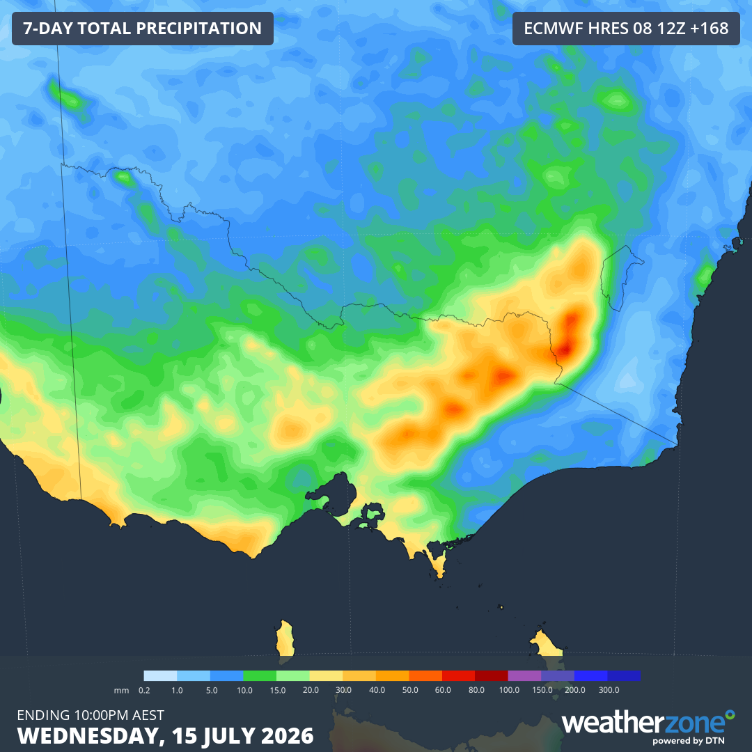
Image: Predicted rainfall accumulations across Victoria until the evening of Wednesday, July 15, 2026. Note that 1 mm of rain = approximately 1 cm of snow when snow settles at higher elevations. Source: Weatherzone.