Freezing rain: unusual phenomenon strikes Snowy Mountains
An unusual weather phenomenon has struck the Snowy Mountains of New South Wales, with freezing rain coating anything solid in a thin layer of ice on the highest parts of the range.
Freezing rain is different to its much more common cousins snow, hail or even sleet. As Weatherzone meteorologist Tom Hough wrote recently in his excellent story about different types of precipitation:
"Essentially, if the cold layer under a cloud is too shallow for the droplet to completely freeze before it hits the ground, it instead hits the ground as a supercooled raindrop. When this drop hits a cold surface, it almost immediately freezes."
Hough went on to write that raindrops smaller than 0.5mm are classified as "freezing drizzle", and it appears that freezing rain and a little freezing drizzle both occurred on Wednesday night into Thursday morning, up high on the Main Range around Mt Kosciuszko and nearby peaks.
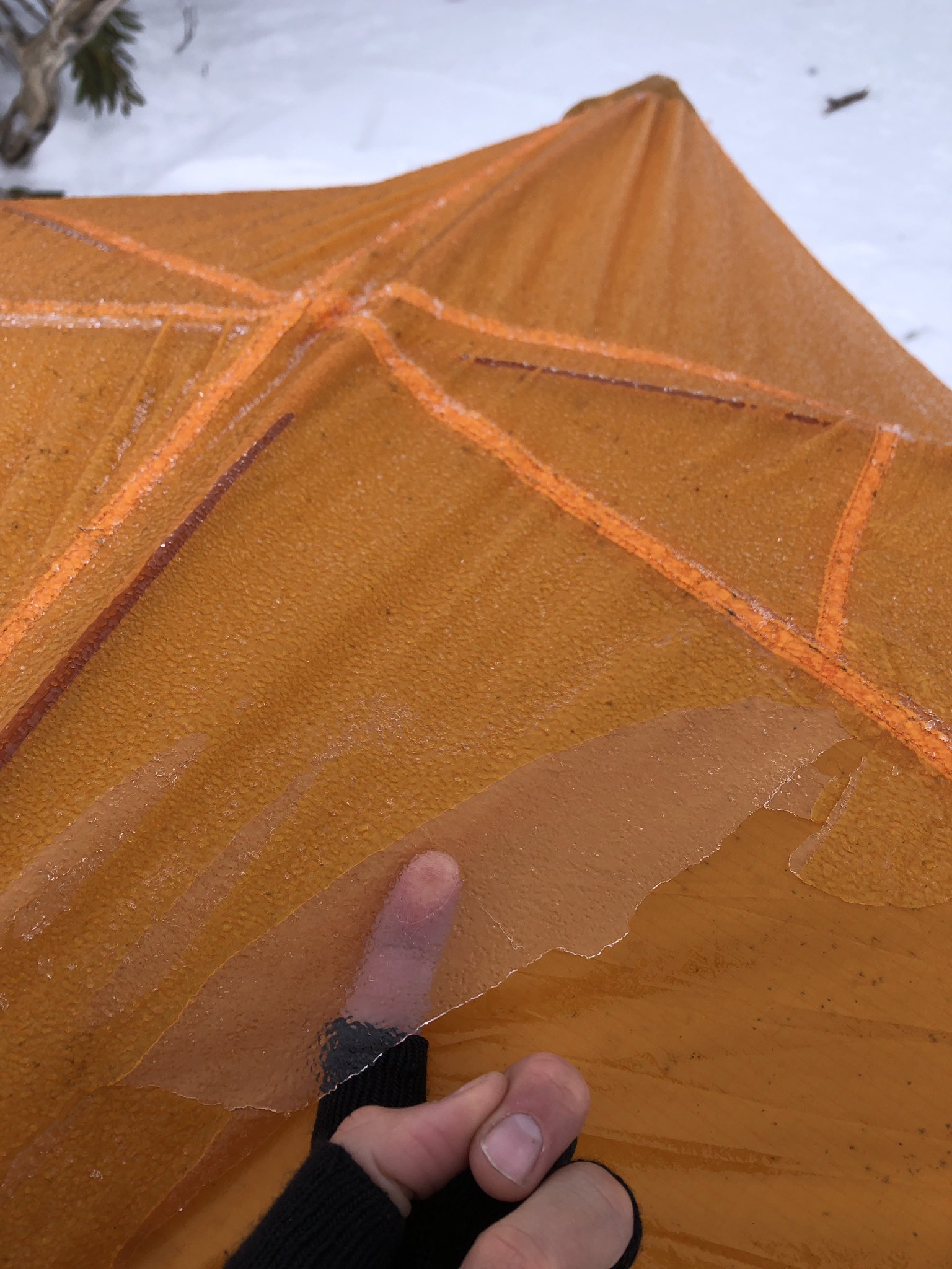
Image: Give us a nice warm ski lodge any day. Source: Tyson Millar.
Snow and weather enthusiast Tyson Millar was camping up on the slopes of Mt Twynam, Australia's third-highest peak on Wednesday night. When he awoke on Thursday morning, he rolled over and hit the wall of his tent, which made shards of ice fall off it.
"I was puzzled at first but then when I opened the fly, the whole door flap of ice fell of it," he told Weatherzone.
Meanwhile here's our weekly rundown of the snow conditions in the ski resorts:
Should I go to the snow this weekend?
The short answer is yes, especially on the mainland. It looks like a good weekend ahead in NSW and Victoria, with mostly clear skies and winds that shouldn't be too strong. The cover was topped up nicely by a fall of 20-30 cm earlier this week, in what were the most significant snowfalls since the huge dump in early June.
VICTORIA
Mt Hotham has 11 of its 12 lifts spinning, and the final lift, locals' favourite Blue Ribbon, can't be far off now. More info here.
-7.4°C and stunning! pic.twitter.com/b2NqNlivtn
— Hotham (@_hotham) July 19, 2022
Mt Buller has 18 lifts operational, with only the Federation and Lydia Lassila chairs yet to open. More info here.
The Aussie mainland's lowest and most southerly ski resort Mt Baw Baw was struggling earlier this month, but has had two nice top-ups in two weeks now (it got 20 cm 10 days ago from a weather system that only gave 5 cm or so to other mainland resorts). Four of seven lifts are now open, with the possibility of more for the weekend. More info here.
Falls Creek is pretty much all systems go, with a snow base of just over a metre. More info here.
NSW
Thredbo has all 14 lifts running, and Australia's longest ski runs are looking sweet. More info here.
Perisher has still not opened the Olympic and North Perisher T-bars, but they both always require a heavy snow cover. The rest of the resort is in tip-top shape. 44 of 48 lifts are currently running, with the chance of more for the weekend. More info here.
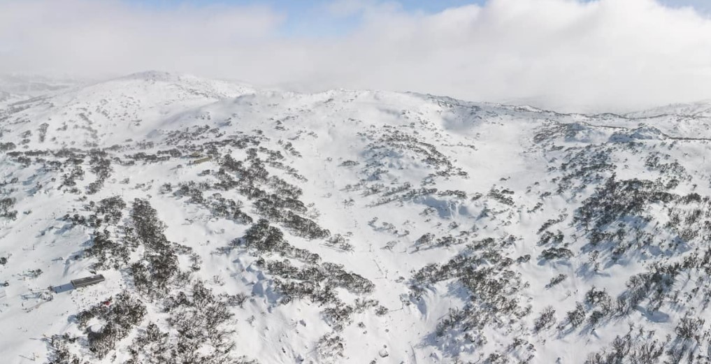
Image: Lookin' good! Source: Perisher Facebook.
Charlotte Pass has all runs and all lifts open, and some of the best snow conditions in the mountains. More info here.
TASMANIA
Ben Lomond and Mt Mawson both closed temporarily earlier this month, but recent snowfalls have helped the situation, and "The Ben", near Launceston, is currently running two of its seven lifts (more info here), while Mt Mawson, closer to Hobart, is on standby. Check the site for updates.
And as ever, please check our snow page for the latest conditions, forecasts, cams and more.